


Image: Monika Mann
Alerts (as of 1:00 a.m.)
A High Surf Advisory is posted through 6 a.m. Tuesday for the west side of the Big Island.
A Small Craft Advisory is in effect for the Alenuihaha channel and windward waters through 6 a.m. Tuesday.
A Wind Advisory is posted for the summits of Mauna Kea and Mauna Loa through 6 p.m. Monday for 35 to 45 mph northwest winds. Gusts up to 55 mph are possible in the morning.
**Click directly on the images below to make them larger. Charts include: Big Island high/low forecasted temperatures, projected winds, chance of cloud cover, projected localized weather conditions, vog/SO2 forecast and expected wave heights.**
Looking Ahead
Dry, stable, and hazy conditions with light winds will dominate ahead of an approaching weak front. The front will produce modest showers across windward slopes and stall near the eastern end of the island chain on Monday. A stable and rather dry land and sea breeze pattern is expected from Tuesday through at least Friday.
Today
Variable winds are expected today around 15 mph. Partly cloudy skies and scattered showers for windward spots with a mostly clear start for the Kona side and afternoon clouds. Hazy conditions are expected. High temperatures from 79° to 84°.
UV index at 7 (“high” exposure level)
Tonight
Variable winds are expected up to 15 mph tonight. Low temperatures from 68° to 73°. Mostly clear skies are expected.
Our Big Island Now Weather homepage always includes daily: Sunrise | Sunset | Moonrise | Moonset | Moon Phase | Live Weather Cams | 5-day Forecast | Current Temperature & Conditions
**Click here for your detailed Big Island surf report.**

Image: NOAA / NWS

Image: NOAA / NWS

Image: NOAA / NWS

Image: NOAA / NWS
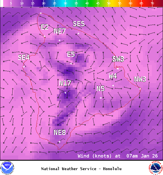
Image: NOAA / NWS
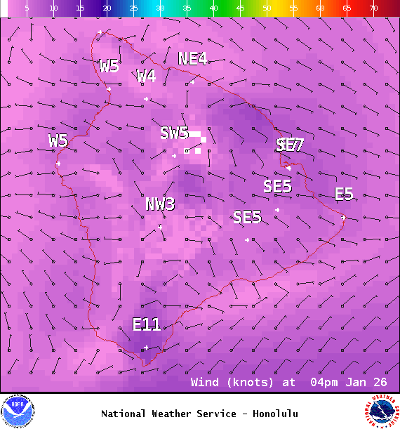
Image: NOAA / NWS
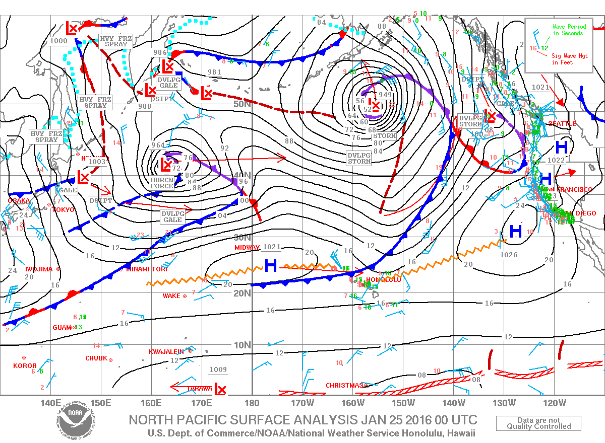
Image: NOAA / NWS
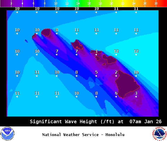
Image: NOAA / NWS
Sponsored Content


