

NW and SSW Slowly Fading Today

Image: James Grenz
Alerts
A Small Craft Advisory is posted for windward waters and the Alenuihaha channel through 6 a.m. Tuesday. This advisory may be extended.
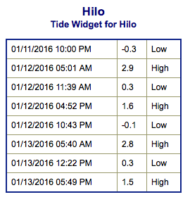
**Click directly on the images below to make them larger. Charts include: Big Island projected winds, tides, swell direction & period and expected wave heights.**
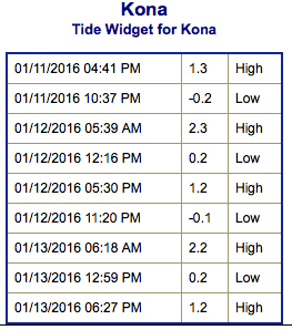 Big Island Surf Forecast
Hilo side: Wave heights are expected to be head high today. The best breaks could get up to overhead or even well overhead on the sets.
Kona side: Wave heights are expected to be knee/waist/chest high today in the morning, then fading. Out of the northwest waist/shoulder high waves are expected.
South: Breaks open to the swell produced by Pali are around knee/waist/chest high today with the most size in the morning.
 Our current northwest swell has begun a slow fading trend but will keep surf elevated through midweek. A new northwest swell is expected to move in Thursday maintaining wave heights around chest high to a few feet overhead at the best breaks.
Trade swell is expected to remain pretty small at waist high or less.
Swell from tropical system Pali is expected to slowly continue fading through the week.
Keep in mind, surf heights are measured on the face of the wave from trough to crest. Heights vary from beach to beach, and at the same beach, from break to break.
**Click here for your detailed Big Island weather report.**
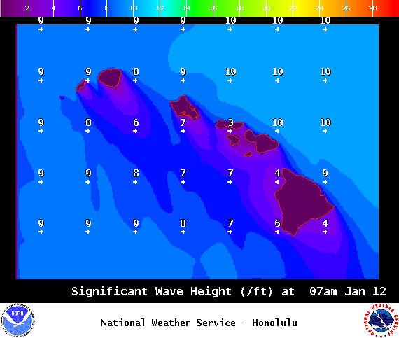
Image: NOAA / NWS
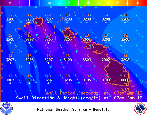
Image: NOAA / NWS
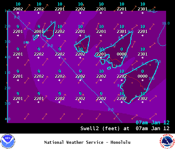
Image: NOAA / NWS
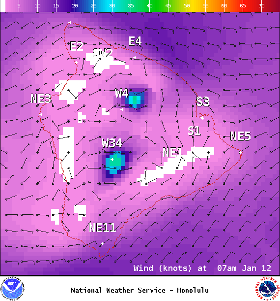
Image: NOAA / NWS
Image: NOAA / NWS
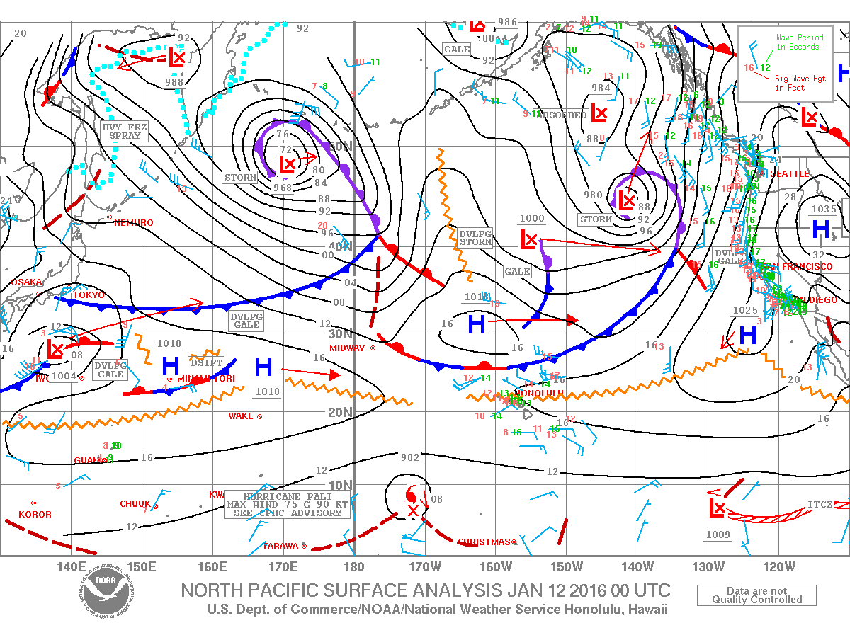
Image: NOAA / NWS
Sponsored Content


