

Large Swell Begins to Fade Today

Image: James Grenz
Alerts
A Small Craft Advisory is in effect for the Alenuihaha channel and windward waters through 6 p.m. Tuesday.
A High Surf Advisory is posted through 6 a.m. Tuesday for surf heights near 8 feet along west facing shores of the Big Island.
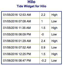
**Click directly on the images below to make them larger. Charts include: Big Island projected winds, tides, swell direction & period and expected wave heights.**
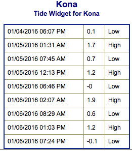 Big Island Surf Forecast
Hilo side: Wave heights are expected well overhead to double overhead out of the northwest. Trade swell is up to waist/chest high.
Kona side: Wave heights are expected to be chest/head high or more today from wrap out of the northwest. South-southwest is knee high or less.
South: Breaks open to the south-southwest swell are around knee/thigh high today.
 Dangerously large west-northwest / northwest swell is expected to drop through Tuesday. Another round of northwest swell is expected to fill in and peak on Wednesday at double overhead or more.
Trade swell is expected to remain pretty small through midweek.
Our current south-southwest lingers through midweek with wave heights topping out in the thigh high range.
Keep in mind, surf heights are measured on the face of the wave from trough to crest. Heights vary from beach to beach, and at the same beach, from break to break.
**Click here for your detailed Big Island weather report.**
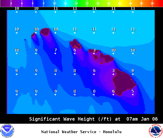
Image: NOAA / NWS
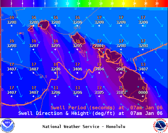
Image: NOAA / NWS
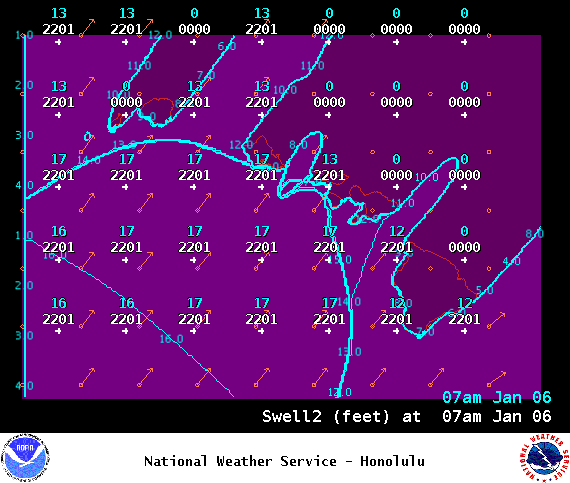
Image: NOAA / NWS
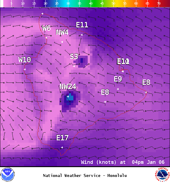
Image: NOAA / NWS
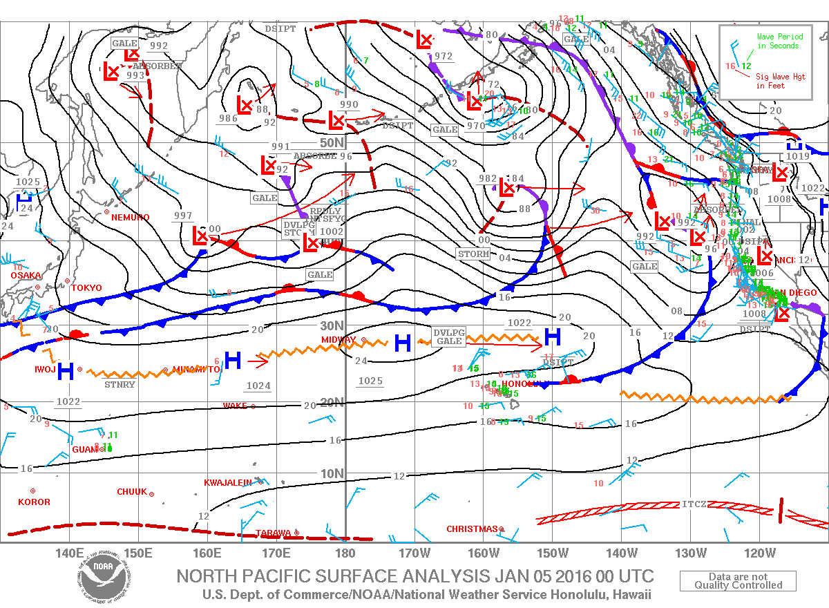
Image: NOAA / NWS
Sponsored Content


