

Swells Peak Today for Big Island
Alerts
A Small Craft Advisory is posted through Monday at 6 a.m. for winds up to 25 knots and seas up to 12 feet.
A High Surf Advisory is posted for east facing shores through 6 a.m. Monday.
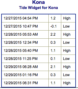
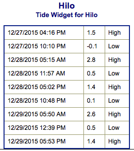
**Click directly on the images below to make them larger. Charts include: Big Island projected winds, tides, swell direction & period and expected wave heights.**
 Big Island Surf Forecast
Hilo side: Wave heights are expected head high or more. Northwest swell should bring waves a few feet overhead possibly even double overhead at the best breaks.
Kona side: Wave heights are expected to be ankle to waist high today.
South: Breaks open to the south-southwest swell could get up to waist high or more at the best exposures. Trade swell up to a few feet overhead at the best exposures.
 A new northwest swell is forecast to peak early Monday before starting an easing trend through Tuesday. Tuesday overhead waves are still expected.
Overhead trade swell is expected to gradually fade through Tuesday.
Our current south-southwest is expected to bring fun surf into Monday around waist/chest high before fading on Tuesday.
Keep in mind, surf heights are measured on the face of the wave from trough to crest. Heights vary from beach to beach, and at the same beach, from break to break.
**Click here for your detailed Big Island weather report.**
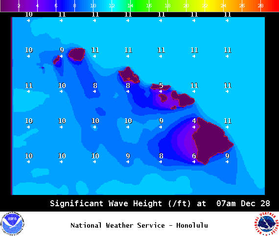
Image: NOAA / NWS
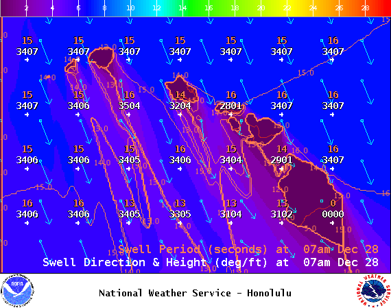
Image: NOAA / NWS
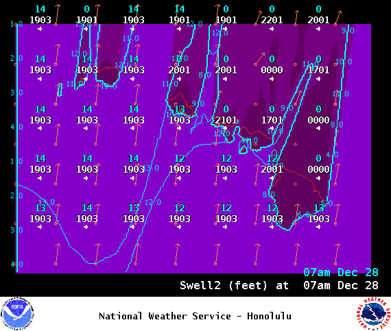
Image: NOAA / NWS
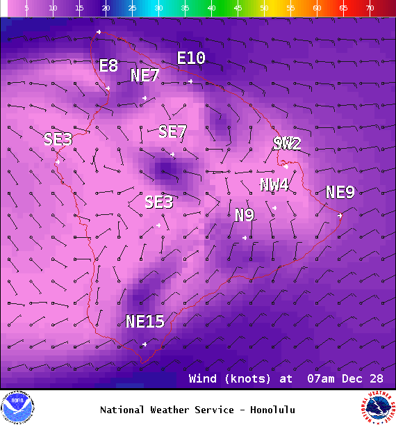
Image: NOAA / NWS
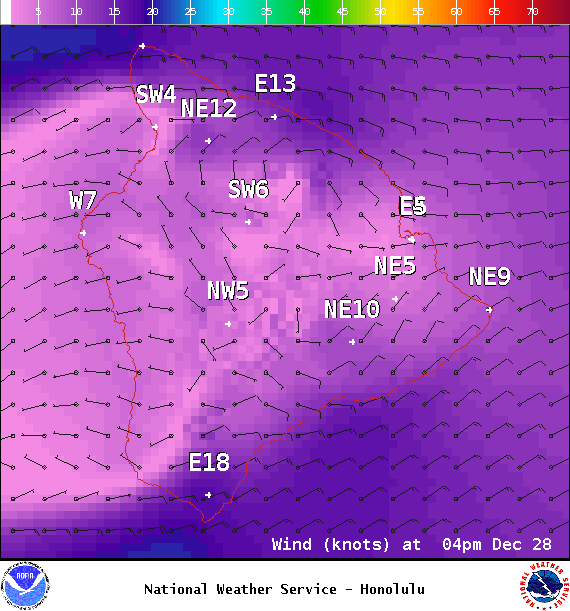
Image: NOAA / NWS
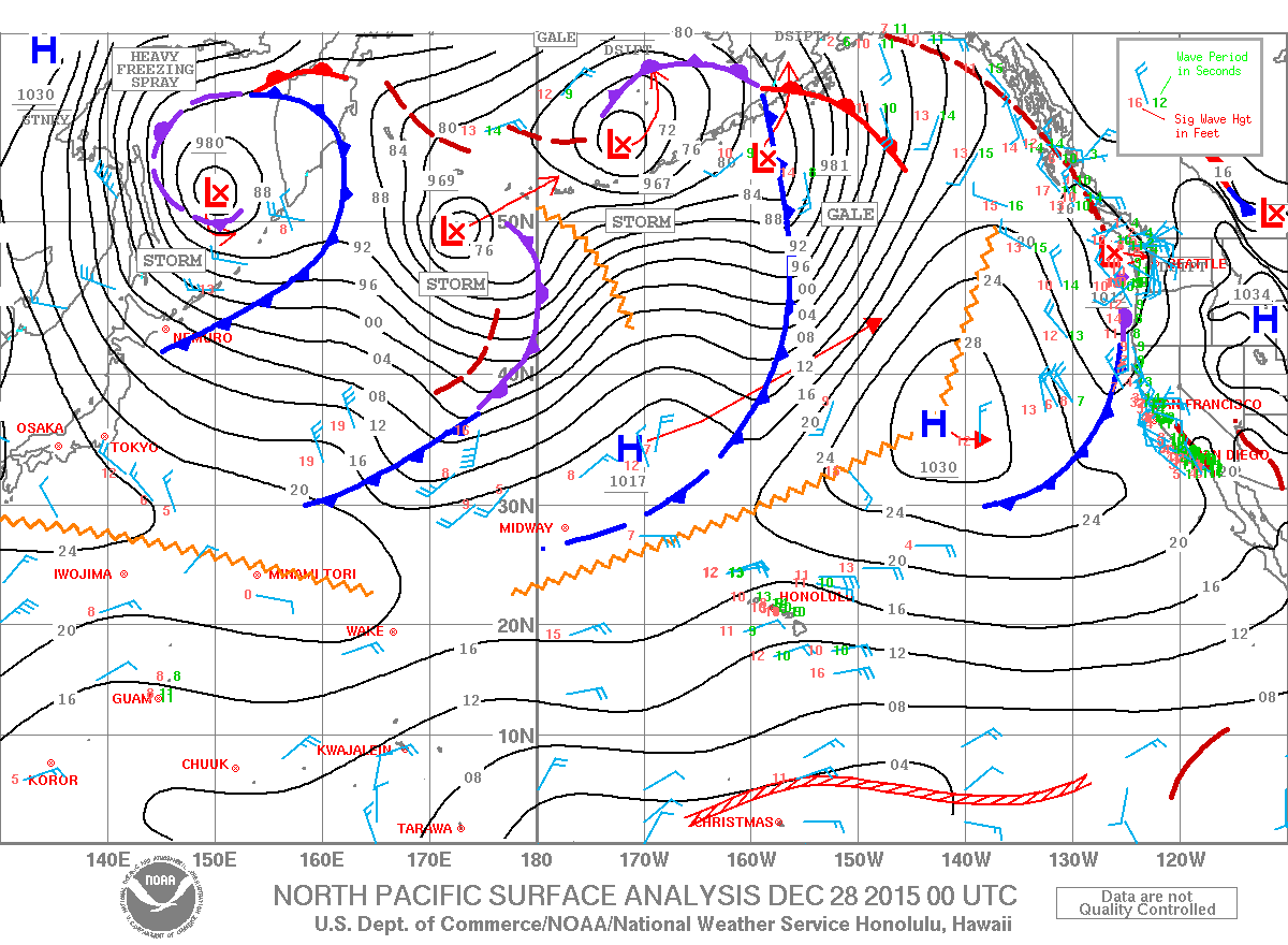
Image: NOAA / NWS
Sponsored Content


