

Numerous Weather Alerts due to High Winds
Alerts
A Small Craft Advisory is posted for Big Island windward waters through 6 p.m. Monday. East winds are expected up to 30 knots and seas up to 12 feet.
A Gale Warning is posted for winds up to 35 knots and seas up to 15 feet in the Alenuihaha channel and to the south and west of the Big Island. The warning is posted through 6 p.m. Monday.
A High Surf Warning is posted for east shores through 6 p.m. Monday for 10 to 15 foot faces.
A Wind Advisory is posted for the Big Island through 6 p.m. Monday for east winds from 15 to 30 mph with gusts to 50 mph.
A Winter Weather Advisory is posted for the summits of Mauna Kea and Mauna Loa above 8000 feet through 6 p.m. Monday. Freezing rain and black ice are expected with temperatures in the upper 20s to lower 30s.
A High Wind Warning is posted through 6 p.m. Monday for Kohala. East winds from 20 to 30 mph with gusts as high as 60 mph are expected.
Check our breaking news section for any urgent weather alerts.
**Click directly on the images below to make them larger. Charts include: Big Island high/low forecasted temperatures, projected winds, chance of cloud cover, projected localized weather conditions, vog/SO2 forecast and expected wave heights.**
Looking Ahead
Strong and gusty trade winds are forecast to continue through Monday before dropping Monday night and Tuesday. Moderate trades are expected to continue through Friday before increasing again late in the week. Rainfall will favor windward and mountain areas with some passing showers reaching leeward locations.
Today
Blustery conditions are expected again today with east winds from 20 to 35 mph with gusts up to 60 mph. Mostly cloudy skies with frequent showers for windward spots and mostly sunny skies in the morning for lee areas and building cloud cover with scattered showers in the afternoon. High temperatures from 79° to 84°.
UV index at 6 (“high” exposure level)
Tonight
East winds are expected from 15 to 25 mph with higher gusts. Low temperatures from 69° to 74°. Mostly cloudy skies are expected with numerous showers in windward spots and scattered showers for the leeward side.
Our Big Island Now Weather homepage always includes daily: Sunrise | Sunset | Moonrise | Moonset | Moon Phase | Live Weather Cams | 5-day Forecast | Current Temperature & Conditions
**Click here for your detailed Big Island surf report.**
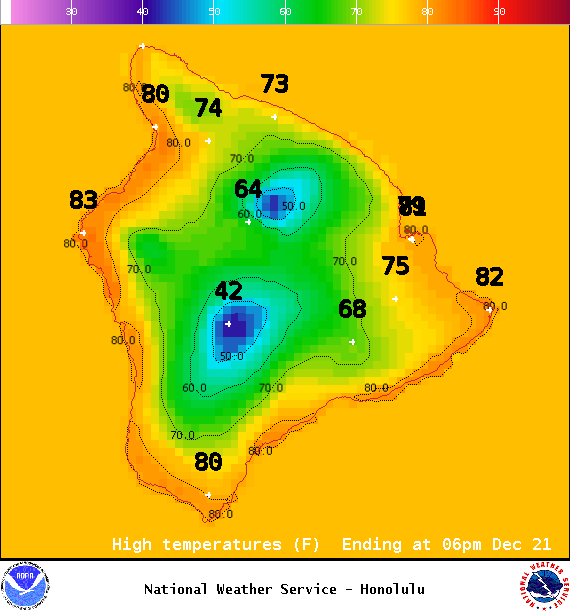
Image: NOAA / NWS
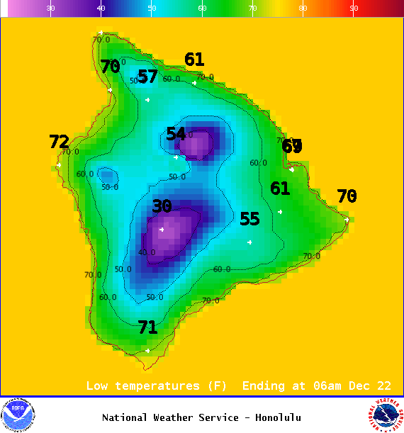
Image: NOAA / NWS
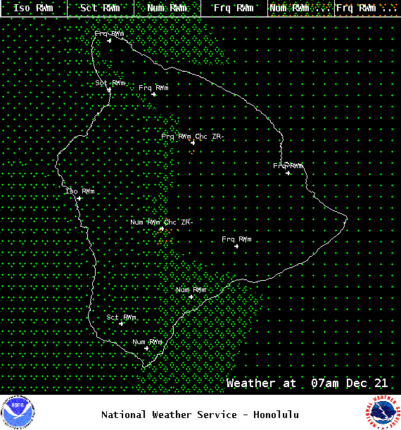
Image: NOAA / NWS
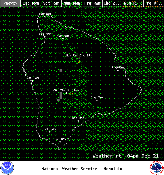
Image: NOAA / NWS
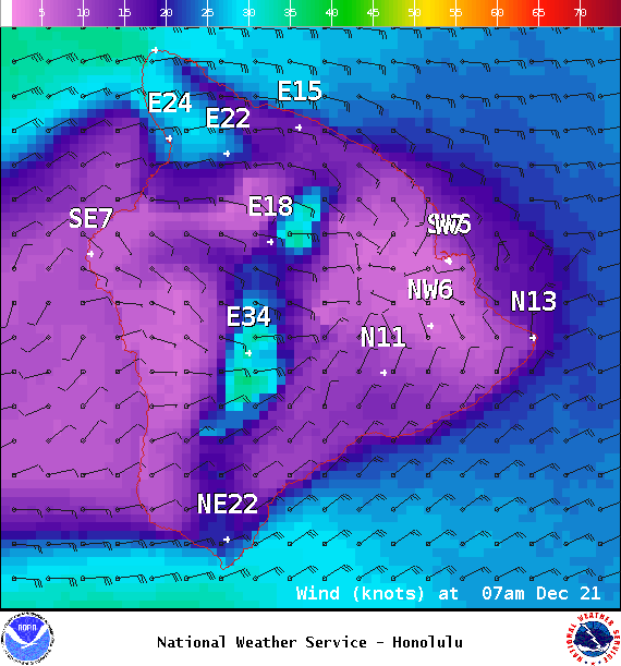
Image: NOAA / NWS
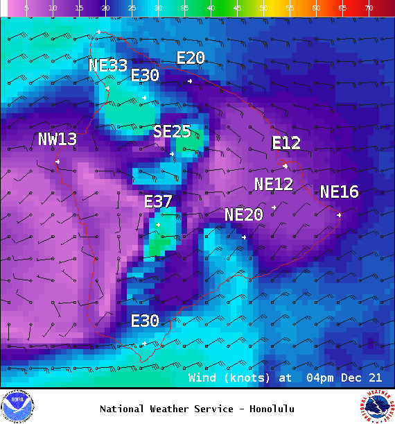
Image: NOAA / NWS
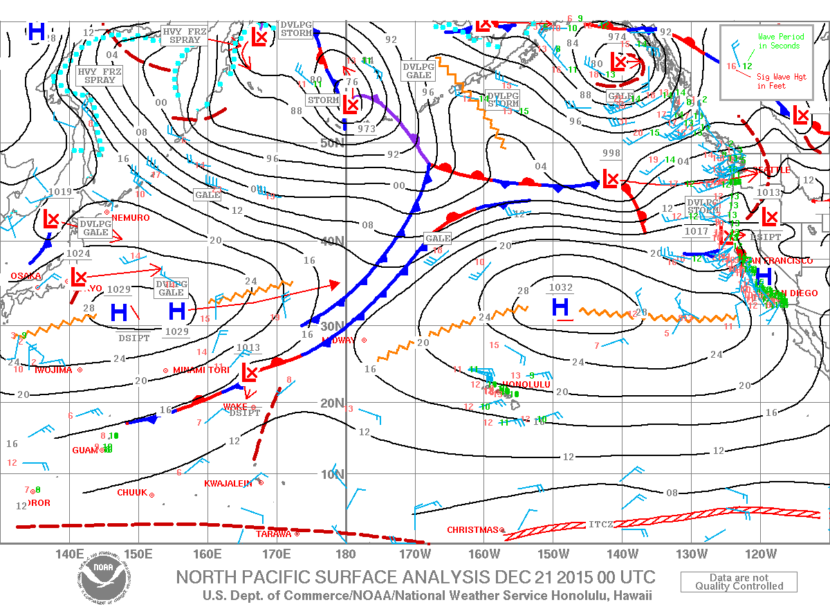
Image: NOAA / NWS
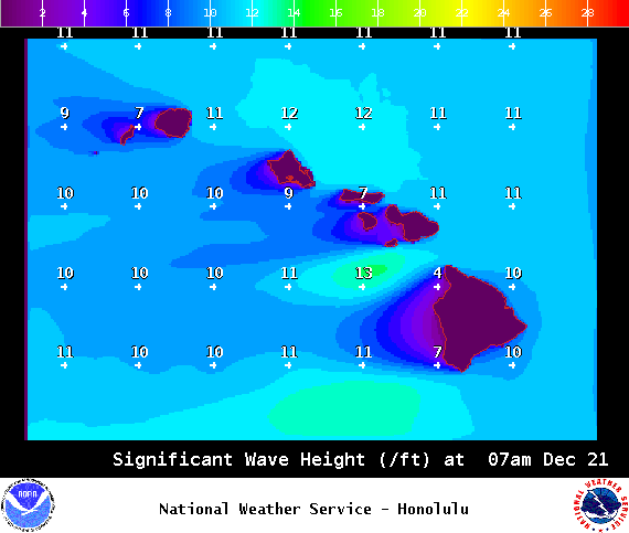
Image: NOAA / NWS
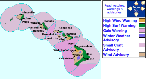
Image: NOAA / NWS
Sponsored Content


