

NW Swell Peaks Today, Small Craft Advisory Posted
Alerts
A Small Craft Advisory is posted for Big Island south and leeward waters and channels through 6 a.m. Thursday. East winds are expected up to 25 knots and seas up to 10 feet.
Check our breaking news section for any urgent weather alerts.
**Click directly on the images below to make them larger. Charts include: Big Island projected winds, tides, swell direction & period and expected wave heights.**
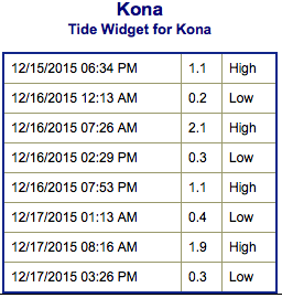
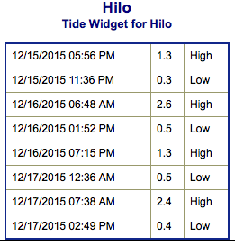 Big Island Surf Forecast
Hilo side: Wave heights are expected head high to overhead today. The best breaks could get up to double overhead on the sets.
Kona side: Wave heights knee high today. Spots catching the wrap could get up to chest high.
South: Breaks open to the trade swell could get up to head high or even overhead at the best exposures. Out of the south-southwest surf will be knee/waist high with the best breaks getting up to chest high on the sets.
 A northwest swell is expected to continue filling in and peak Wednesday at or near advisory levels. The swell is forecast to diminish Wednesday night and Thursday.
A big surge in easterly winds has brought small craft advisory conditions over most coastal waters. Strong trades are expected for the second half of the week, in fact, winds may approach gale warning levels across the windier zones around the Big Island and Maui by late in the week.
Nothing of note expected out of the Southern Hemi for the final weeks of 2015.
Keep in mind, surf heights are measured on the face of the wave from trough to crest. Heights vary from beach to beach, and at the same beach, from break to break.
**Click here for your detailed Big Island weather report.**
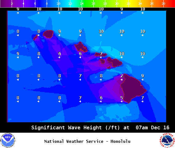
Image: NOAA / NWS
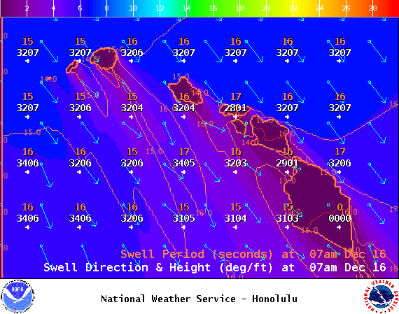
Image: NOAA / NWS
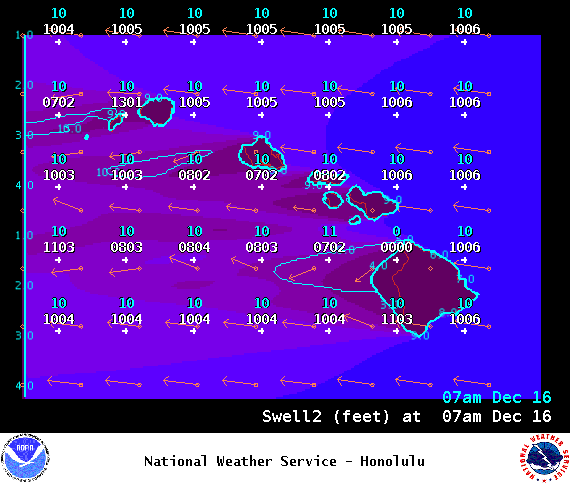
Image: NOAA / NWS
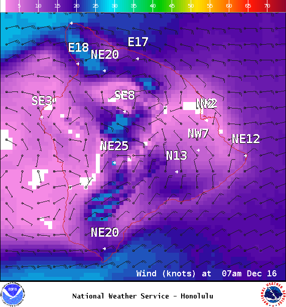
Image: NOAA / NWS
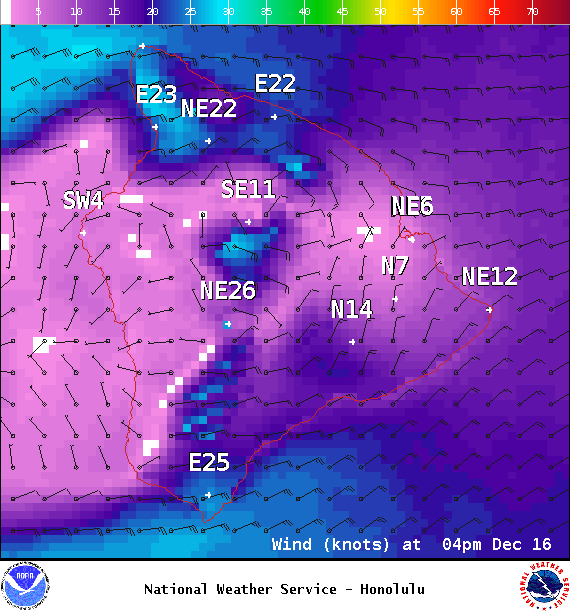
Image: NOAA / NWS
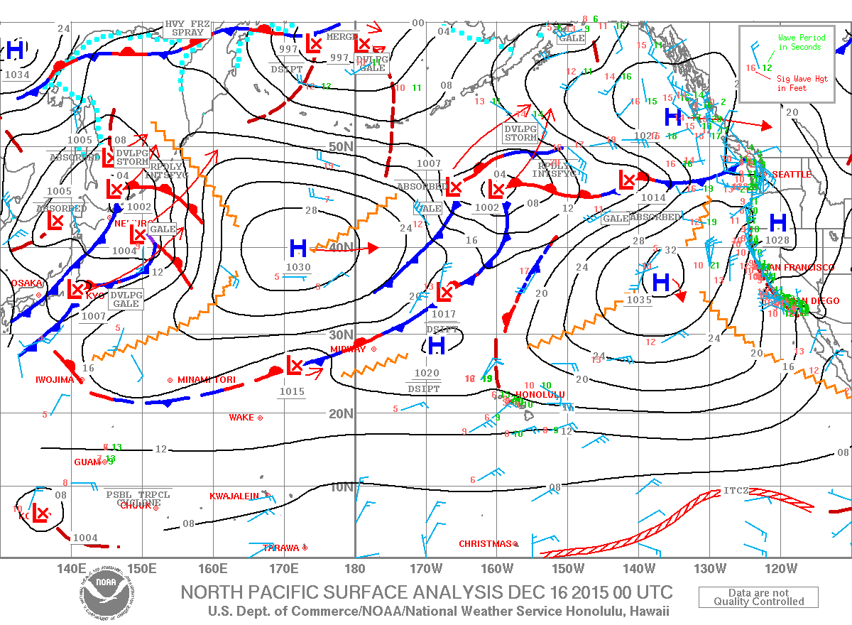
Image: NOAA / NWS
Sponsored Content


