

SSW & Trade Swell Hold, NW Swell Shifting
Alerts
A Small Craft Advisory is posted for most Big Island coastal waters and the ʻAlenuihāhā channel through 6 a.m. Saturday for east to southeast winds up to 25 knots and seas up to 10 feet.
Check our breaking news section for any urgent weather alerts.
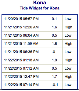
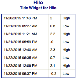
**Click directly on the images below to make them larger. Charts include: Big Island projected winds, tides, swell direction & period and expected wave heights.**
 Big Island Surf Forecast
Hilo side: Wave heights are expected head high today with the best breaks getting overhead from time to time on the sets.
Kona side: Wave heights waist high and up to occasionally chest high.
South: Most breaks are waist high and up to occasionally chest high. Breaks open to the trade swell could still get up to chest/head high or even overhead.
 Our current swell continues to shift farther out of the north on Friday as the swell also starts a downward trend. A couple small northwest pulses will move in over the weekend but the energy mixes in with more dominant trade swell which holds through Saturday with head high to overhead surf. Trade swell is expected to start a downward trend Sunday and through early next week.
Our current south-southwest is expected to hold Saturday around waist/chest high and fade Sunday into early next week. Nothing of note otherwise.
Keep in mind, surf heights are measured on the face of the wave from trough to crest. Heights vary from beach to beach, and at the same beach, from break to break.
**Click here for your detailed Big Island weather report.**
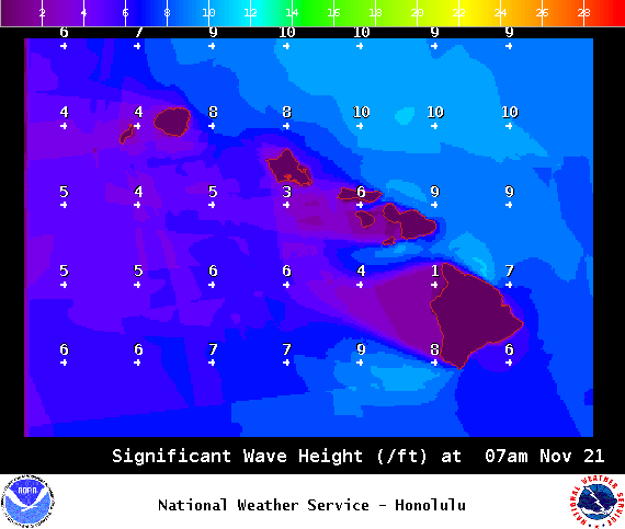
Image: NOAA / NWS
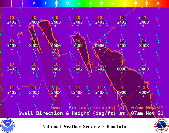
Image: NOAA / NWS
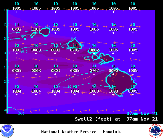
Image: NOAA / NWS
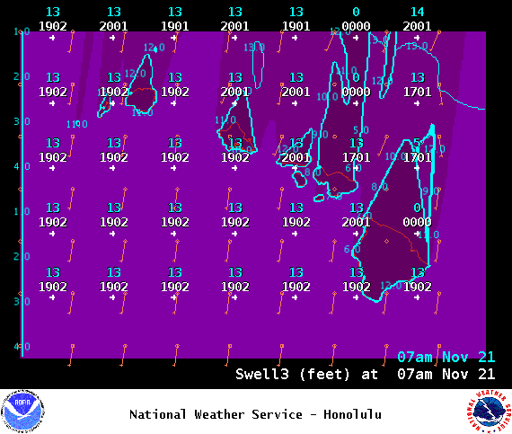
Image: NOAA / NWS
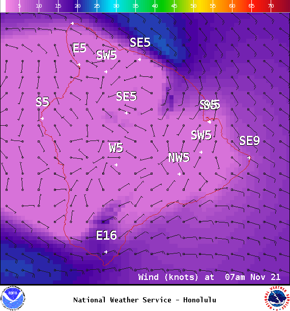
Image: NOAA / NWS
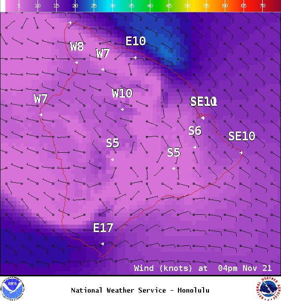
Image: NOAA / NWS
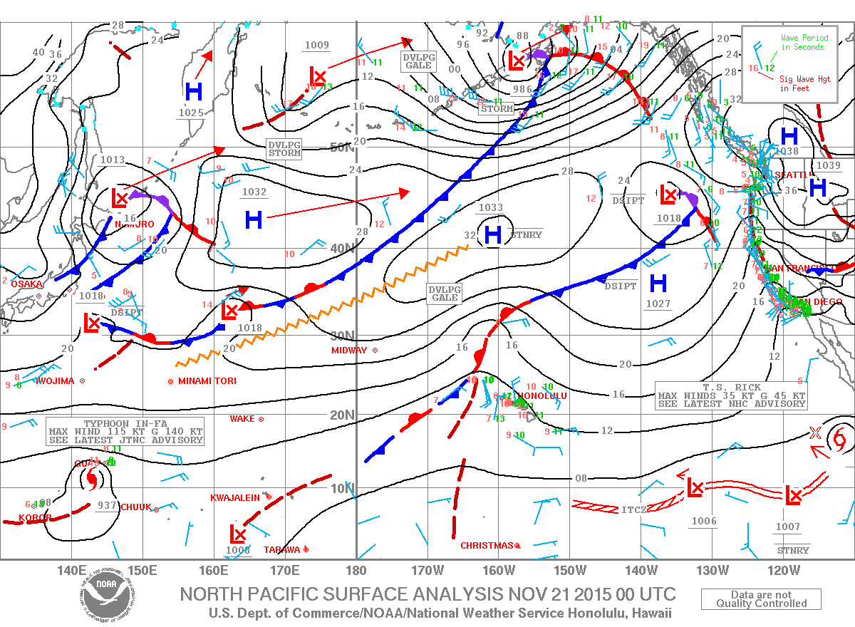
Image: NOAA / NWS
Sponsored Content


