

Advisory Swell Continues, NW Swells for Weekend
Alerts
A Small Craft Advisory is posted for all Big Island coastal waters and the ʻAlenuihāhā channel through 6 p.m. Friday for northeast winds up to 30 knots and seas up to 14 feet.
A High Surf Advisory is in effect for east facing shores through Friday at 6 p.m. Surf heights of 7 to 10 foot faces are expected.
Check our breaking news section for any urgent weather alerts.
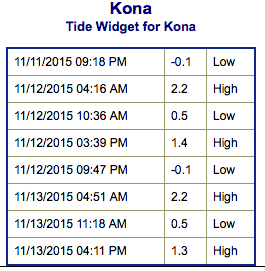
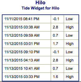
**Click directly on the images below to make them larger. Charts include: Big Island projected winds, tides, swell direction & period and expected wave heights.**
 Big Island Surf Forecast
Hilo side: Wave heights are expected head high today with the best breaks getting up to a few feet overhead from time to time on the sets.
Kona side: Wave heights knee/waist high are expected today. The best breaks could get up to tummy/chest high on the sets.
South: Breaks open to the south-southwest swell could get up to knee/waist high. The best spots could get up to chest/shoulder high on the sets.
 An advisory level east-northeast trade swell continues to affect windward coasts this week.
Our current south-southwest continues to trend down today.
Our current northwest swell is also on a downward trend. However, a pair of northwesterly swells are expected to roll in. The first begins to build late Thursday, peaking Friday. The second swell shows for the weekend.
Keep in mind, surf heights are measured on the face of the wave from trough to crest. Heights vary from beach to beach, and at the same beach, from break to break.
**Click here for your detailed Big Island weather report.**
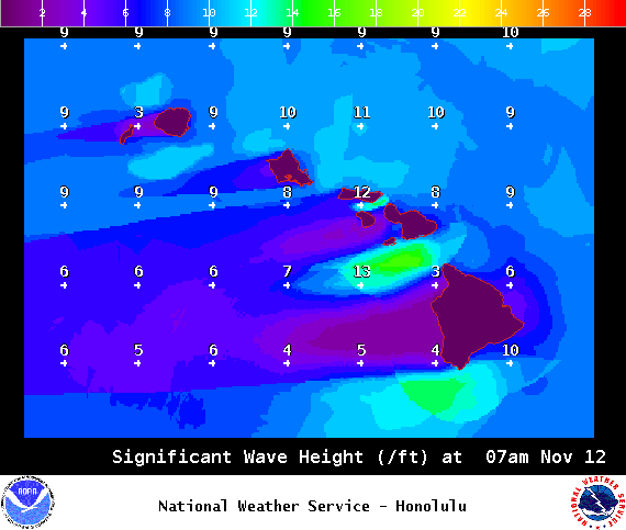
Image: NOAA / NWS
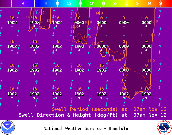
Image: NOAA / NWS
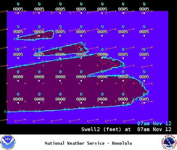
Image: NOAA / NWS
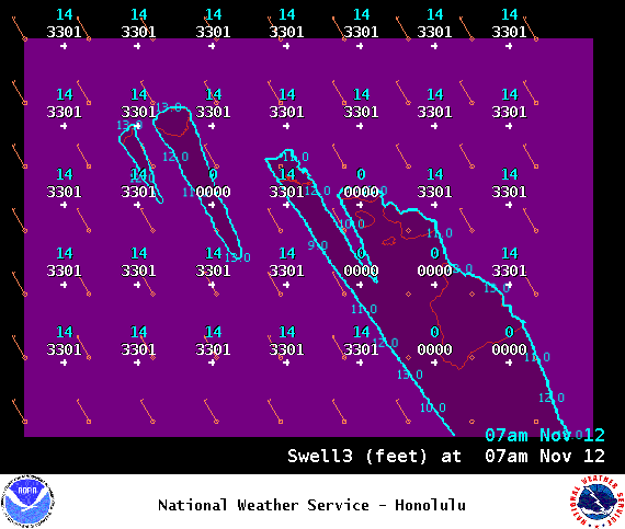
Image: NOAA / NWS
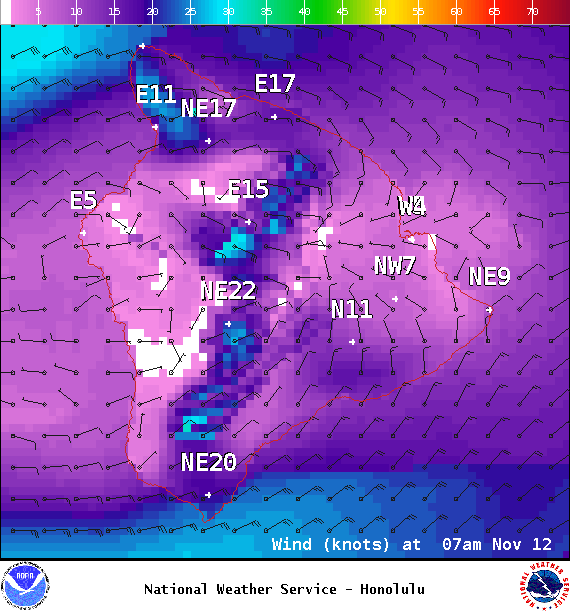
Image: NOAA / NWS
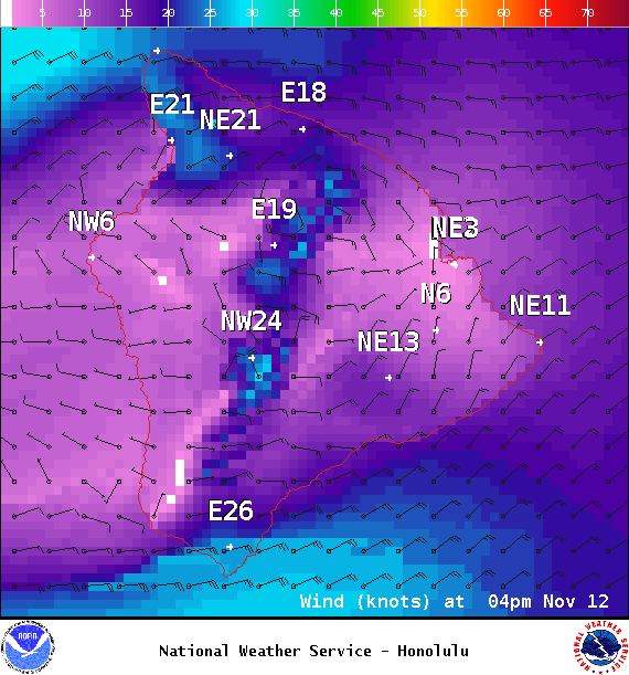
Image: NOAA / NWS
Image: NOAA / NWS
Sponsored Content


