

Today’s Weather Re-play of Yesterday
Alerts
A Small Craft Advisory is posted for all Big Island coastal waters and the ʻAlenuihāhā channel through 6 p.m. Wednesday for east winds up to 25 knots and seas up to 11 feet.
Check our breaking news section for any urgent weather alerts.
**Click directly on the images below to make them larger. Charts include: Big Island high/low forecasted temperatures, projected winds, chance of cloud cover, projected localized weather conditions, vog/SO2 forecast and expected wave heights.**
Looking Ahead
Moderate trades are expected through Wednesday with only a few showers. A wet trade wind pattern is expected to affect the state from Wednesday night through Thursday night, with more typical trade wind showers forecast Friday through the weekend. Trades should increase to moderate levels Thursday and persist through the weekend.
Today
Today partly sunny skies are expected with scattered showers for windward spots. The Kona side is expected to have mostly clear skies with isolated showers in the afternoon. Hazy skies are expected. High temperatures from 83° to 88°. East winds are forecast from 15 to 20 mph with higher gusts.
UV index at 8 (“very high” exposure level)
Tonight
East winds are expected in the evening around 15 mph. Low temperatures from 72° to 77°. Partly cloudy skies are expected in the evening with scattered showers for windward spots. Leeward spots should see isolated evening showers and clearing as the night goes on.
Our Big Island Now Weather homepage always includes daily: Sunrise | Sunset | Moonrise | Moonset | Moon Phase | Live Weather Cams | 5-day Forecast | Current Temperature & Conditions
**Click here for your detailed Big Island surf report.**

Image: NOAA / NWS

Image: NOAA / NWS

Image: NOAA / NWS

Image: NOAA / NWS
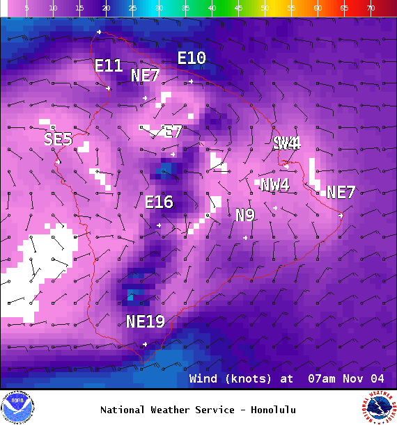
Image: NOAA / NWS
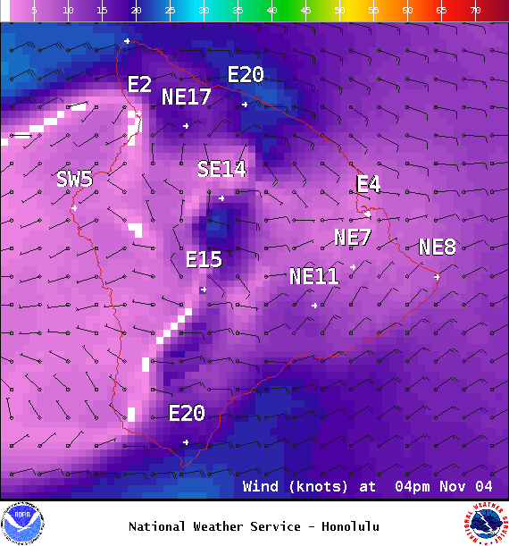
Image: NOAA / NWS
Image: NOAA / NWS

Image: NOAA / NWS
Sponsored Content


