

Advisory Still Posted for Northeast Shores
Alerts
A High Surf Advisory is posted for northeast facing shores of the Big Island through 6 p.m. Friday. Wave heights are expected from 6 to 10 foot faces.
A Small Craft Advisory is posted for all Big Island channels and waters through 6 p.m. Friday. Hazardous seas up to about 11 feet are expected.
Check our breaking news section for any urgent weather alerts.
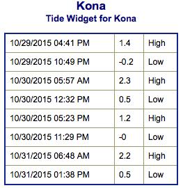
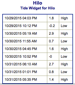
**Click directly on the images below to make them larger. Charts include: Big Island projected winds, tides, swell direction & period and expected wave heights.**
 Big Island Surf Forecast
Hilo side: Wave heights are expected shoulder high to a few feet overhead today as the swell peaks in the afternoon.
Kona side: Wave heights knee/waist high are expected today. The best breaks could get a bit bigger on the sets. Some north-northwest will filter in for spots open to the swell.
South: Wave heights are expected shoulder high to a couple feet overhead today as the swell peaks in the afternoon. Breaks open to the south-southwest swell could get up to knee/waist/chest high.
 Our current more west-northwest swell (295° to 315°) is expected to build and peak Friday afternoon into early Saturday. This swell is expected to ease over the weekend.
A south-southwest keeps wave heights around knee/waist/chest high range Friday but is down to leftovers by the end of the weekend.
Next week another pulse of south-southwest is expected. Will keep an eye on it.
Keep in mind, surf heights are measured on the face of the wave from trough to crest. Heights vary from beach to beach, and at the same beach, from break to break.
**Click here for your detailed Big Island weather report.**
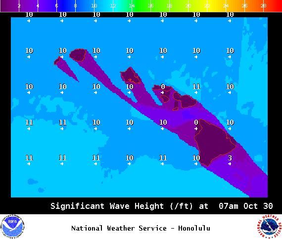
Image: NOAA / NWS
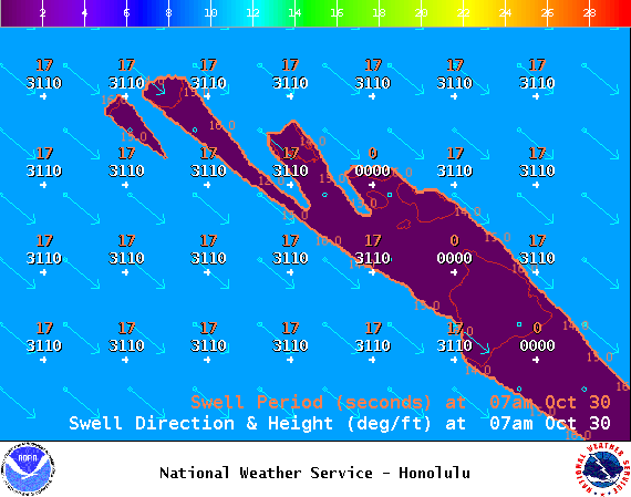
Image: NOAA / NWS
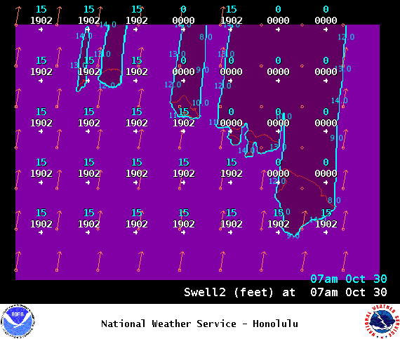
Image: NOAA / NWS
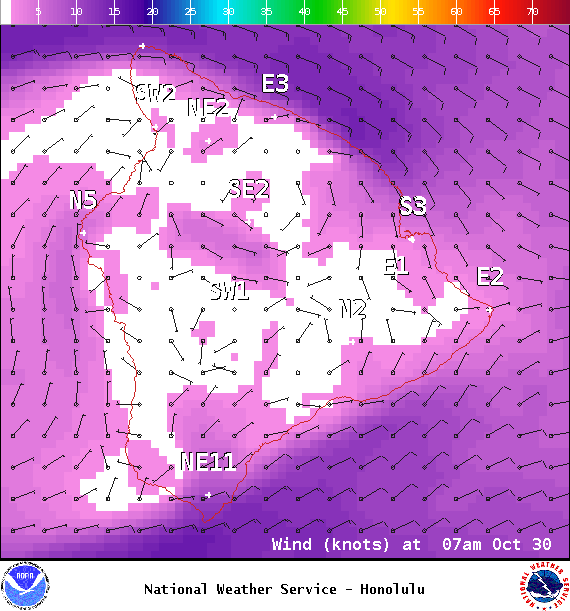
Image: NOAA / NWS

Image: NOAA / NWS

Image: NOAA / NWS
Sponsored Content


