

New Swell Builds Late Today
Alerts
A High Surf Advisory goes into effect for west facing shores of the Big Island from 6 p.m. this evening through 6 p.m. Friday.
A High Surf Warning is in effect through 6 p.m. Friday for northeast facing shores of the Big Island.
Check our breaking news section for any urgent weather alerts.
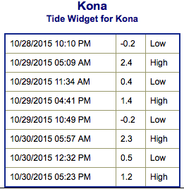
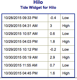
**Click directly on the images below to make them larger. Charts include: Big Island projected winds, tides, swell direction & period and expected wave heights.**
 Big Island Surf Forecast
Hilo side: Wave heights are expected head to well overhead today early on with a downward trend expected.
Kona side: Wave heights knee/waist high are expected today. The best breaks could get a bit bigger on the sets. Some north-northwest will filter in for spots open to the swell.
South: Wave heights are expected knee/waist high today. Best breaks open to the swell could get up to belly/tummy high on the sets.
 A solid north-northwest swell is presently affecting northwest exposures. This swell is expected to drop out quickly Thursday.
Another more ‘westerly’ swell (295° to 315°) is expected on the heels of the current swell energy. This swell is forecast to quickly build late Thursday and mix in with our current swell for head high to well overhead waves. This swell should peak late Friday before slowly fading.
Our current south-southwest is down to leftovers today. A new south-southwest fills in Thursday/Friday to keep wave heights around knee/waist/chest high.
Next week another pulse of south-southwest is expected. Will keep an eye on it.
Keep in mind, surf heights are measured on the face of the wave from trough to crest. Heights vary from beach to beach, and at the same beach, from break to break.
**Click here for your detailed Big Island weather report.**
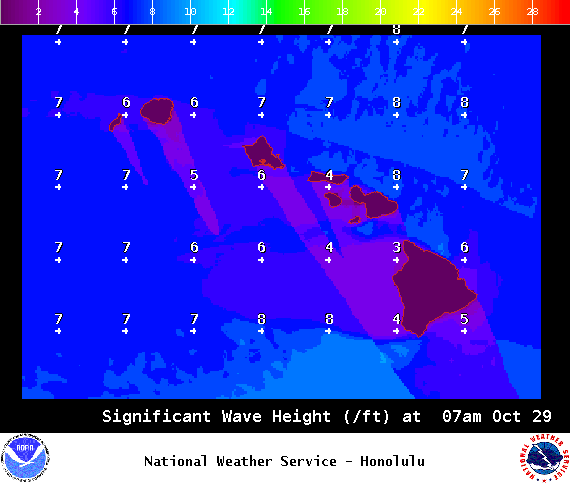
Image: NOAA / NWS
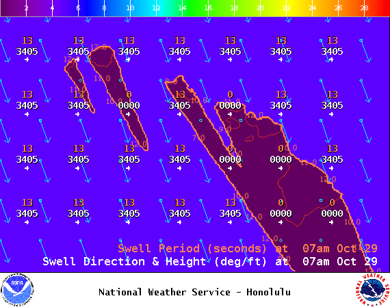
Image: NOAA / NWS
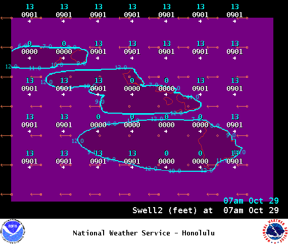
Image: NOAA / NWS
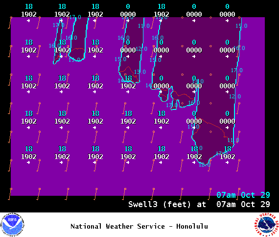
Image: NOAA / NWS

Image: NOAA / NWS
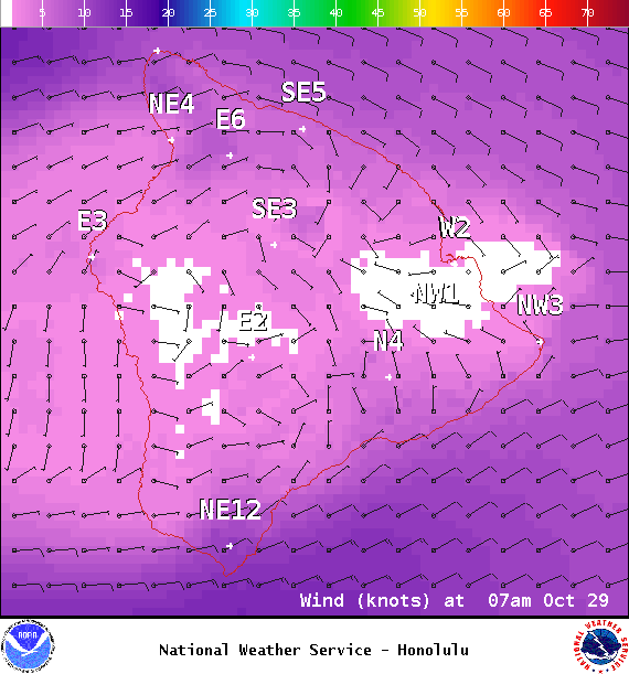
Image: NOAA / NWS
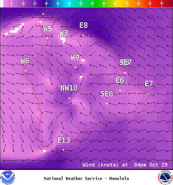
Image: NOAA / NWS
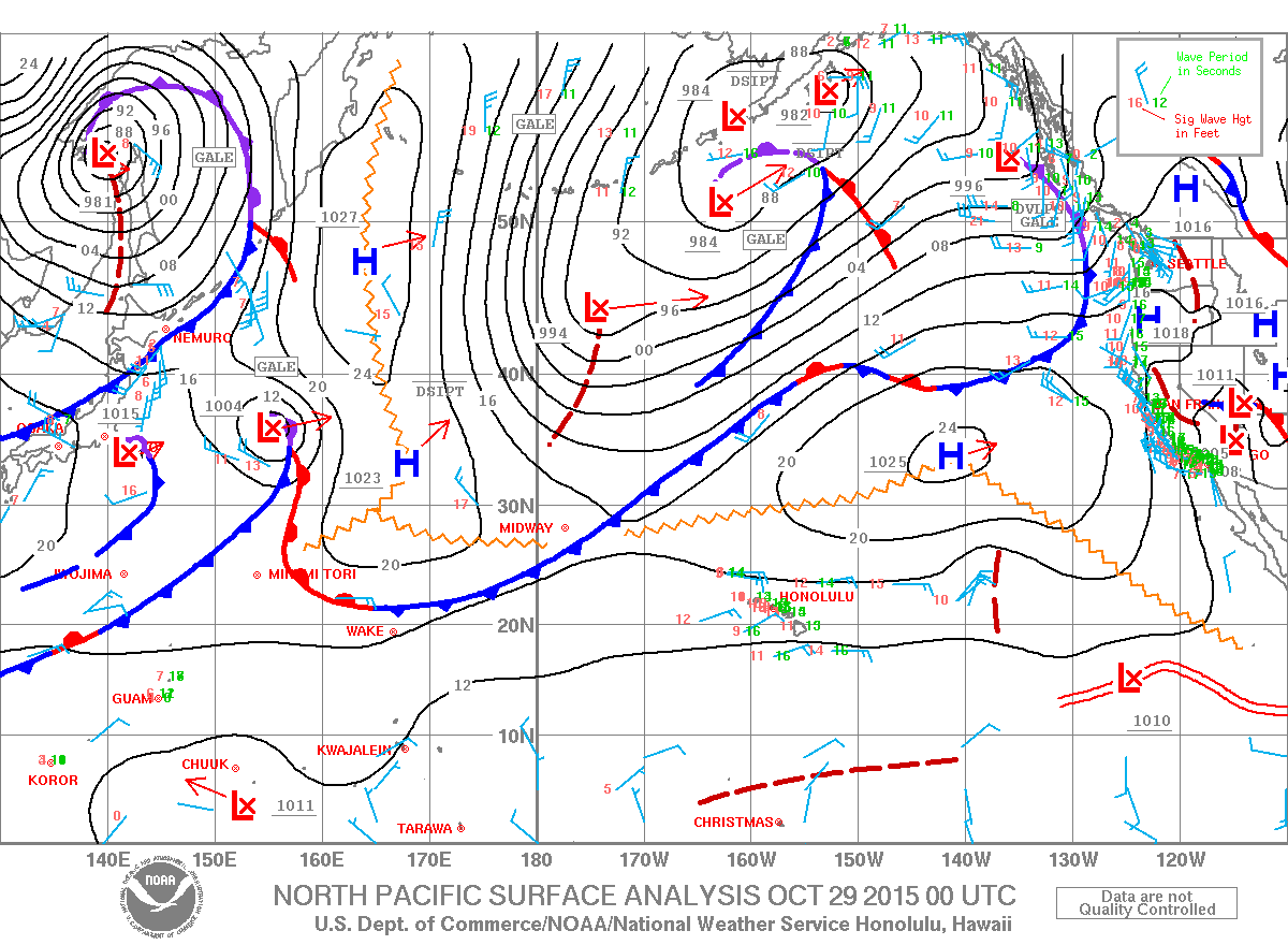
Image: NOAA / NWS
Sponsored Content


