

SSW Fills in Today, Large NNW Expected Tomorrow
Alerts
A High Surf Advisory is posted for the east facing coastlines of the Big Island through 6 a.m. Monday. Surf heights of 6 to 10 foot faces are expected.
Check our breaking news section for any urgent weather alerts.
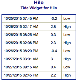
**Click directly on the images below to make them larger. Charts include: Big Island projected winds, tides, swell direction & period and expected wave heights.**
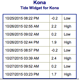 Big Island Surf Forecast
Hilo side: Wave heights are expected shoulder high to slightly overhead today.
Kona side: Wave heights waist/shoulder high are expected today. The best breaks could get head high or more on the sets. Smaller waves are expected for spots not open to the south-southwest.
South: Wave heights are expected waist/head high today. Best breaks open to the building swell could get up to overhead on the sets by sunset.
 Tropical swell generated by hurricane Olaf continues to impact the east shores of the Big Island and Maui. The swell is on a downward trend and expected to drop further Tuesday and Wednesday.
Our current south-southwest swell continues to fade while a new reinforcement fills in. The new swell is expected to peak Tuesday before beginning to fade Wednesday.
A larger NW swell is forecast to build Tuesday with surf heights reaching advisory levels.
Keep in mind, surf heights are measured on the face of the wave from trough to crest. Heights vary from beach to beach, and at the same beach, from break to break.
**Click here for your detailed Big Island weather report.**
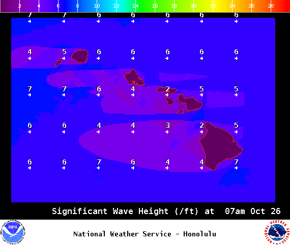
Image: NOAA / NWS
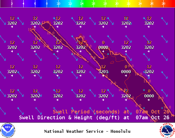
Image: NOAA / NWS
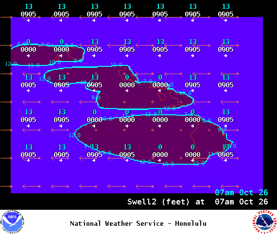
Image: NOAA / NWS
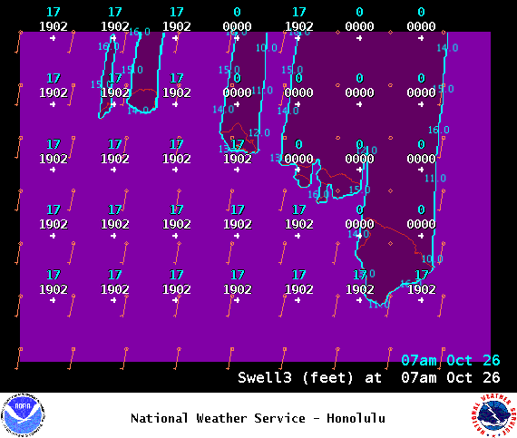
Image: NOAA / NWS
Image: NOAA / NWS
Image: NOAA / NWS
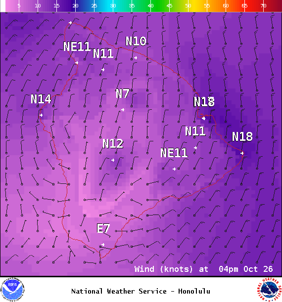
Image: NOAA / NWS
Sponsored Content


