

Weekend Surf: Warnings and Advisories Posted
Alerts
A High Surf Warning is posted for the north and east facing shores of the island of Hawaii through 6 p.m. Saturday. Swell from hurricane Olaf is expected to impact the area with wave heights of 15 to 20 foot faces.
A High Surf Advisory is posted for the south facing coastlines of the Big Island through 6 p.m. Saturday. Surf heights of 5 to 8 foot faces are expected.
A Small Craft Advisory is posted for all waters surrounding the Big Island through 6 p.m. Sunday. East to northeast winds up to 25 knots are forecast along with high seas.
Check our breaking news section for any urgent weather alerts.
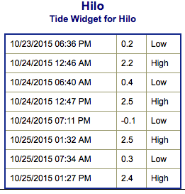
**Click directly on the images below to make them larger. Charts include: Big Island projected winds, tides, swell direction & period and expected wave heights.**
 Big Island Surf Forecast
Hilo side: Wave heights are expected head high to overhead or more today.
Kona side: Wave heights chest/head high are expected today. The best breaks could get overhead on the sets. Smaller waves are expected for spots not open to the south-southwest.
South: Wave heights are expected head high to overhead today. Best breaks open to the Olaf swell could get bigger on the sets.
 Tropical swell generated by hurricane Olaf continues to impact the east shores of the Big Island and Maui. A warning is in effect at this time with dangerous surf conditions expected through Saturday. The swell is expected to slowly begin to fade and shift over the weekend.
An advisory level south-southwest swell continues to influence south facing shores. The swell is expected to peak Saturday before slowly beginning a fading trend on Sunday. Another smaller south swell is expected to fill in Monday.
A larger NW swell is forecast to build Monday night and Tuesday with surf heights reaching advisory levels.
Keep in mind, surf heights are measured on the face of the wave from trough to crest. Heights vary from beach to beach, and at the same beach, from break to break.
**Click here for your detailed Big Island weather report.**
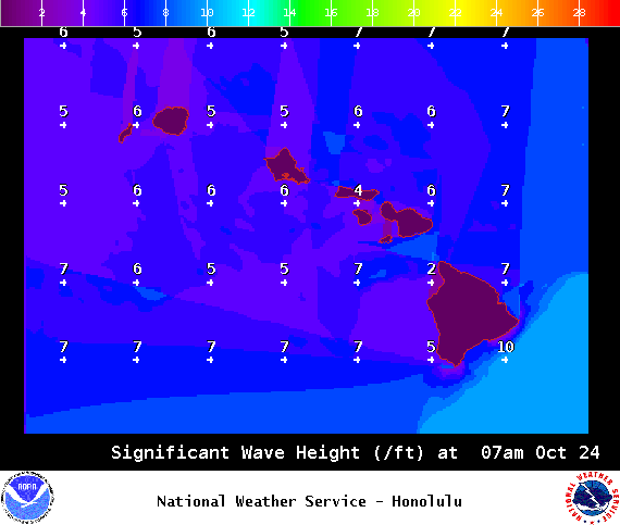
Image: NOAA / NWS
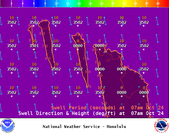
Image: NOAA / NWS
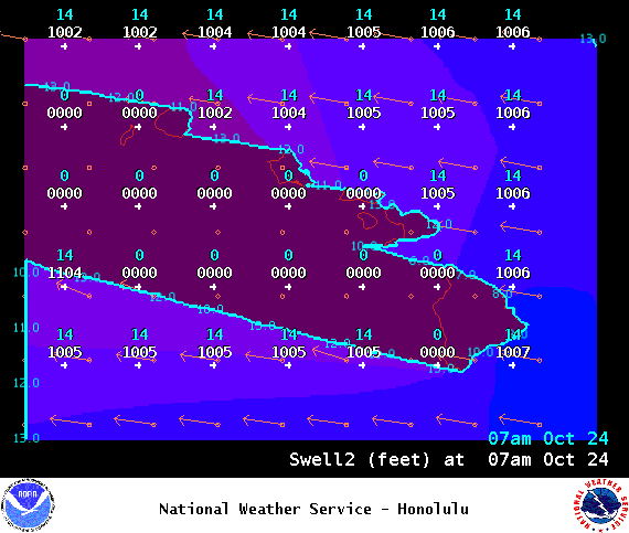
Image: NOAA / NWS
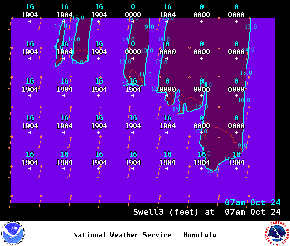
Image: NOAA / NWS
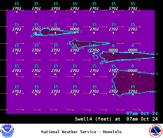
Image: NOAA / NWS
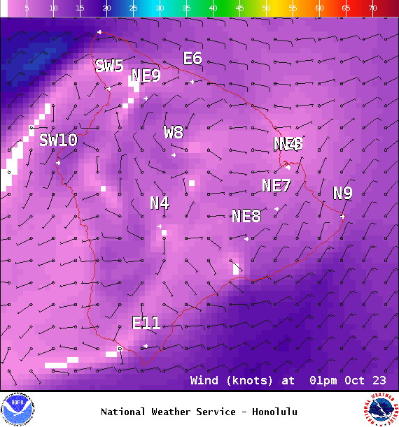
Image: NOAA / NWS
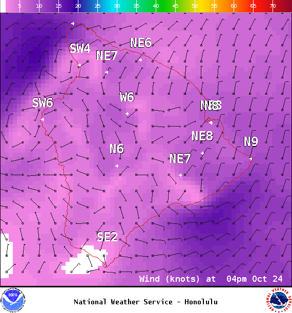
Image: NOAA / NWS
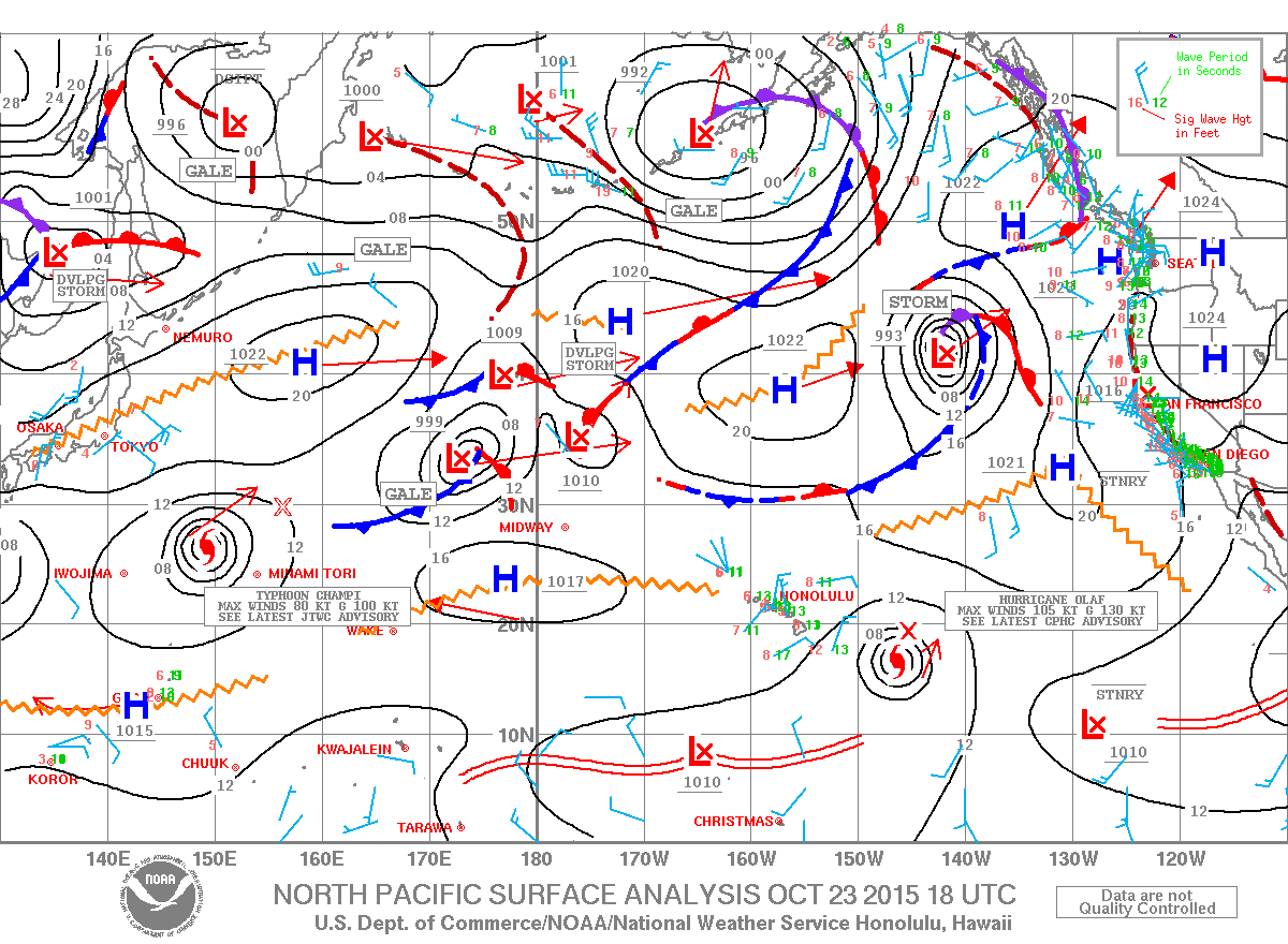
Image: NOAA / NWS
Sponsored Content


