

Cold Front Expected Next Week, Sunshine Today
Alerts
A High Surf Warning is posted for the north and east facing shores of the island of Hawaii through 6 p.m. Saturday. Swell from hurricane Olaf is expected to impact the area with wave heights of 12 to 18 foot faces.
A High Surf Advisory is posted for the south facing coastlines of the Big Island through 6 a.m. Saturday. Surf heights of 5 to 8 foot faces are expected.
A Small Craft Advisory is posted for all waters surrounding the Big Island through 6 p.m. Sunday. East to northeast winds up to 25 knots are forecast along with high seas.
Check our breaking news section for any urgent weather alerts.
**Click directly on the images below to make them larger. Charts include: Big Island high/low forecasted temperatures, projected winds, chance of cloud cover, projected localized weather conditions, vog/SO2 forecast and expected wave heights.**
Looking Ahead
Trade winds are forecast to gradually weaken while clouds along with a few light showers focus over the windward slopes through the weekend. A cold front will move across the island chain during the first half of next week bringing an increase to showers. Trade winds are expected to strengthen on Tuesday and Wednesday, then weaken again Thursday.
Hurricane Olaf is forecast to pass well east of the islands over the weekend. Olaf is expected to bring large surf to the islands, other weather impacts are not expected.
Today
Today partly cloudy skies are expected with isolated morning showers in windward areas. Sunshine is forecast as the day goes on. The Kona side is forecast to get clear skies in the morning with some clouds in the afternoon. High temperatures from 82° to 87°. Northeast winds are forecast around 15 mph.
UV index at 9 (“very high” exposure level)
Tonight
Northeast winds are expected in the evening around 15 mph. Low temperatures from 70° to 75°. Partly cloudy skies are expected in the evening with scattered showers for windward spots. Leeward spots should see clearing as the night goes on.
Our Big Island Now Weather homepage always includes daily: Sunrise | Sunset | Moonrise | Moonset | Moon Phase | Live Weather Cams | 5-day Forecast | Current Temperature & Conditions
**Click here for your detailed Big Island surf report.**
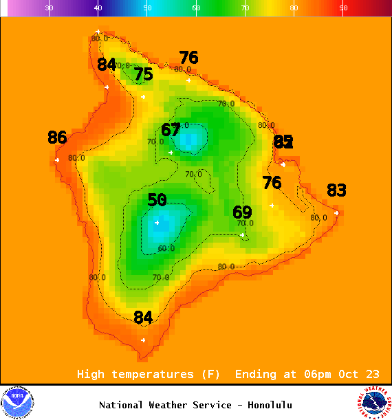
Image: NOAA / NWS

Image: NOAA / NWS
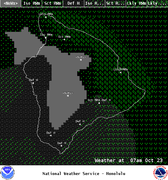
Image: NOAA / NWS
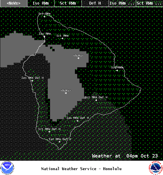
Image: NOAA / NWS
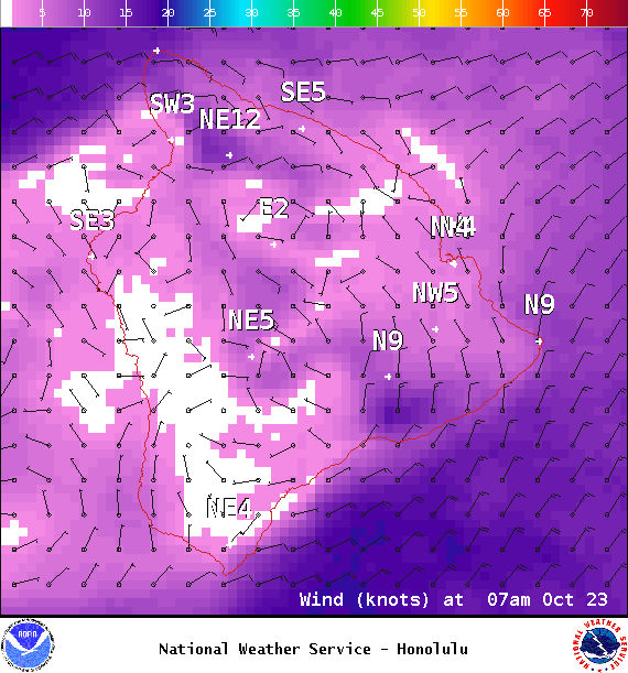
Image: NOAA / NWS
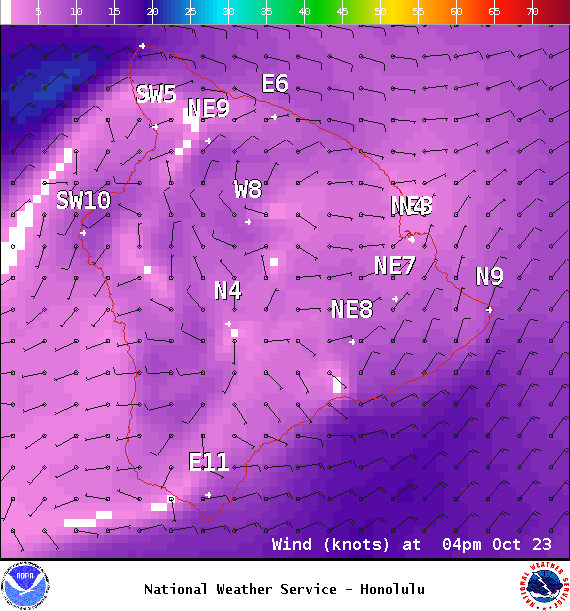
Image: NOAA / NWS
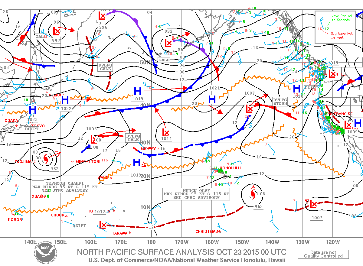
Image: NOAA / NWS
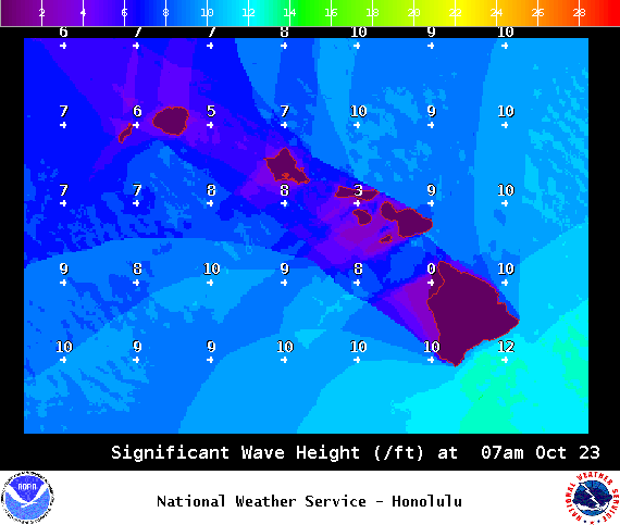
Image: NOAA / NWS
Sponsored Content


