

Drier Weather Expected Through Weekend
Alerts
A High Surf Warning is posted for the north and east facing shores of the island of Hawaii through 6 p.m. Saturday. Swell from hurricane Olaf is expected to impact the area with wave heights of 12 to 18 foot faces.
A Small Craft Advisory is posted for the ʻAlenuihāhā channel as well as waters to the south and west of the Big Island through 6 p.m. Sunday. East to northeast winds up to 25 knots are forecast along with seas up to 10 feet.
Check our breaking news section for any urgent weather alerts.
**Click directly on the images below to make them larger. Charts include: Big Island high/low forecasted temperatures, projected winds, chance of cloud cover, projected localized weather conditions, vog/SO2 forecast and expected wave heights.**
Looking Ahead
Moderate trade wind flow will slowly weaken Thursday through the weekend with drier conditions expected. A cold front will move through the islands early next week bringing an increase in chances for showers as well as stronger trade winds and lower humidity.
Hurricane Olaf is forecast to pass well east of the islands over the weekend. Olaf is expected to bring large surf to the islands, but it is too soon to know what other impacts Olaf will have. We will keep an eye on this situation and let you know if anything changes drastically.
Today
Today partly to mostly cloudy skies are expected with morning showers favoring windward areas. More sunshine is forecast as the day goes on. The Kona side is forecast to get clear skies in the morning with building cloud cover and isolated showers by the afternoon. High temperatures from 83° to 88°. Northeast winds are forecast around 15 mph.
UV index at 9 (“very high” exposure level)
Tonight
Northeast winds are expected in the evening around 15 mph. Low temperatures from 71° to 76°. Mostly cloudy skies are expected in the evening with scattered showers for windward spots. Leeward spots should see clearing as the night goes on.
Our Big Island Now Weather homepage always includes daily: Sunrise | Sunset | Moonrise | Moonset | Moon Phase | Live Weather Cams | 5-day Forecast | Current Temperature & Conditions
**Click here for your detailed Big Island surf report.**
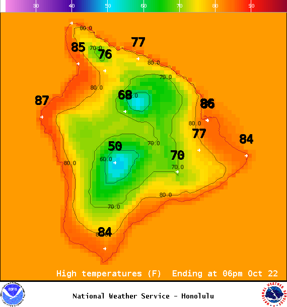
Image: NOAA / NWS
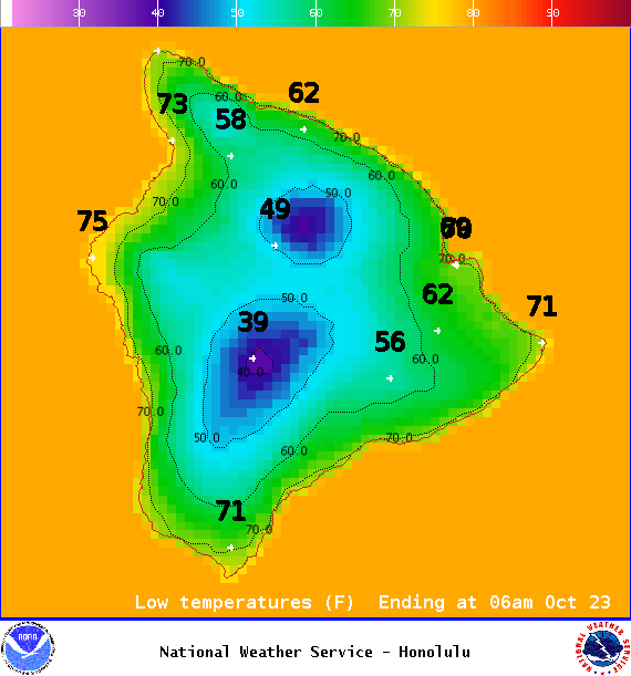
Image: NOAA / NWS
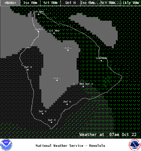
Image: NOAA / NWS
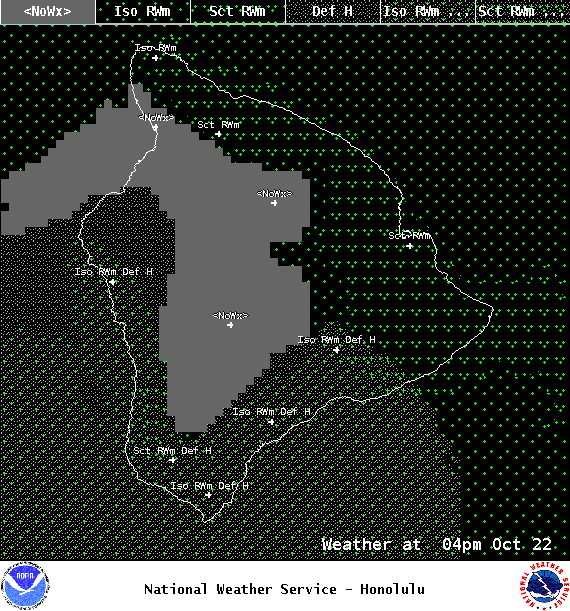
Image: NOAA / NWS
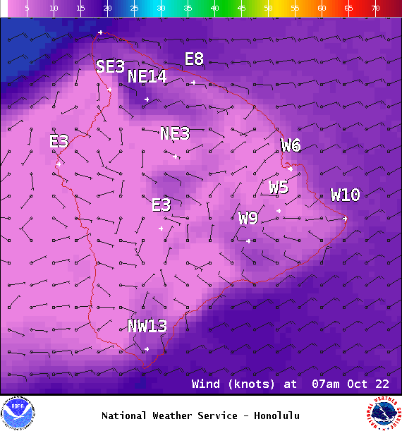
Image: NOAA / NWS
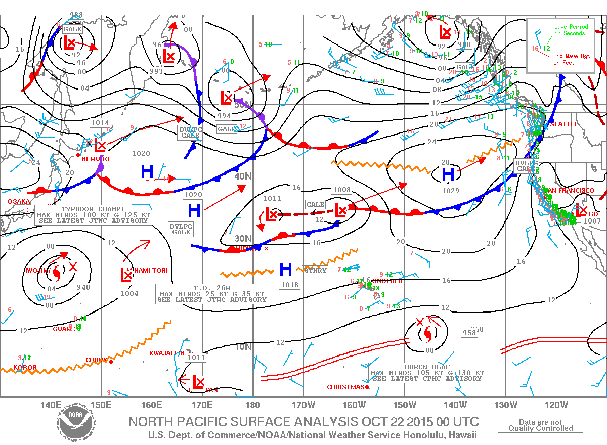
Image: NOAA / NWS
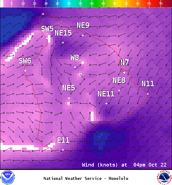
Image: NOAA / NWS
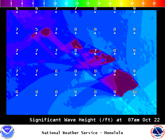
Image: NOAA / NWS
Sponsored Content


