

Olaf Generates Advisory Level Surf for Big Island
Alerts
A High Surf Advisory is posted for the north and east facing shores of the island of Hawaii through 6 a.m. Thursday. Swell from hurricane Olaf is expected to begin impacting the area early Wednesday morning with wave heights of 6 to 10 foot faces.
A Small Craft Advisory is posted for the ʻAlenuihāhā channel as well as waters to the south and west of the Big Island through 6 a.m. Thursday. East to northeast winds up to 25 knots are forecast along with seas up to 10 feet.
Check our breaking news section for any urgent weather alerts.
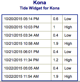
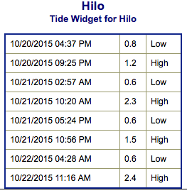
**Click directly on the images below to make them larger. Charts include: Big Island projected winds, tides, swell direction & period and expected wave heights.**
 Big Island Surf Forecast
Hilo side: Wave heights are expected head high or more today. The best breaks could get up to well overhead by sunset.
Kona side: Wave heights waist/tummy/chest high are expected today. The best breaks could get a bit bigger on the sets. Smaller waves are expected for spots not open to the south-southwest.
South: Wave heights waist/chest high are expected today. Best breaks could get a bit bigger on the sets. Spots catching the Olaf swell may get up to overhead by sunset.
 Our current shot of northwest is expected build through the day and peak Wednesday night before easing late Thursday into Friday.
Our current south-southwest swell is expected to hold Wednesday. New swell out of the southern hemisphere is expected Thursday into Friday.
Tropical swell is expected for the north and east shores of the Big Island, generated by hurricane Olaf. An advisory is in effect and warning level surf could occur. The swell is expected to quickly build Wednesday and peak Thursday and Friday.
Keep in mind, surf heights are measured on the face of the wave from trough to crest. Heights vary from beach to beach, and at the same beach, from break to break.
**Click here for your detailed Big Island weather report.**
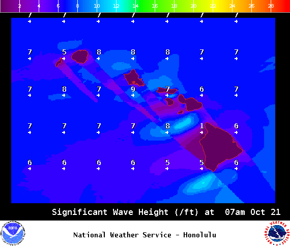
Image: NOAA / NWS
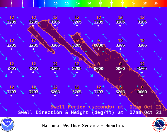
Image: NOAA / NWS
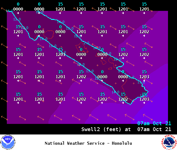
Image: NOAA / NWS
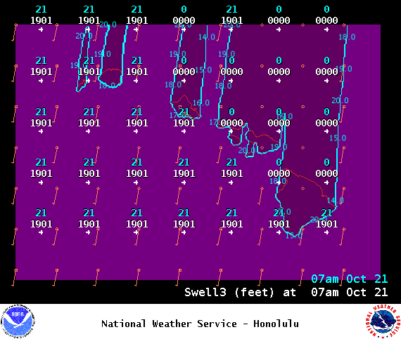
Image: NOAA / NWS
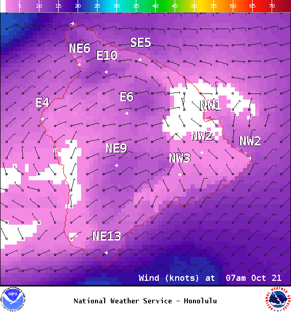
Image: NOAA / NWS
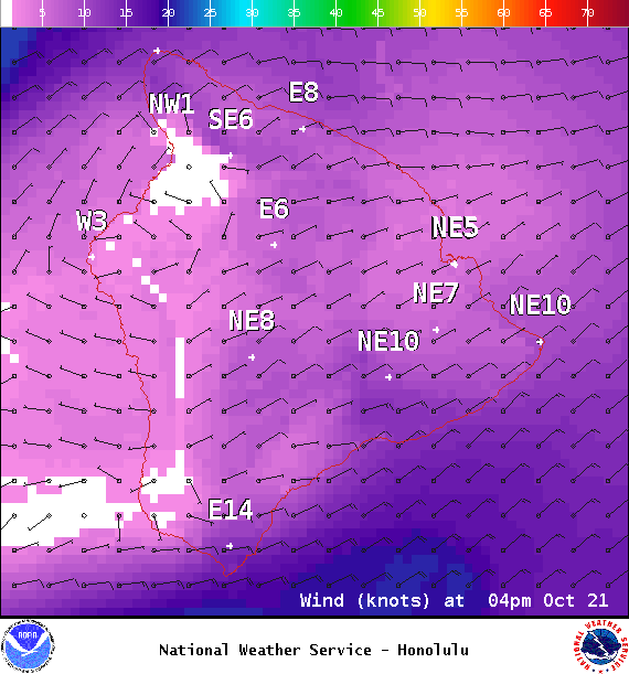
Image: NOAA / NWS
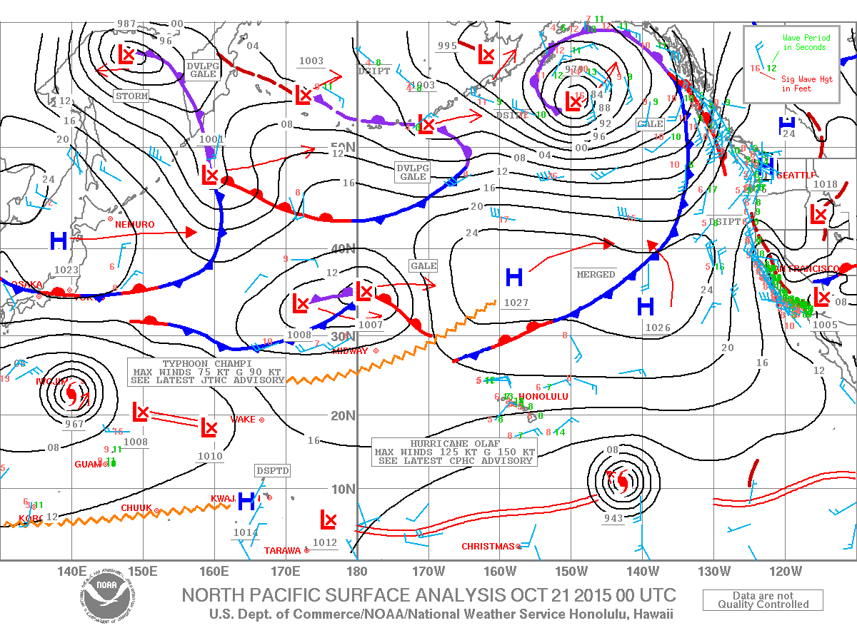
Image: NOAA / NWS
Sponsored Content


