

Trade Wind Weather Taking Over Forecast
Alerts
A High Surf Advisory is posted for south, north and east shores of the Big Island through 6 p.m. Thursday. Surf, generated by Nora, of 6 to 9 foot faces is expected. Expect strong breaking waves, shore break and strong longshore and rip currents making swimming difficult and dangerous.
Check our breaking news section for any urgent weather alerts.
**Click directly on the images below to make them larger. Charts include: Big Island high/low forecasted temperatures, projected winds, chance of cloud cover, projected localized weather conditions, vog/SO2 forecast and expected wave heights.**
Looking Ahead
Trade wind weather slowly returning to the islands. Clouds and passing showers will again favor windward and mauka areas. Over the weekend there may be a possible increase in clouds and showers across portions of the state as tropical moisture may spread over the area from the southeast.
Today
Today we expect partly sunny skies and isolated showers for windward spots. The Kona side is forecast to start out mostly sunny with clouds building in the afternoon and scattered showers. High temperatures from 82° to 87°. Northeast winds are forecast up to 15 mph.
UV index at 9 (“very high” exposure level)
Tonight
Northeast winds are expected in the evening up to 15 mph. Low temperatures from 71° to 76°. Mostly cloudy skies are expected in the evening with scattered showers for windward spots and isolated showers for leeward areas.
Our Big Island Now Weather homepage always includes daily: Sunrise | Sunset | Moonrise | Moonset | Moon Phase | Live Weather Cams | 5-day Forecast | Current Temperature & Conditions
**Click here for your detailed Big Island surf report.**
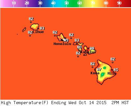
Image: NOAA / NWS
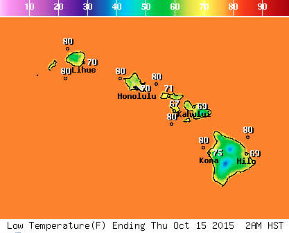
Image: NOAA / NWS
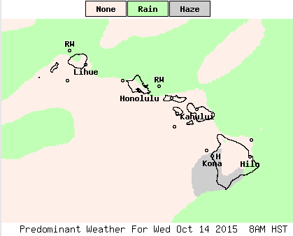
Image: NOAA / NWS
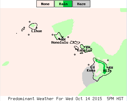
Image: NOAA / NWS
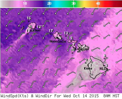
Image: NOAA / NWS
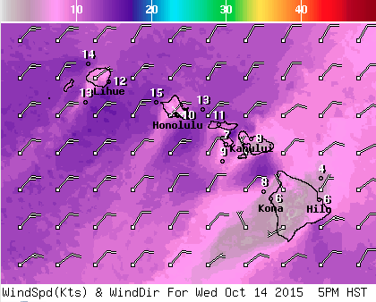
Image: NOAA / NWS
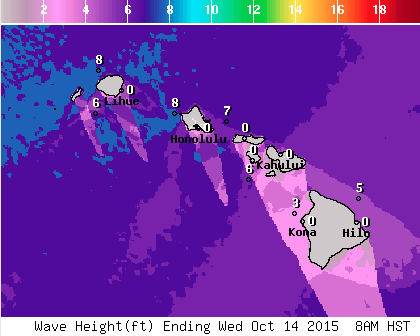
Image: NOAA / NWS
Image: NOAA / NWS
Sponsored Content


