

Hawaii County Surf Report for Thursday 9/17
Alerts
The Tsunami Advisory has been dropped. The PTWC says tsunami wave heights across the state of Hawaii are now below advisory levels and are continuing to diminish. Based on all available data, the PTWC has cancelled the advisory.
Small sea level changes and strong or unusual currents may persist for several additional hours in some coastal areas and appropriate caution should be exercised by boaters and swimmers.
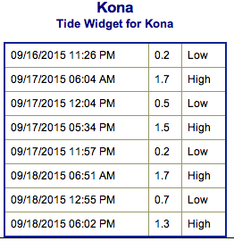
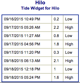
**Click directly on the images below to make them larger. Charts include: Big Island projected winds, tides, swell direction & period and expected wave heights.**
 Big Island Surf Forecast
Hilo side: Wave heights are expected waist/shoulder high today. The best breaks catching the trade swell could get a bit bigger on the sets.
Kona side: Wave heights knee/waist high are expected today. Best breaks could get up to chest high on the sets as a new SSW builds late in the day.
South: Wave heights waist/chest high are expected for the breaks open to the fading south-southwest swell. The best breaks could a bit bigger on the sets.
 Our current fun south-southwest continues to trend down today. A reinforcing swell is likely to begin to build late Thursday but size isn’t expected to show until early Friday. Another reinforcement is expected to overlap this swell moving in Sunday and peaking Monday.
A small northwest is all but gone and there is nothing of note out of the NPAC.
Keep in mind, surf heights are measured on the face of the wave from trough to crest. Heights vary from beach to beach, and at the same beach, from break to break.
**Click here for your detailed Big Island weather report.**
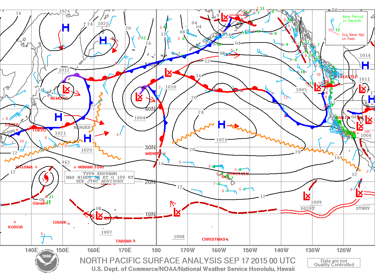
Image: NOAA / NWS
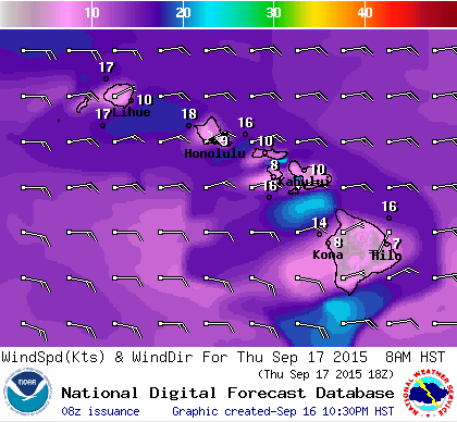
Image: NOAA / NWS
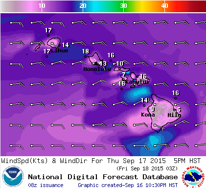
Image: NOAA / NWS
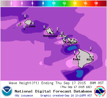
Image: NOAA / NWS
Sponsored Content


