

Afternoon Showers Expected for Kona Side Today
Alerts
The tsunami advisory has been dropped. The PTWC says tsunami wave heights across the state of Hawaii are now below advisory levels and are continuing to diminish. Based on all available data, the PTWC has cancelled the advisory.
Small sea level changes and strong or unusual currents may persist for several additional hours in some coastal areas and appropriate caution should be exercised by boaters and swimmers.
**Click directly on the images below to make them larger. Charts include: Big Island high/low forecasted temperatures, projected winds, chance of cloud cover, projected localized weather conditions, vog/SO2 forecast and expected wave heights.**
Looking Ahead
Moderate to fresh trade winds are forecasted to bring passing showers across the islands during the next several days, with rainfall focusing over windward and mauka areas. Some of the larger areas of showers will reach leeward locations at times. Daytime heating will also continue to trigger afternoon and early evening showers over the leeward Big Island slopes and coast. Another round of unsettled weather is possible again this weekend into next week as an upper level disturbance approaches the islands from the northeast, and deep tropical moisture spreads over the state once again.
Today
Today we expect mostly cloudy skies for windward Big Island in the morning with numerous showers and partly cloudy skies and scattered showers in the afternoon. The Kona side will be clear to start and mostly cloudy with showers likely each afternoon. High temperatures from 85° to 90°. Northeast winds are expected from 10 to 20 mph.
UV index at 10 (“very high” exposure level)
Tonight
Northeast winds are expected this evening from 10 to 20 mph. Low temperatures from 73° to 78°. Mostly cloudy skies are expected in the evening with scattered showers for windward spots. Leeward spots should get scattered showers in the evening with a clearing trend as the night goes on.
Our Big Island Now Weather homepage always includes daily: Sunrise | Sunset | Moonrise | Moonset | Moon Phase | Live Weather Cams | 5-day Forecast | Current Temperature & Conditions
**Click here for your detailed Big Island surf report.**
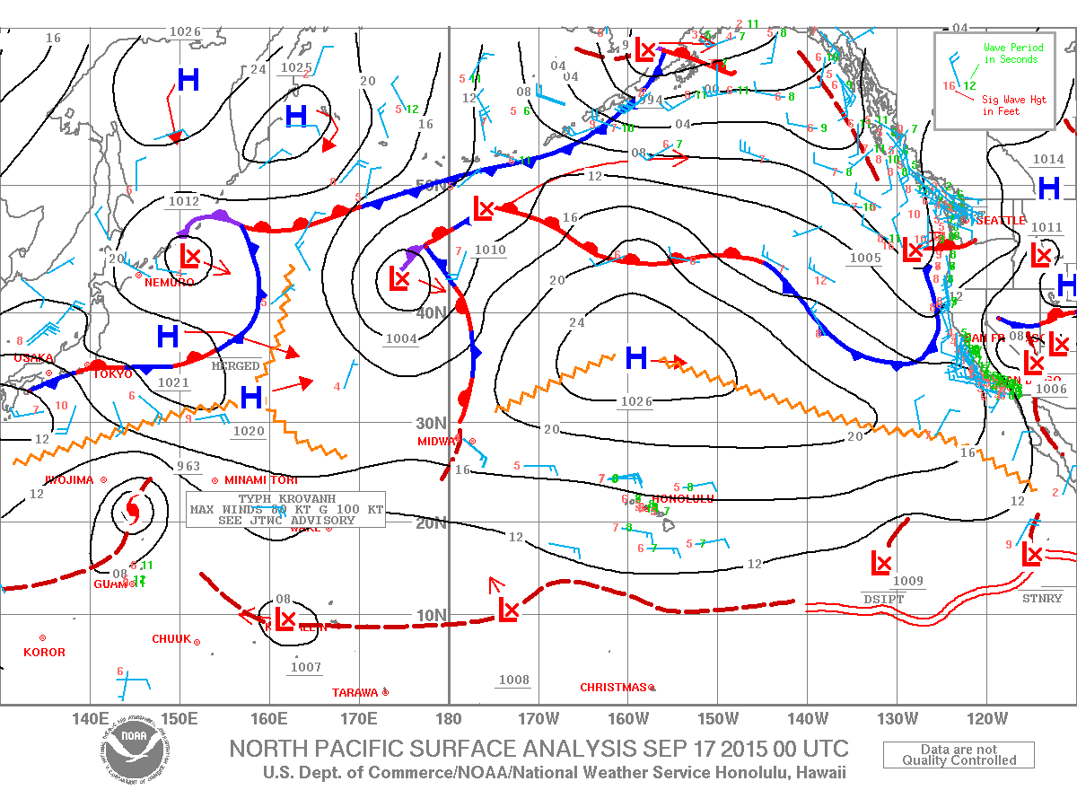
Image: NOAA / NWS

Image: UHSOEST
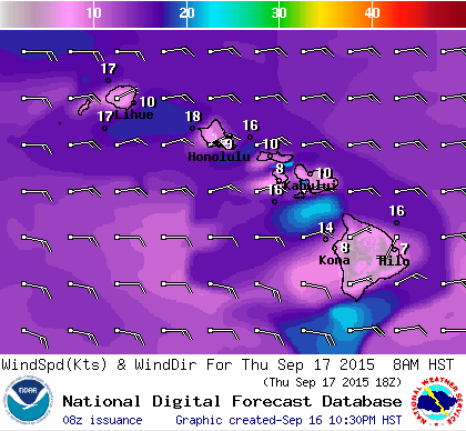
Image: NOAA / NWS

Image: NOAA / NWS
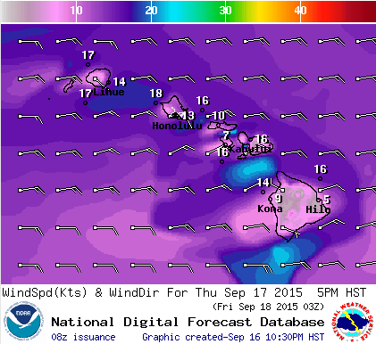
Image: NOAA / NWS
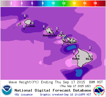
Image: NOAA / NWS

Image: NOAA / NWS

Image: NOAA / NWS
Sponsored Content


