

Labor Day Big Island Weather Forecast
Alerts
A High Surf Warning is posted for east facing shores of the Big Island through 6 p.m. Monday with wave heights up to 10 to 18 foot faces in some spots Tuesday. Expect ocean water occasionally sweeping across portions of beaches, very strong breaking waves and strong longshore and rip currents. Breaking waves may occasionally impact harbors making navigating the harbor channel difficult. Large breaking surf, significant shore break and dangerous currents will make entering the water very hazardous. Boaters should be aware of an increased number of surfers in the water.
A High Surf Advisory is posted for south facing shores through 6:00 p.m. Monday. Expect strong breaking waves, shore break and strong longshore and rip currents making swimming difficult and dangerous.
**Click directly on the images below to make them larger. Charts include: Big Island high/low forecasted temperatures, projected winds, chance of cloud cover, projected localized weather conditions, vog/SO2 forecast and expected wave heights.**
Looking Ahead
Light winds are expected to continue through the middle of the week as Jimena moves by to the north of the islands and continues to block our trade winds. Sea breezes are forecasted to produce clouds and showers from the late mornings through the evenings with clearing skies during the late nights and early mornings. The weather may turn quite wet during the second half of the week as moisture from Jimena moves over the islands.
Today
Today we expect partly cloudy skies with scattered windward showers and hazy leeward conditions (see UHSOEST vog model). There is a chance of locally heavy rainfall in the afternoon as clouds build on the Kona side due to daytime heating. High temperatures from 87° to 92°. Variable winds up to 15 mph.
UV index at 12 (“extreme” exposure level)
Tonight
Variable winds are expected this evening up to 15 mph. Low temperatures from 75° to 80°. Partly to mostly cloudy skies and a chance of showers are expected with clearing skies as the night goes on.
Our Big Island Now Weather homepage always includes daily: Sunrise | Sunset | Moonrise | Moonset | Moon Phase | Live Weather Cams | 5-day Forecast | Current Temperature & Conditions
**Click here for your detailed Big Island surf report.**

Image: UHSOEST
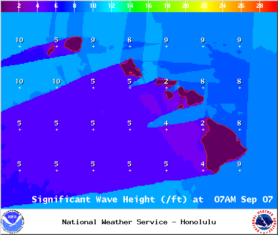
Image: NOAA / NWS
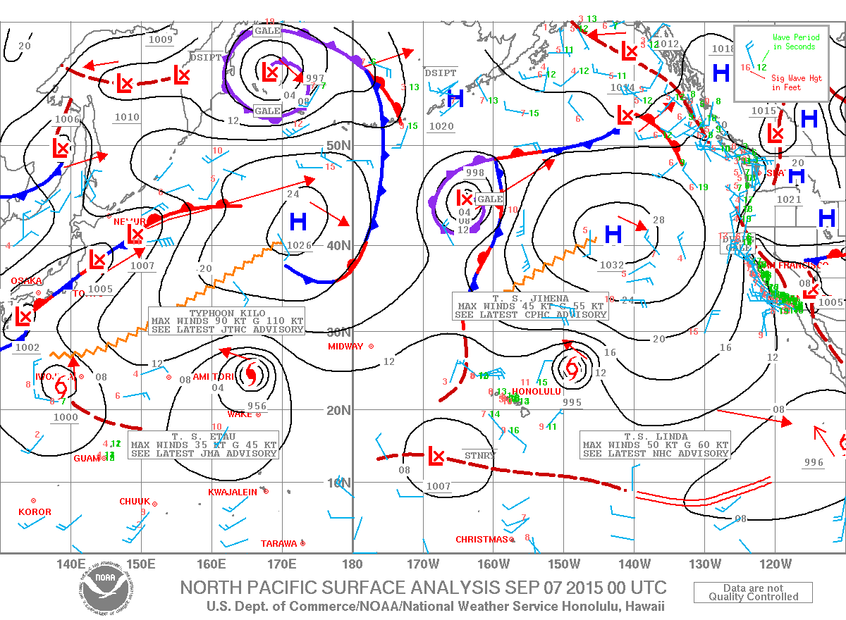
Image: NOAA / NWS
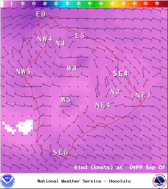
Image: NOAA / NWS
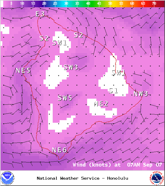
Image: NOAA / NWS

Image: NOAA / NWS

Image: NOAA / NWS

Image: NOAA / NWS

Image: NOAA / NWS
Sponsored Content


