

High Surf Advisory in Effect for all Big Island Shorelines
Alerts
A High Surf Advisory is posted for north, east and south facing shores of the Big Island from 6 a.m. Saturday through 6 p.m. Sunday. Wave heights of 5 to 8 feet are expected Saturday increasing to 10 to 14 feet late Sunday. Expect strong breaking waves, shore break and strong longshore and rip currents making swimming difficult and dangerous.
A High Surf Advisory is also posted for the Kona and Kohala coastlines through 6 p.m. Saturday for wave heights of 5 to 8 feet.
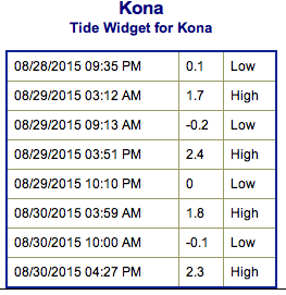
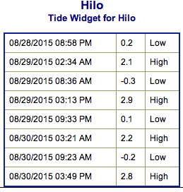
**Click directly on the images below to make them larger. Charts include: Big Island projected winds, tides, swell direction & period and expected wave heights.**
 Big Island Surf Forecast
Hilo side: Wave heights are expected to be knee/waist high today. We could see the beginning of Ignacio swell building in the afternoon up to chest/shoulder/head high by sunset.
Kona side: Wave heights chest/head high are expected for the best breaks open to the west blend swell. Could get up to slightly overhead on the sets. Waist/belly high waves for spots that are catching the southerly swell.
South: Wave heights are expected to be waist/chest high today for the best exposures open to the south swell. Spots open to the west will show in the waist/chest high range but most spots will be shut out.
 A west swell from former typhoon Atsani peaked overnight and is expected to continue into Saturday before slowly fading. A new east swell from hurricane Ignacio will arrive late tonight and build to advisory levels on Saturday. This swell will continue to build through the weekend approaching warning levels late Sunday. Warning level surf for east facing shores is possible early next week but is highly dependent upon the strength and track of Ignacio.
Our current southerly mix of swells are expected to hold through the weekend.
Keep in mind, surf heights are measured on the face of the wave from trough to crest. Heights vary from beach to beach, and at the same beach, from break to break.
**Click here for your detailed Big Island weather report.**
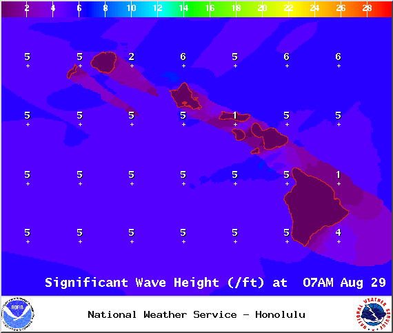
Image: NOAA / NWS
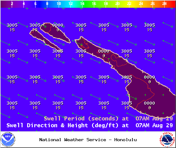
Image: NOAA / NWS
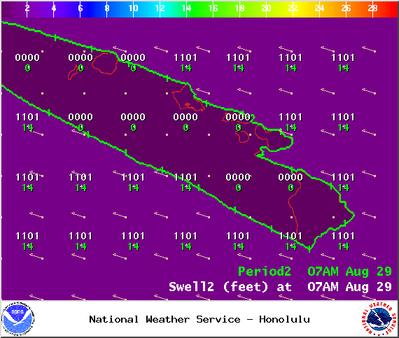
Image: NOAA / NWS
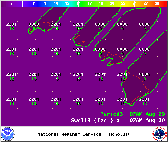
Image: NOAA / NWS
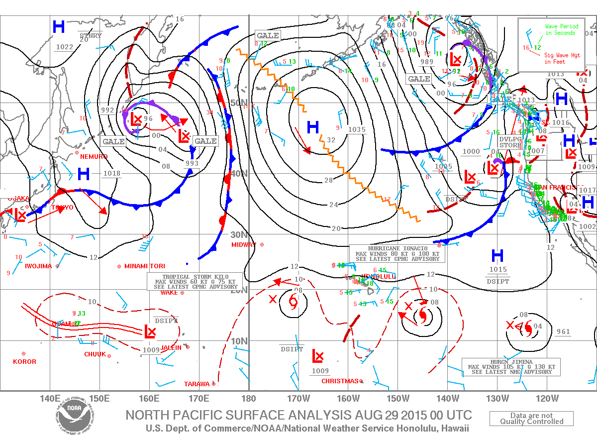
Image: NOAA / NWS
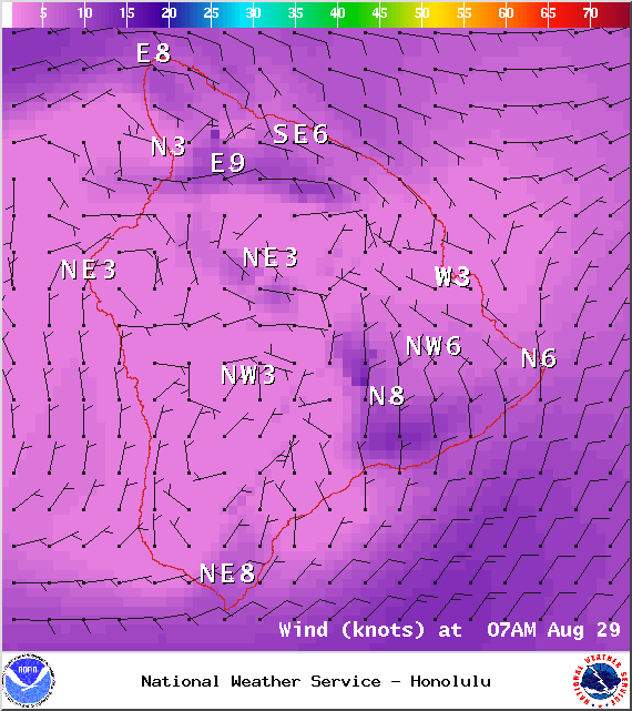
Image: NOAA / NWS
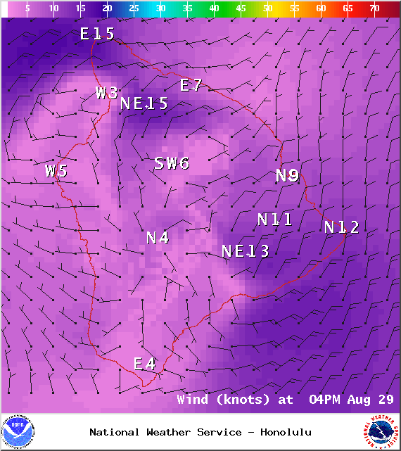
Image: NOAA / NWS
Sponsored Content


