

Westerly Atsani Swell Peaks, High Surf Advisory Issued
Alerts
A High Surf Advisory is posted through 6:00 a.m. Saturday for west facing shores of the Big Island.
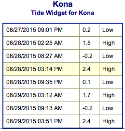
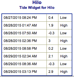
**Click directly on the images below to make them larger. Charts include: Big Island projected winds, tides, swell direction & period and expected wave heights.**
 Big Island Surf Forecast
Hilo side: Wave heights are expected to be knee/waist high today. The best breaks open to the swell could get a bit bigger on the sets.
Kona side: Wave heights waist/chest high are expected for the best breaks open to the west blend swell. Could get up to shoulder/head high on the sets. Waist/belly high waves for spots that are catching the southerly swell.
South: Wave heights are expected to be waist/chest high today for the best exposures open to the south swell. Spots open to the west will show in the waist/chest high range but most spots will be shut out.
 Our current south-southeast and south-southwest shifting south swell is expected to hold Friday and Saturday.
Depending on how Kilo develops we could continue to see swell from it next week.
Atsani has gone extra-tropical and we are expecting a west-northwest swell from Atsani to build Friday and peak late Friday into Saturday. Size will fade from then through the rest of the weekend.
Ignacio and Jimena are also expected to generate swells out of the east-southeast. Timing is currently expected for mid next week but will depend on the eventual track and intensity of the systems.
Keep in mind, surf heights are measured on the face of the wave from trough to crest. Heights vary from beach to beach, and at the same beach, from break to break.
**Click here for your detailed Big Island weather report.**
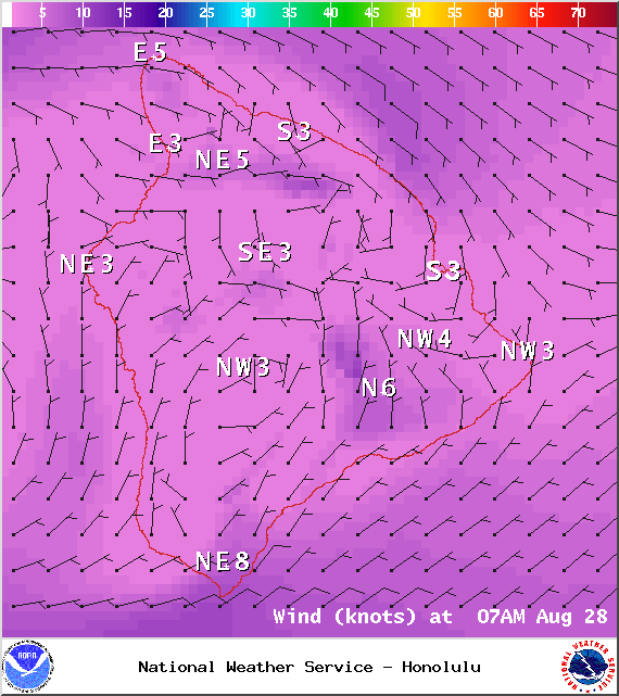
Image: NOAA / NWS
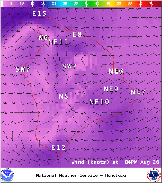
Image: NOAA / NWS
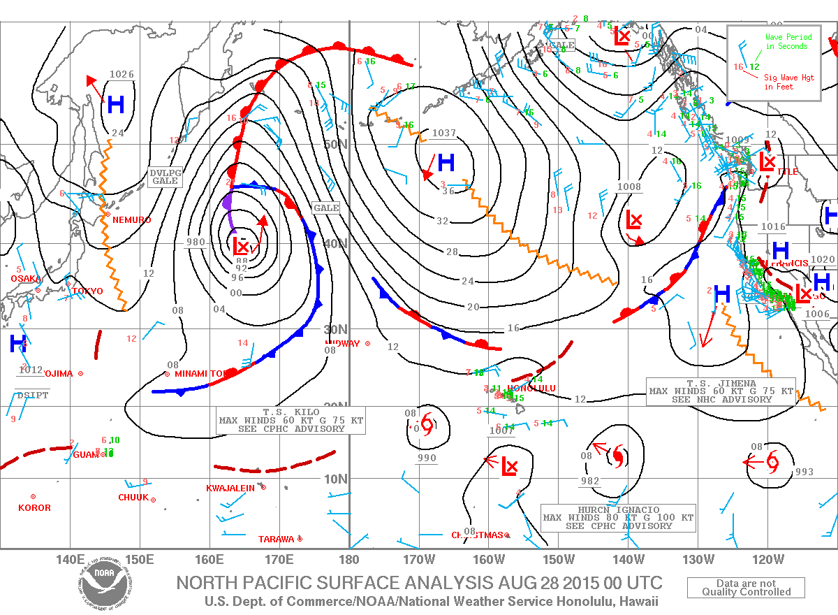
Image: NOAA / NWS
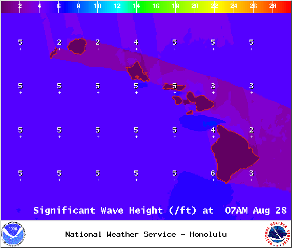
Image: NOAA / NWS
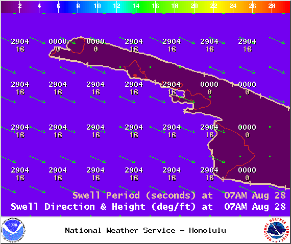
Image: NOAA / NWS
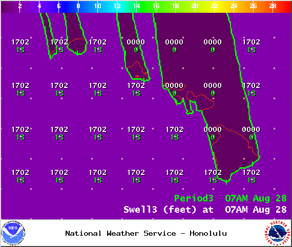
Image: NOAA / NWS
Sponsored Content


