Surf Fading, New Swells on Horizon
Alerts
There are no marine alerts posted at this time.
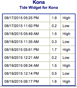
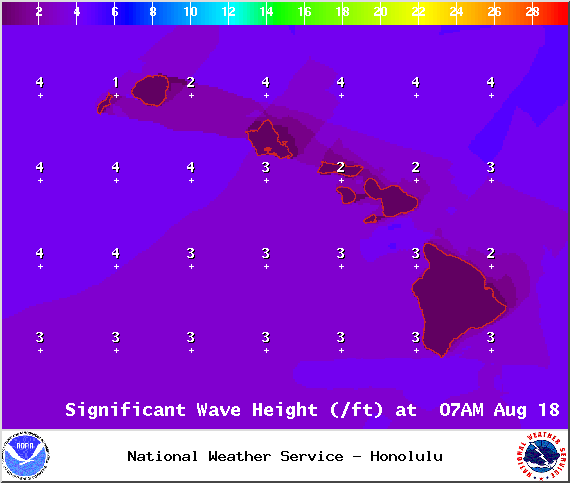
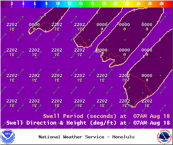
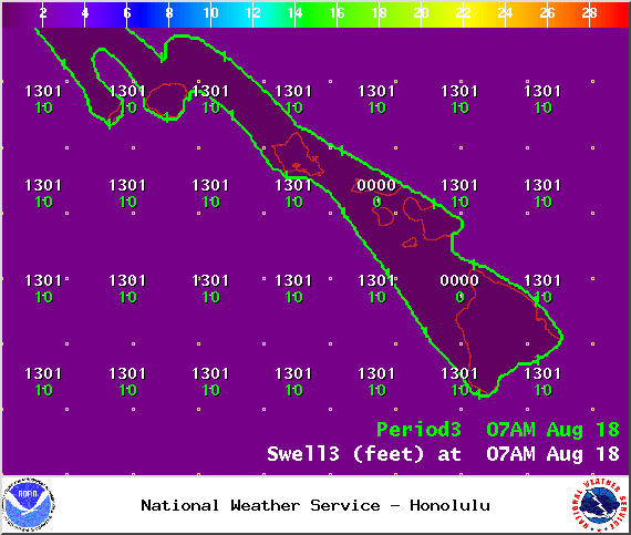
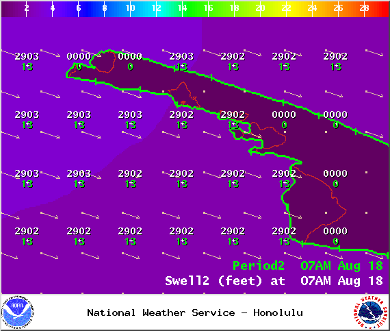
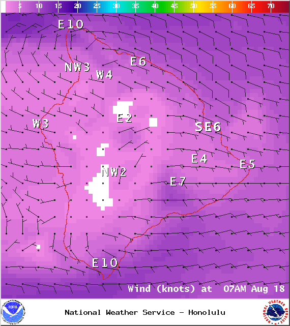
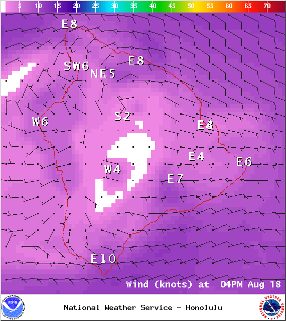
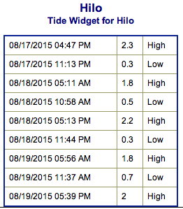
**Click directly on the images below to make them larger. Charts include: Big Island projected winds, tides, swell direction & period and expected wave heights.**
Hilo side: Wave heights are expected to be waist/head high today.
Kona side: Wave heights ankle/knee high are expected for the best breaks.
South: Wave heights are expected to be waist/chest high today for the best exposures open to trade swell.
Trade swell is expected to fade a bit as trades weaken. Tropical system Molave is expected to produce a small/fun swell that should arrive late Monday through Wednesday. The Big Island will be mostly blocked from this swell however.
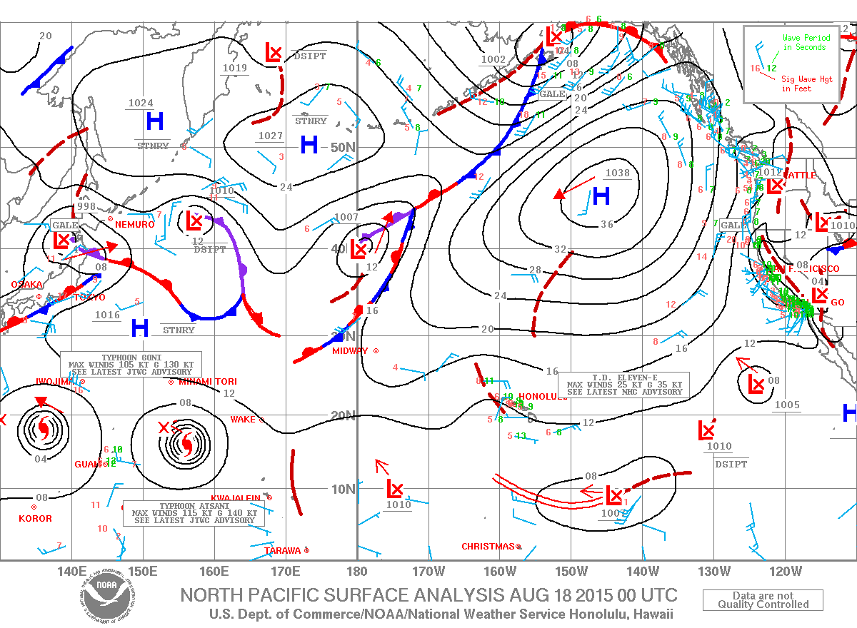
 No significant swells are on the horizon out of the SPAC. Energy out of the south continues to fade today. A storm near New Zealand is expected to send us a decent swell late this week and into the weekend.
Tropical systems in the West Pacific are expected to generate swell for the islands possibly starting next weekend (8/21). Will keep an eye on it.
Keep in mind, surf heights are measured on the face of the wave from trough to crest. Heights vary from beach to beach, and at the same beach, from break to break.
**Click here for your detailed Big Island weather report.**


