

Hot Weather Could Spawn Thunderstorms Today
Alerts
A Special Weather Statement has been issued by the National Weather Service for unsettled weather expected this afternoon.
Locally heavy rainfall is forecasted for Monday and Tuesday afternoons for island interiors.
Daytime heating along with lots of moisture in the atmosphere could lead to locally heavy downpours with rainfall rates of 2 to 3 inches per hour and even lightning strikes.
Motorists are advised that during rush hour they may experience these conditions as well as ponding on the roadways and low visibility due to heavy rain.
By evening the showers will likely move back offshore. The same weather pattern is expected Tuesday.
**Click directly on the images below to make them larger. Charts include: Big Island high/low forecasted temperatures, projected winds, chance of cloud cover, projected localized weather conditions, vog/SO2 forecast and expected wave heights.**
Looking Ahead
A bit of unsettled weather is on tap for the islands for the first half of the work week. Light southeast to south winds are expected. Volcanic haze is likely to show up over the western islands on Tuesday as well, lasting through Wednesday. The light wind conditions when combined with plenty of low level moisture will most likely lead to scattered showers. Showers could be locally heavy at times. Leeward Big Island will have active afternoon showers each day this week. In fact, a Flood Advisory was again posted for that area yesterday evening. A more stable trade wind weather pattern is expected to return to the islands Thursday.
Today
Partly sunny skies are expected in the morning with scattered windward showers. Leeward spots will be mostly sunny with mostly cloudy skies building in the afternoon. Scattered showers are expected for upslope areas as clouds build. There is a slight chance of thunderstorms and locally heavy rainfall as well. Winds will be light and variable up to 15 mph so our high temperatures, expected from 84° to 89°, will likely feel warmer due to the humidity.
UV index at 12 (“extreme” exposure level)
Tonight
Variable winds are forecasted up to 15 mph. Partly cloudy skies and scattered showers are expected in windward spots. Leeward areas should gradually clear as the night goes on. Low temperatures from 73° to 78° are expected.
Our Big Island Now Weather homepage always includes daily: Sunrise | Sunset | Moonrise | Moonset | Moon Phase | Live Weather Cams | 5-day Forecast | Current Temperature & Conditions
**Click here for your detailed Big Island surf report.**

Image: NOAA / NWS

Image: NOAA / NWS

Image: NOAA / NWS

Image: NOAA / NWS
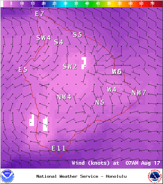
Image: NOAA / NWS
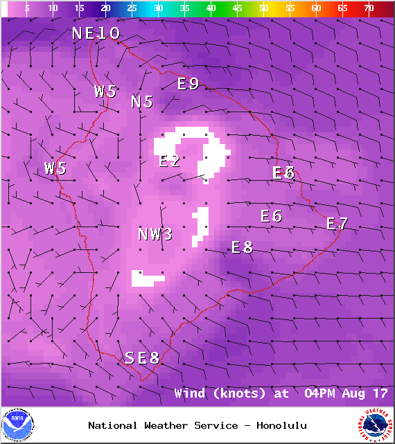
Image: NOAA / NWS
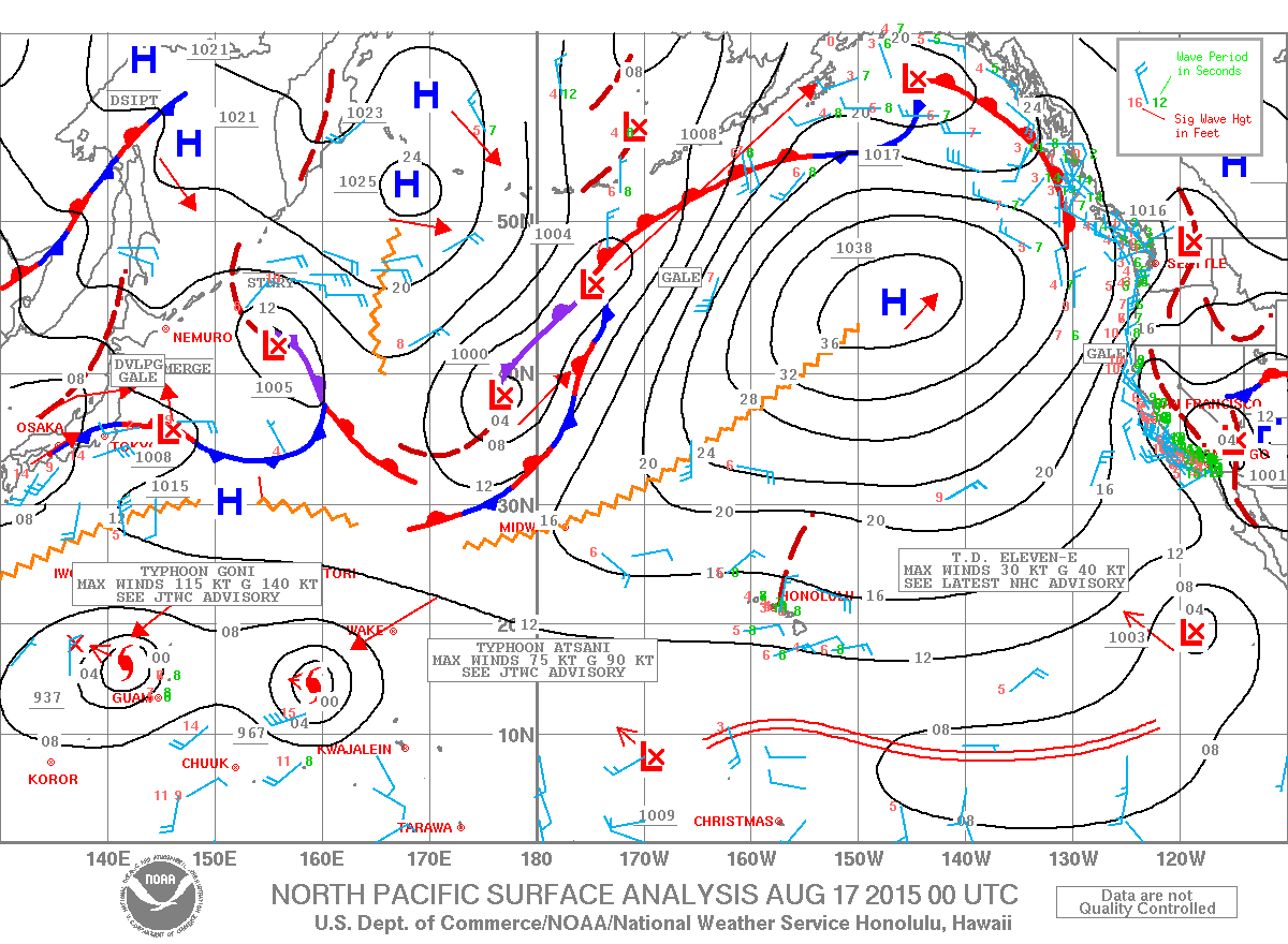
Image: NOAA / NWS
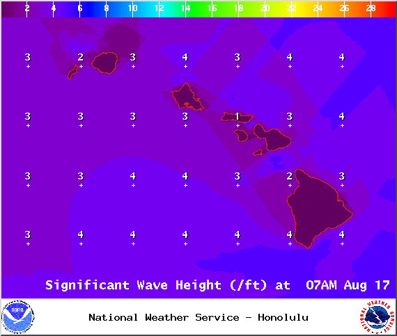
Image: NOAA / NWS
Sponsored Content


