

Today’s Weather Forecast Hilda Dependent
Alerts
A Flash Flood Watch has been issued for the Big Island. This watch goes into effect at 6:00 a.m. on Thursday through 6:00 a.m. Saturday. Abundant moisture from weakening Hilda is expected to produce the potential for excessive runoff, rock/mudslides and fast-moving water that could create life-threatening situations. Storm total rainfall amounts of 4 to 8 inches are possible with upslope areas getting up to a foot of rain.
A High Surf Advisory is posted for the Big Island as swell generated by Hilda continues to affect easterly exposures. The advisory is posted through 6:00 p.m. Thursday. Wave heights of 8 to 12 feet are expected. Expect strong breaking waves, shore break and strong longshore and rip currents making swimming difficult and dangerous.
A Tropical Storm Watch is posted for the waters to the south and west of the Big Island until further notice.
A Small Craft Advisory is posted for the rest of the Big Island coastal waters through 6:00 p.m. Friday for winds up to 30 knots and rough seas up to 10 feet. Inexperienced mariners should avoid navigating in these conditions.
A Tropical Storm Warning is in effect for offshore waters from 40 nm out to 240 nm.
**Click directly on the images below to make them larger. Charts include: Big Island high/low forecasted temperatures, projected winds, chance of cloud cover, projected localized weather conditions, vog/SO2 forecast and expected wave heights.**
Today
Today our weather is in flux and these forecast details could change as Hilda approaches. If so, we will update the forecast. For now, we expect high temperatures from 86° to 91°. East winds are expected from 15 to 25 mph with higher gusts. Partly to mostly cloudy skies are forecasted with frequent showers expected in windward areas. Leeward spots are expected to be partly cloudy with scattered showers early on with clouds building and showers likely in the afternoon. There is a slight chance of thunderstorms. Locally heavy rainfall is expected.
UV index at 12 (“extreme” exposure level)
Tonight
There is a slight chance for thunderstorms with locally heavy rainfall tonight. Mostly cloudy skies and frequent showers are expected for windward spots. Leeward spots should be partly to mostly cloudy with scattered showers. East winds are forecasted from 15 to 20 mph. Low temperatures from 74° to 79° are expected.
Looking Ahead
Tropical storm Hilda will boost northeast winds across the eastern portion of the state over the next couple days. Hilda is expected to bring widespread rain across the Big Island and some rain may eventually spread to the smaller islands over the next couple days. This will result in heavy showers and the potential for flash flooding on the Big Island over the next two days. Moisture associated with Hilda will clear the state on Saturday. A trough passing near the islands later in the weekend will cause trade winds to weaken and shift out of the east-southeast into early next week.
Our Big Island Now Weather homepage always includes daily: Sunrise | Sunset | Moonrise | Moonset | Moon Phase | Live Weather Cams | 5-day Forecast | Current Temperature & Conditions
**Click here for your detailed Big Island surf report.**

Image: NOAA /NWS

Image: NOAA /NWS

Image: NOAA /NWS

Image: NOAA /NWS

Image: NOAA /NWS
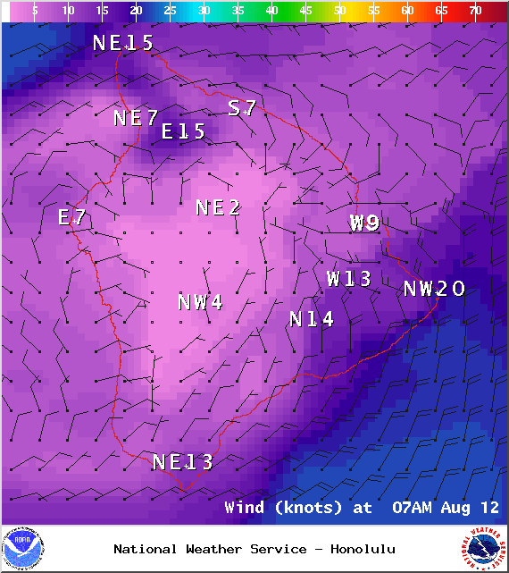
Image: NOAA /NWS
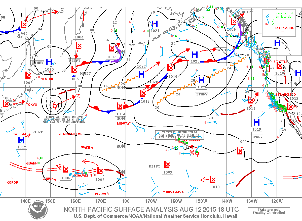
Image: NOAA /NWS
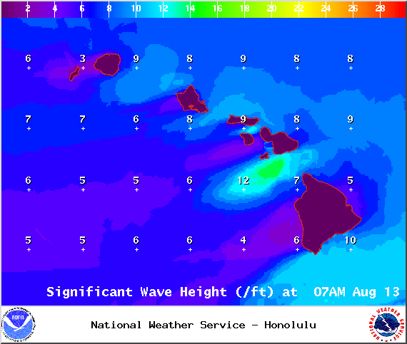
Image: NOAA /NWS
Sponsored Content


