

Increased Moisture Could Arrive as Early as Today
Alerts
A Hydrologic Outlook has been issued by the National Weather Service. Heavy rain and flash flooding are possible late Wednesday night through Friday as Hilda approaches the state. The NWS warns that regardless of its strength, the system will have the potential to produce very heavy rainfall and flash flooding as moisture spreads from east to west over the island chain. Details of timing, location and amount of rainfall are still highly dependent on where Hilda ends up tracking.
A Tropical Storm Watch is posted for the Big Island and its surrounding waters. A Tropical Storm Watch means that tropical storm conditions are possible within the next 48 hours somewhere within the specified areas. A watch is typically issued before the possible arrival of tropical storm force winds which make continuing outside preparations dangerous. A watch is the time for you to prepare.
A High Surf Warning is posted for the east side as swell generated by hurricane Hilda builds. The warning is posted through 6:00 a.m. Wednesday. Wave heights of 10 to 15 feet are expected Tuesday. Expect ocean water occasionally sweeping across portions of beaches, very strong breaking waves and strong longshore and rip currents. Breaking waves may occasionally impact harbors making navigating the harbor channel difficult. Large breaking surf, significant shore break and dangerous currents will make entering the water very hazardous. Boaters should be aware of an increased number of surfers in the water.
A Hurricane Warning is posted for Hawaiian offshore waters from 40 nautical miles out to 240 nautical miles until further notice.
**Click directly on the images below to make them larger. Charts include: Big Island high/low forecasted temperatures, projected winds, chance of cloud cover, projected localized weather conditions, vog/SO2 forecast and expected wave heights.**
Today
We expect high temperatures from 83° to 88°. Northeast winds are expected from 10 – 20 mph. Mostly cloudy skies are forecasted with showers likely in windward areas. Leeward spots are expected to be sunny to start with building cloud cover and scattered afternoon showers.
UV index at 12 (“extreme” exposure level)
Tonight
Mostly cloudy skies are expected with scattered showers for windward spots. Leeward spots should be partly cloudy with isolated showers. Northeast winds are forecasted from 10 to 20 mph. Low temperatures from 71° to 76° are expected.
Looking Ahead
Moderate to locally breezy trade winds will decline slightly on Tuesday. Showers will remain focused over windward slopes, with an increase in low level moisture expected as early as Tuesday for windward Big Island. The forecast for the second half of the work week continues to depend on the evolution of hurricane Hilda, though chances are increasing for heavy rainfall and flash flooding over portions of the state.
Our Big Island Now Weather homepage always includes daily: Sunrise | Sunset | Moonrise | Moonset | Moon Phase | Live Weather Cams | 5-day Forecast | Current Temperature & Conditions
**Click here for your detailed Big Island surf report.**

Image: NOAA / NWS

Image: NOAA / NWS

Image: NOAA / NWS

Image: NOAA / NWS
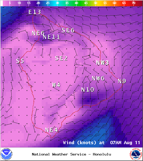
Image: NOAA / NWS
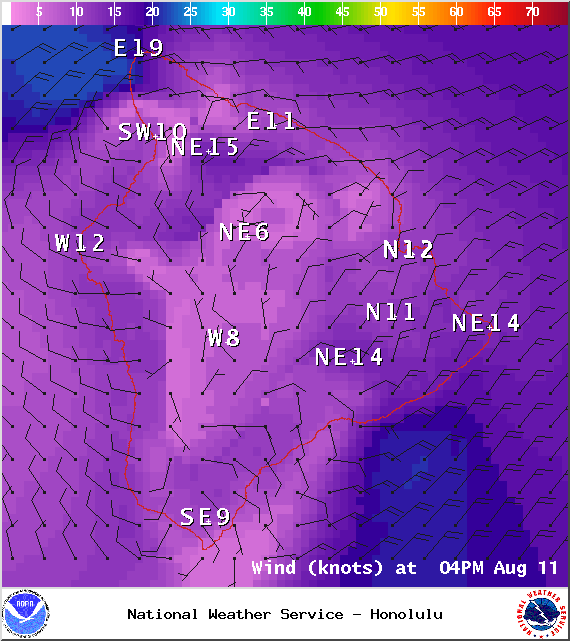
Image: NOAA / NWS
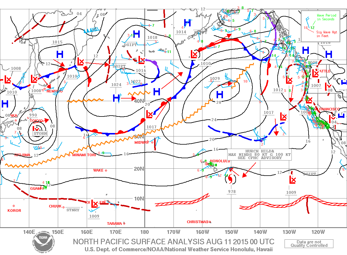
Image: NOAA / NWS
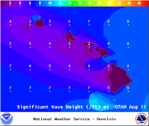
Image: NOAA / NWS
Sponsored Content


