

Swell Slowly Easing Today
Alerts
The High Surf Warning has been cancelled and replaced by a High Surf Advisory. The advisory is posted for the south facing shores of all islands in Maui County through 6:00 a.m. Tuesday. Wave heights of 8 to 12 foot faces are forecasted. Expect strong breaking waves, shore break and strong longshore and rip currents making swimming difficult and dangerous.
A Marine Weather Statement has also been issued. The National Weather Service says “a long period south swell will continue to generate moderate surges in south facing harbors. Additionally, waves my break in and near channel entrances through Monday.
**Click directly on the images below to make them larger. Charts include: Big Island projected winds, tides, swell direction & period and expected wave heights.**
 Big Island Surf Forecast
Hilo side: Knee/waist high waves expected today for well exposed breaks. Best breaks could see sets up to tummy/chest high waves from time to time.
Kona side: Wave heights head high to overhead are expected in the morning with an easing trend through the day. The best breaks could still be well overhead on the sets in the morning.
South: Wave heights head high to well overhead are expected in the morning with an easing trend through the day. The best breaks could still be near double overhead on the sets in the morning.
 Our current south-southwest swell is expected to slowly start an easing trend Monday, continuing to ease through the week, dropping out around Thursday. Small rideable pulses out of the south are expected but nothing super notable.
Small trade swell will push into northeasterly exposures. Otherwise, the north Pacific is looking very quiet.
Keep in mind, surf heights are measured on the face of the wave from trough to crest. Heights vary from beach to beach, and at the same beach, from break to break.
**Click here for your detailed Big Island weather report.**
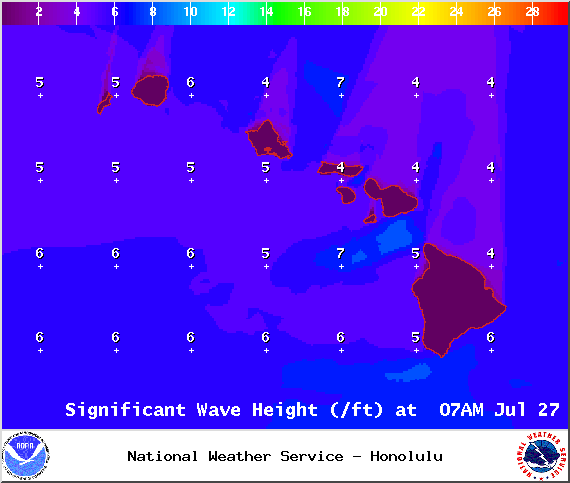
Image: NOAA / NWS

Image: NOAA / NWS

Image: NOAA / NWS
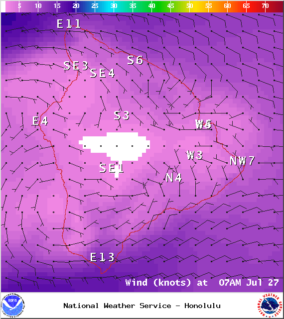
Image: NOAA / NWS
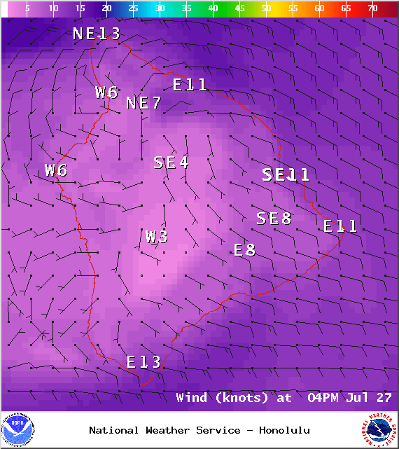
Image: NOAA / NWS
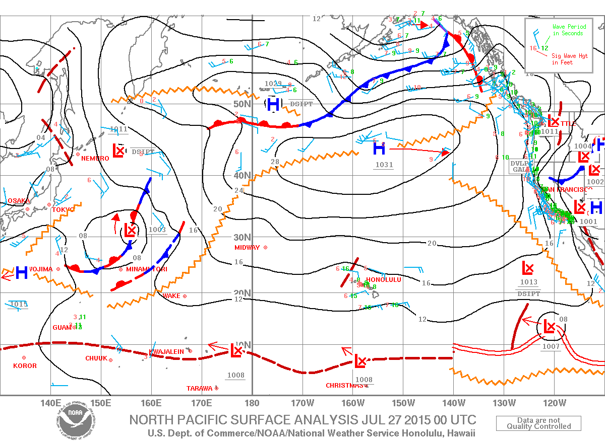
Image: NOAA / NWS
Sponsored Content


