Kilauea Summit Update – 7/1/15
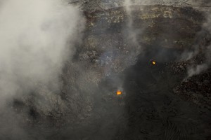
Hawaiian Volcano Observatory conducted an overflight assessment of the Puʻu ʻŌʻō and June 27, 2014 lava flow areas on Tuesday. During the overflight geologists, noticed two incandescent vents in the southern portion of the Puʻu ʻŌʻō crater and a “robust outgassing plume coming from the wall of a pit in the northeast part of the crater.”
In addition, HVO reported observations of a crusted-over lava pond deep in a large circular pit in the west area of the Puʻu ʻŌʻō crater. This pond was reportedly bubbling over along its own margin.
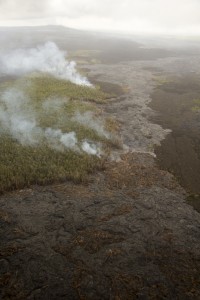
Observations of the June 27, 2014 lava flow conducted during the Tuesday overflight confirmed recent webcam visuals. HVO reports that active lava breakouts were visible and extended to the northeast of Puʻu ʻŌʻō by about 5 miles.
Between HVO’s June 19 overflight assessment and Tuesday’s assessment, geologists reported seeing no downslope advancement of the June 27, 2014 flow. Expansion of flow margins, within moderate levels, was observed.
Tilt at the summit of Kilauea remains flat, according to HVO, who reported that tiltmeters at the summit have not record significant tilt trends since Friday.
Lava within the Overlook crater’s lava lake measured Wednesday morning has dropped about 15 feet since the previous day. The surface of the lake is now about 155 feet below the current crater rim.
Seismic rates below Kilauea’s summit remain at background levels as bursts of seismic tremor in association with periods of vigorous spattering of the lava lake continues.

June 30: Active pāhoehoe lava is scattered over a broad area northeast of Puʻu ʻŌʻō, but has not advanced significantly over the past month. On Tuesday, the farthest active lava was about 7.5 km (4.7 miles) from the vent on Puʻu ʻŌʻō, with the leading tip of this breakout burning vegetation. Aerial view towards the southwest. Puʻu ʻŌʻō is in the upper left. USGS/HVO photo.

June 30: A view of the southern portion of Puʻu ʻŌʻō crater, where two small incandescent vents have been active recently. USGS/HVO photo.

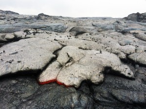
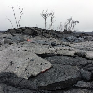
June 30: A closer view of the one of the pāhoehoe breakouts near Puʻu Kahaualeʻa. The dark flakes on the surface are bits of crust from the underlying flow that get stuck to the front of the newer flow, and end up on the top surface as the nose of the new flow inflates. USGS/HVO photo.


