

SSW Peaks Father’s Day Weekend
Alerts
A High Surf Advisory is posted for south-facing shores. A slow-moving storm near New Zealand generated a south-southwest swell that will continue to build across Hawaiian waters today. Advisory level surf is expected through 6:00 p.m. Sunday. Waves of 6-8 feet are expected with bigger sets at the best breaks exposed to the swell. The swell is expected to continue to build today and peak overnight.
A Small Craft Advisory is posted for the ʻAlenuihāhā channel and waters to the southeast and lee side of the Big Island through 6:00 a.m. Sunday. Northeast winds from 15 to 25 knots are expected with rough seas up to 11 feet.
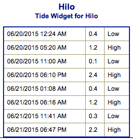
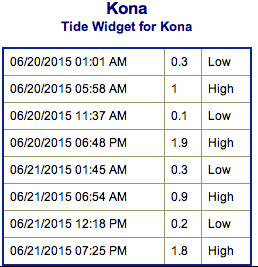
**Click directly on the images below to make them larger. Charts include: Big Island projected winds, tides, swell direction & period and expected wave heights.**
 Big Island Surf Forecast
Hilo side: Waist/shoulder high waves expected today for east exposed breaks.
Kona side: Wave heights of shoulder/head high are expected. The best breaks could get up to a couple feet overhead on the sets.
South: Wave heights shoulder/head high are expected. Standout spots could get up to a couple feet overhead.
 A fun swell is expected to continue building and peak on Saturday with a reinforcement right on its heels.
Out of the North Pacific conditions will be pretty flat with no significant swells on the horizon.
Trade swell it expected through Saturady in the waist/chest high range before slowly decreasing starting Sunday.
Keep in mind, surf heights are measured on the face of the wave from trough to crest. Heights vary from beach to beach, and at the same beach, from break to break.
**Click here for your detailed Big Island weather report.**
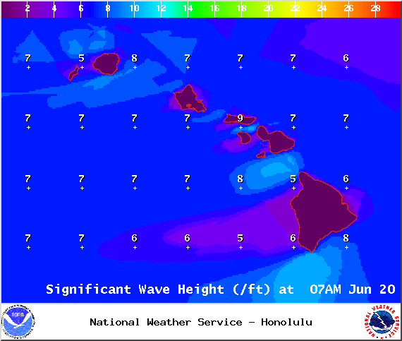
Image: NOAA / NWS
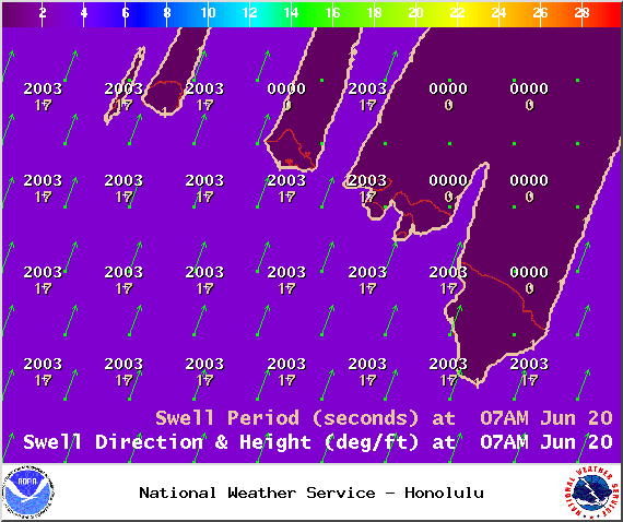
Image: NOAA / NWS
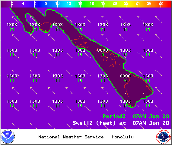
Image: NOAA / NWS
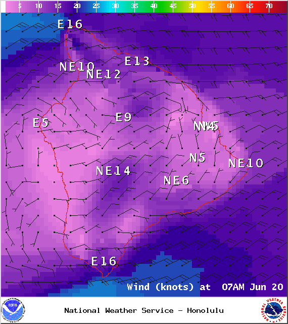
Image: NOAA / NWS
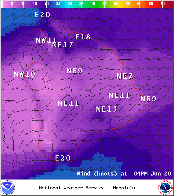
Image: NOAA / NWS
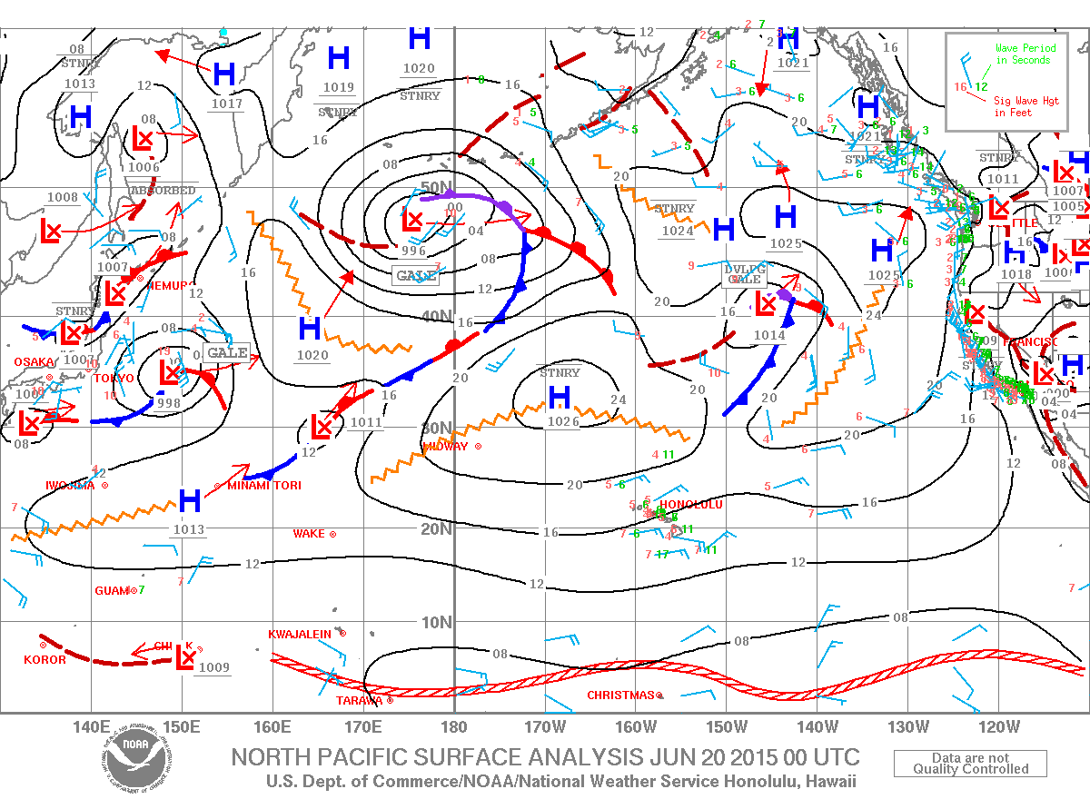
Image: NOAA / NWS
Sponsored Content


