

Wind Advisory Posted For Winds Topping 50 mph
Alerts
A Small Craft Advisory is posted for all Big Island waters through 6:00 p.m. Thursday. East winds up to 30 knots are forecasted along with rough seas of 9 to 13 feet. Inexperienced mariners should avoid navigating in these conditions.
A High Surf Advisory is posted for our east facing shores through 6:00 a.m. Thursday. Surf is expected to reach 6 to 9 foot faces. Expect strong breaking waves, shore break and strong longshore and rip currents making swimming difficult and dangerous.
A Gale Warning is posted for the ʻAlenuihāhā channel through 6:00 p.m. Wednesday for northeast winds up to 35 knots with higher gusts and rough seas up to 15 feet.
A Wind Advisory is posted for Waimea, Kawaihae and the Saddle Road on the Big Island. Winds out of the northeast from 25 to 35 mph are expected with gusts up to 50 mph. The strongest winds will be over and around mauka areas. The National Weather Service advises that winds this strong can make walking and driving difficult. Use extra caution when driving and be careful when opening and closing doors. If camping in the area, be sure your tent is well anchored.
**Click directly on the images below to make them larger. Charts include: Big Island high/low forecasted temperatures, projected winds, chance of cloud cover, projected localized weather conditions, vog/SO2 forecast and expected wave heights.**
Today
Gusty northeast winds are forecasted from 15 to 35 mph with gusts over 50 mph in the windiest areas. Mostly cloudy skies are forecasted for windward spots with scattered showers. Partly cloudy skies for leeward areas becoming mostly cloudy by the afternoon with isolated showers. High temperatures from 81° to 86°.
UV index at 11 (“extreme” exposure level)
Tonight
Mostly cloudy skies are expected tonight with likely windward showers. Partly cloudy for leeward spots with isolated showers and clearing as the night goes on. Northeast winds are forecasted from 10 to 25 mph. Low temperatures from 68° to 73° are expected.
Looking Ahead
We expect strong and gusty trade wind conditions to continue for the state through Wednesday. The trades are forecasted to ease Thursday to moderate levels and persist into the weekend. Showers will favor windward and mountain areas through the week with some showers blowing over to leeward locations. The leeward Big Island will see a few showers each afternoon.
Our Big Island Now Weather homepage always includes daily: Sunrise | Sunset | Moonrise | Moonset | Moon Phase | Live Weather Cams | 5-day Forecast | Current Temperature & Conditions
**Click here for your detailed Big Island surf report.**
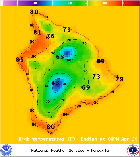
Image: NOAA / NWS
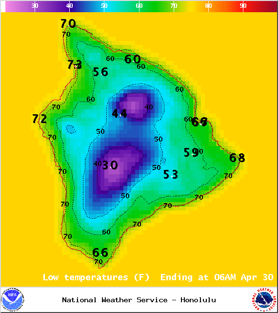
Image: NOAA / NWS
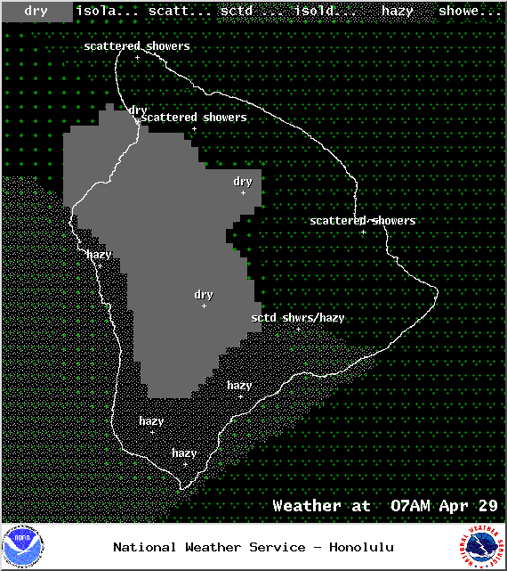
Image: NOAA / NWS
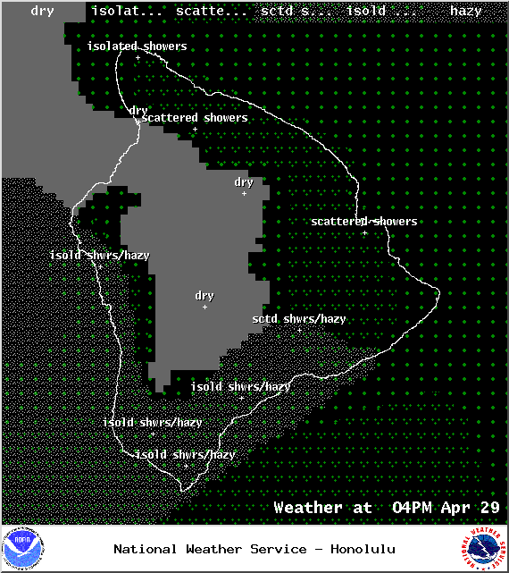
Image: NOAA / NWS
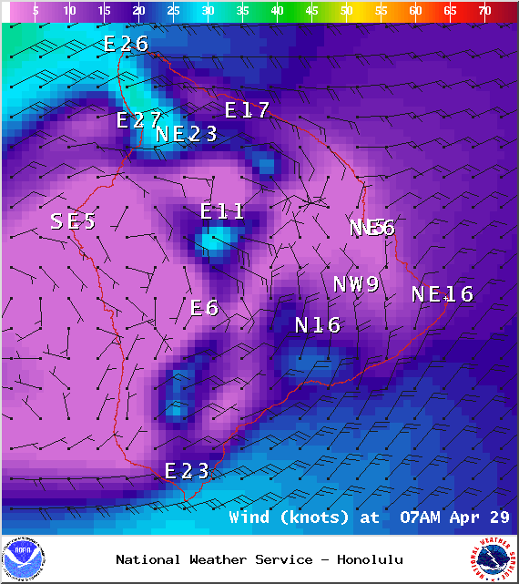
Image: NOAA / NWS
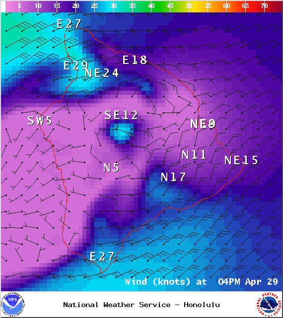
Image: NOAA / NWS
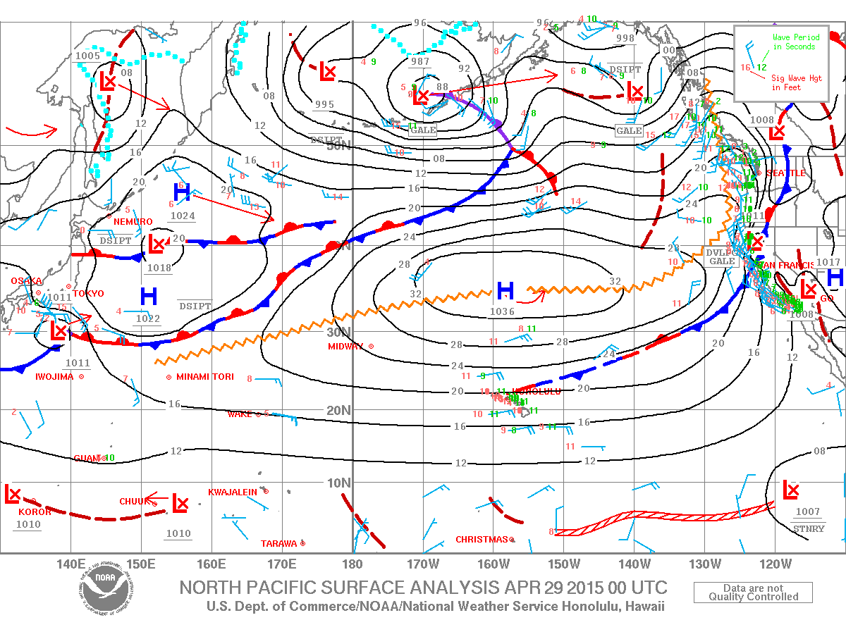
Image: NOAA / NWS

Image: NOAA / NWS
Sponsored Content


