

New NW Builds Today
Alerts
A Small Craft Advisory is posted for the Alenuihaha Channel through 6:00 a.m. Tuesday. Northeast winds up to 25 knots are forecasted along with rough seas of 8 to 15 feet. Inexperienced mariners should avoid navigating in these conditions.
**Click directly on the images below to make them larger. Charts include: Big Island projected winds, tides, swell direction & period and expected wave heights.**
 Big Island Surf Forecast
Hilo side: Knee to belly high trade wind waves are expected today. New northwest swell builds up to chest high or more by sunset.
Kona side: Wave heights of ankle/waist high are expected.
South: Wave heights knee/waist high today with sets reaching about belly high.
 A boost out of the northwest is expected to build Monday in the overhead to well overhead range by the peak. Swell is expected to slowly ease Tuesday.
Our current south-southwest swell is expected to fade through the early part of this week. This week is looking pretty quite out of the southern hemisphere. Next week we could see some activity around May 5th or 6th pending development of storms.
Keep in mind, surf heights are measured on the face of the wave from trough to crest. Heights vary from beach to beach, and at the same beach, from break to break.
**Click here for your detailed Big Island weather report.**
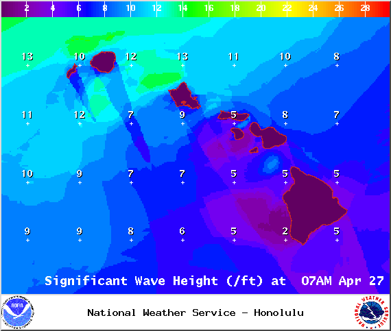
Image: NOAA / NWS

Image: NOAA / NWS

Image: NOAA / NWS
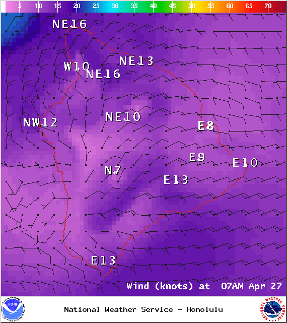
Image: NOAA / NWS

Image: NOAA / NWS
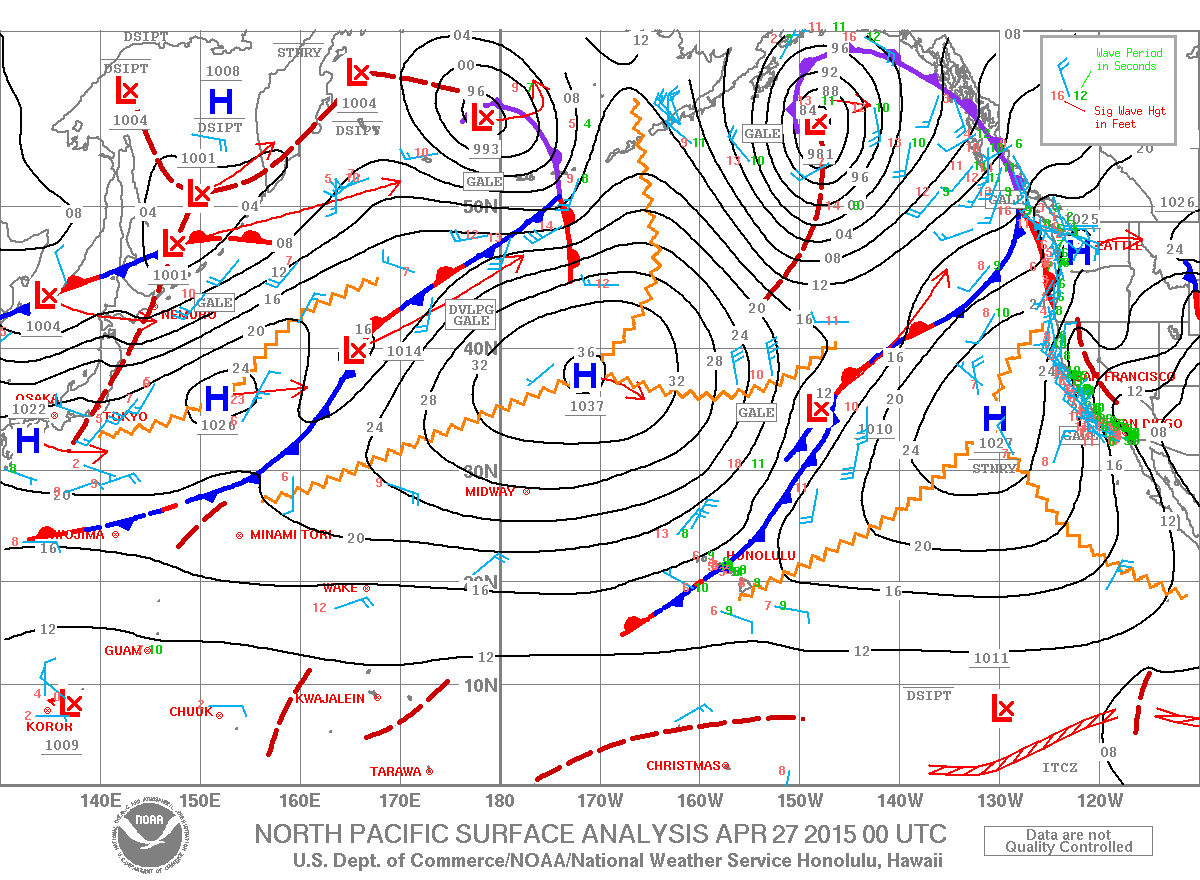
Image: NOAA / NWS
Sponsored Content


