

Breezy Winds and Hazy Skies Today
Alerts
A High Surf Advisory is posted for the northeast and south facing shores of the Big Island through 6:00 p.m. Thursday. Surf of 6 to 8 feet is expected. Expect strong breaking waves, shore break and strong longshore and rip currents making swimming difficult and dangerous.
A Small Craft Advisory is posted for all Big Island waters through 6 p.m. Friday for southeast winds up to to 30 knots and rough seas up to 13 feet. Inexperienced mariners should avoid navigating in these conditions.
**Click directly on the images below to make them larger. Charts include: Big Island high/low forecasted temperatures, projected winds, chance of cloud cover, projected localized weather conditions, vog/SO2 forecast and expected wave heights.**
Today
Partly to mostly cloudy skies are expected for the Hilo side with scattered windward showers. Kona side should get sunshine in the morning with building cloud cover in the afternoon and scattered showers. East to southeast winds are forecasted from 10 to 25 mph with localized sea breezes developing in some spots. High temperatures from 81° to 86°.
UV index at 11 (“extreme” exposure level)
Tonight
Windward and southeastern facing slopes are expected to get scattered showers tonight and mostly cloudy skies. Leeward spots are forecasted to be partly cloudy with just isolated showers. East to southeast winds are forecasted from 10 to 25 mph. Low temperatures from 68° to 73° are expected.
Looking Ahead
Moderate to locally breezy trade winds are expected near the Big Island into the weekend, delivering a few clouds and showers to windward and southeast slopes. Winds are forecasted to weaken statewide and shift to the south ahead of a front this weekend. The southeast winds will spread volcanic haze to the other smaller islands the next couple of days. The southeast winds will bring periods of clouds and showers, mainly to windward and southeast slopes, but will also allow a few showers to affect leeward and interior areas. The weakening front is expected to move over the islands this weekend and early next week, accompanied by more widespread clouds and showers.
Our Big Island Now Weather homepage always includes daily: Sunrise | Sunset | Moonrise | Moonset | Moon Phase | Live Weather Cams | 5-day Forecast | Current Temperature & Conditions
**Click here for your detailed Big Island surf report.**
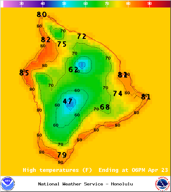
Image: NOAA / NWS
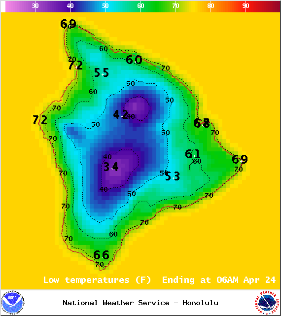
Image: NOAA / NWS
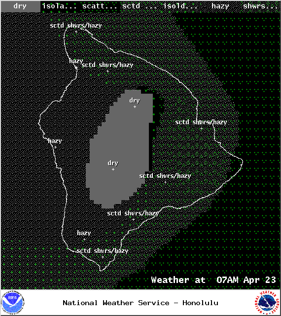
Image: NOAA / NWS
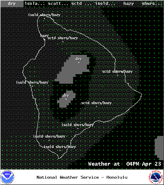
Image: NOAA / NWS
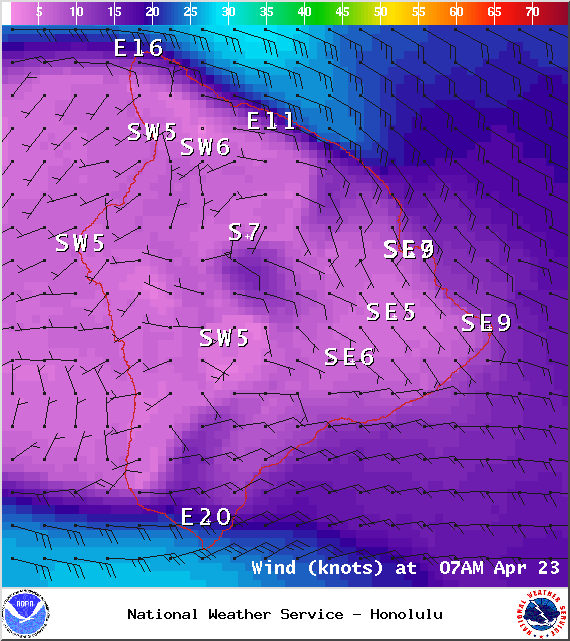
Image: NOAA / NWS
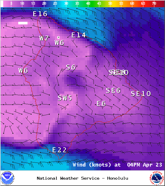
Image: NOAA / NWS
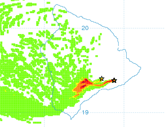
Image: UHSOEST
Image: NOAA / NWS
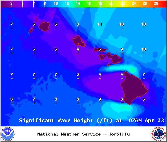
Image: NOAA / NWS
Sponsored Content


