

Advisory Level Swell Continues
Alerts
A High Surf Advisory is posted for the north and east facing shores of the Big Island through 6:00 a.m. Wednesday. Surf of 6 to 10 feet is expected. Expect strong breaking waves, shore break and strong longshore and rip currents making swimming difficult and dangerous.
A Small Craft Advisory is posted for all Big Island waters through 6 a.m. Tuesday for northeast winds up to to 30 knots and rough seas up to 15 feet. Inexperienced mariners should avoid navigating in these conditions.
A Gale Warning is posted through Tuesday morning at 6:00 a.m. for the ʻAlenuihāhā Channel. East winds up to 35 knots and rough seas up to 18 feet are forecasted. Mariners without the proper vessel and experience should remain in port until gale conditions end.
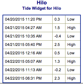
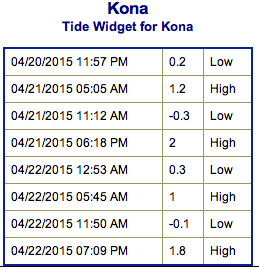
**Click directly on the images below to make them larger. Charts include: Big Island projected winds, tides, swell direction & period and expected wave heights.**
 Big Island Surf Forecast
Hilo side: Shoulder to head high waves are expected today from the trade swell. The NW is expected to bring waist to chest high waves.
Kona side: Wave heights of waist to shoulder high are expected.
South: Wave heights chest/shoulder high today with sets reaching a couple feet overhead from time to time.
 Our current northwest is expected to hold through the first half of this week. It should fade out by Thursday. Another boost is expected early next week out of the northwest.
Combo of southwest and south-southwest swells expected to hold through Thursday and fade out Friday into the weekend. Next week is looking pretty quite out of the southern hemisphere.
Keep in mind, surf heights are measured on the face of the wave from trough to crest. Heights vary from beach to beach, and at the same beach, from break to break.
**Click here for your detailed Big Island weather report.**
**Details on the Lyrid Meteor shower.**
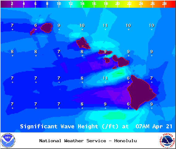
Image: NOAA / NWS
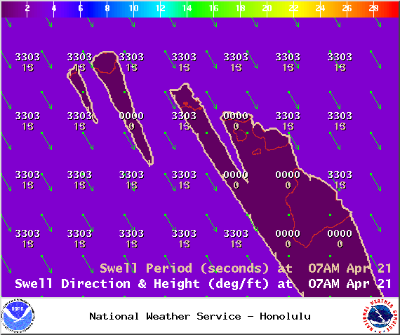
Image: NOAA / NWS
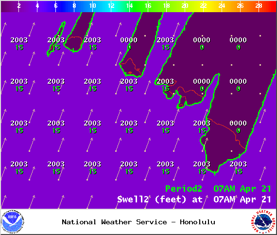
Image: NOAA / NWS
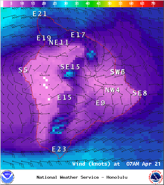
Image: NOAA / NWS
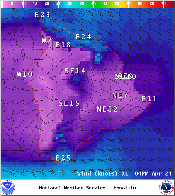
Image: NOAA / NWS
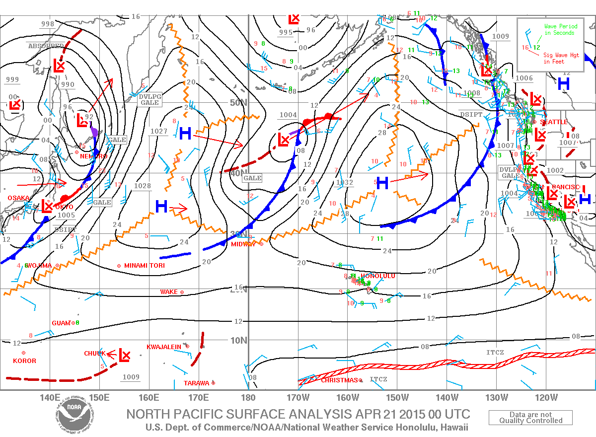
Image: NOAA / NWS
Sponsored Content


