

Solid NW Swell Expected Soon
Alerts
A Small Craft Advisory is posted for the Alenuihaha channel and Big Island leeward and southeast waters through 6:00 a.m. Wednesday for east winds up to to 25 knots and rough seas up to 10 feet. Inexperienced mariners should avoid navigating in these conditions.
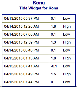
**Click directly on the images below to make them larger. Charts include: Big Island projected winds, tides, swell direction & period and expected wave heights.**
 Big Island Surf Forecast
Hilo side: Messy shoulder to head high trade swell waves are expected today. Our NNW swell should bring ankle to thigh high waves.
Kona side: Wave heights of ankle to waist high are expected. The best breaks could be a bit bigger at the best tides on the sets.
South: Wave heights of knee to waist high are expected. Messy trade swell is expected for the southeast coast up to waist or even chest high.
 Our current north-northwest swell is expected to slowly fade out Tuesday.
A solid northwest swell is expected to build Wednesday, peak Thursday and slowly fade out Friday into the weekend. Some spots are expected to be overhead or more at the peak.
Our current small south-southwest is slowly fading out. Small reinforcement keeps wave heights steady Wednesday and Thursday. Otherwise, nothing much on the horizon out of the South Pacific.
Keep in mind, surf heights are measured on the face of the wave from trough to crest. Heights vary from beach to beach, and at the same beach, from break to break.
**Click here for your detailed Big Island weather report.**
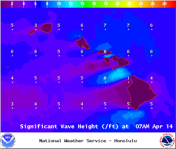
Image: NOAA / NWS
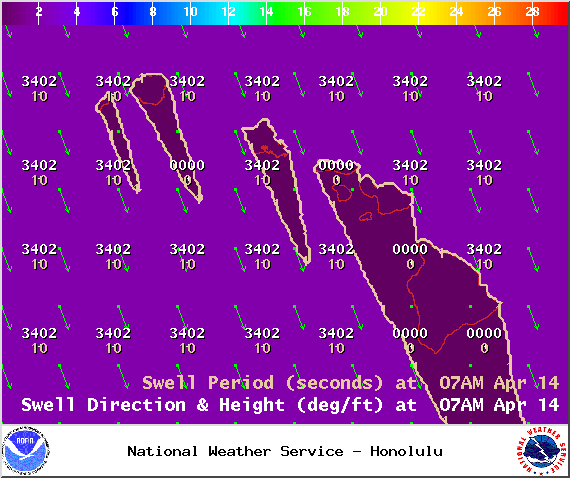
Image: NOAA / NWS
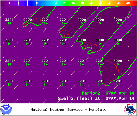
Image: NOAA / NWS
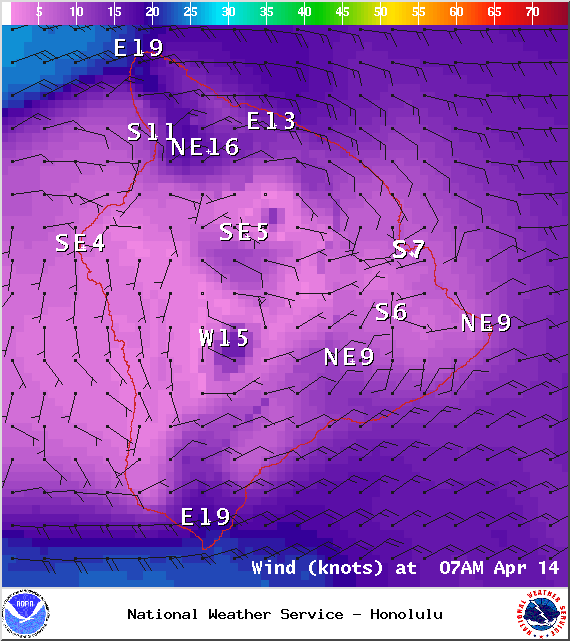
Image: NOAA / NWS

Image: NOAA / NWS
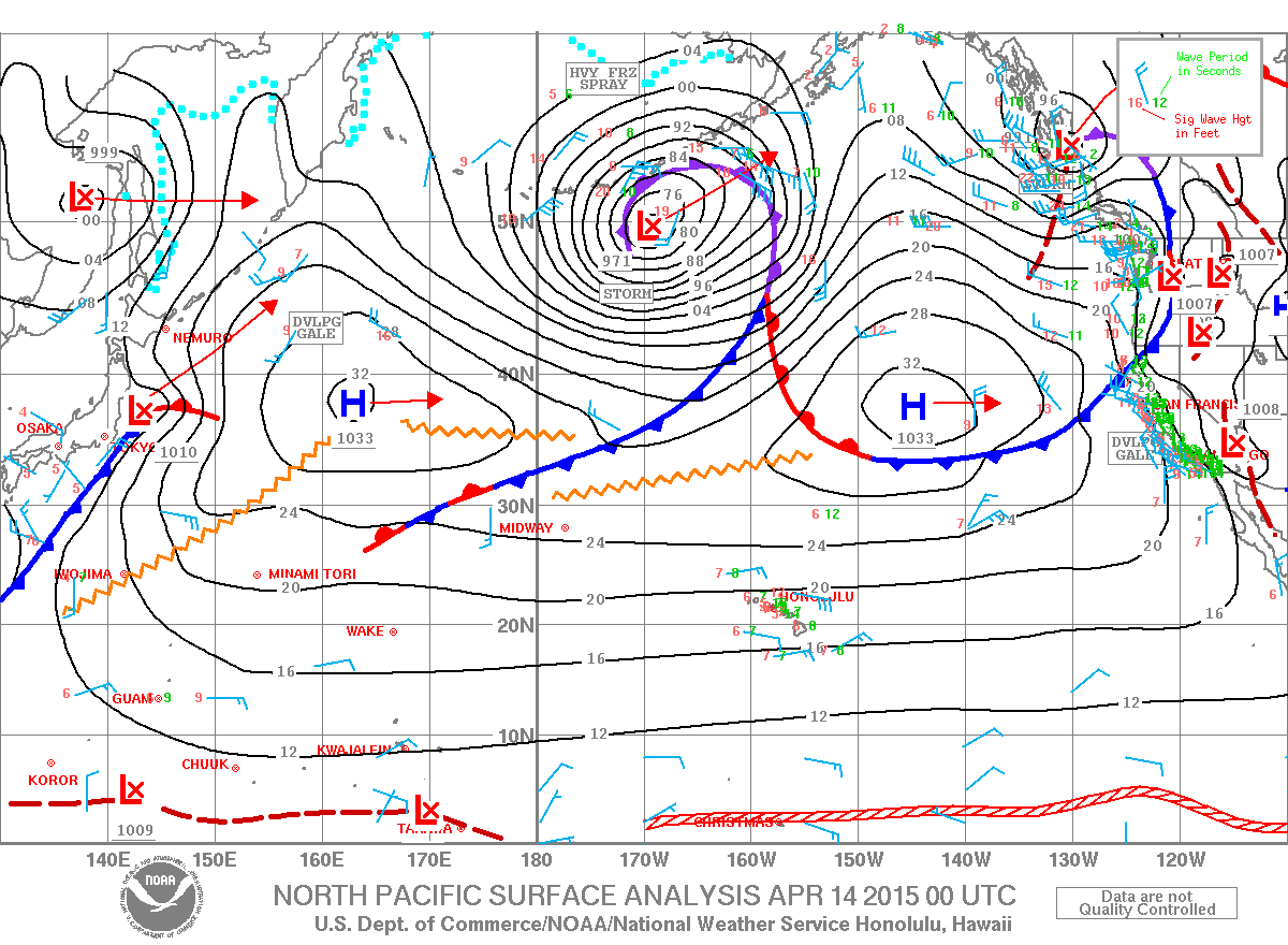
Image: NOAA / NWS
Sponsored Content


