

New WNW Swell Builds Today
Alerts
A Small Craft Advisory is posted for the ʻAlenuihāhā channel as well as waters to the south and west of the Big Island through 6:00 p.m. Tuesday for east winds up to to 30 knots and rough seas up to 14 feet. Inexperienced mariners should avoid navigating in these conditions.
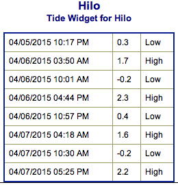
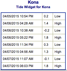
**Click directly on the images below to make them larger. Charts include: Big Island projected winds, tides, swell direction & period and expected wave heights.**
 Big Island Surf Forecast
Hilo side: Messy shoulder to head high waves are expected today with some plusses at the best breaks open to the trade swell.
Kona side: Wave heights of knee to waist high are expected. Standout spots open to the south could get larger waves on the sets.
South: Wave heights of ankle to waist high are expected. Tummy high waves are possible at the best breaks.
 Small west-northwest leftovers are expected to fade out Monday. A new west-northwest swell is expected to build in late Monday and peak Tuesday.
A northwest boost is expected midweek due to a storm in the Bering Sea with a small bump out of the northwest also expected next weekend.
Tradeswell is expected to fade over the next couple of days.
Our current southerly swell is expected to fade Monday and Tuesday with another small bump expected midweek. A possible reinforcement swell is on the horizon for next weekend.
Keep in mind, surf heights are measured on the face of the wave from trough to crest. Heights vary from beach to beach, and at the same beach, from break to break.
**Click here for your detailed Big Island weather report.**
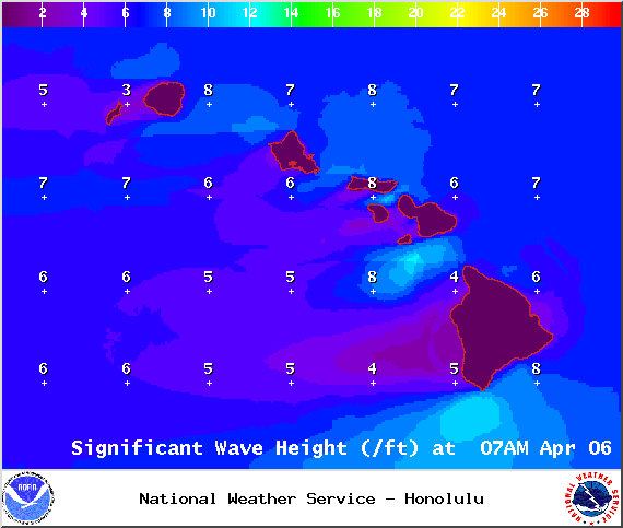
Image: NOAA / NWS
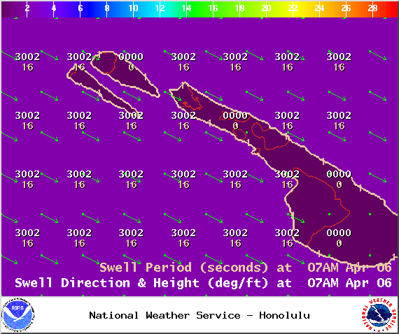
Image: NOAA / NWS
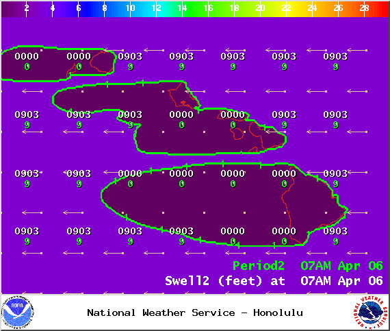
Image: NOAA / NWS
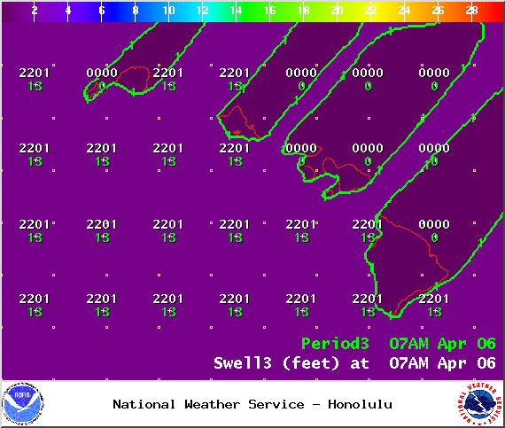
Image: NOAA / NWS
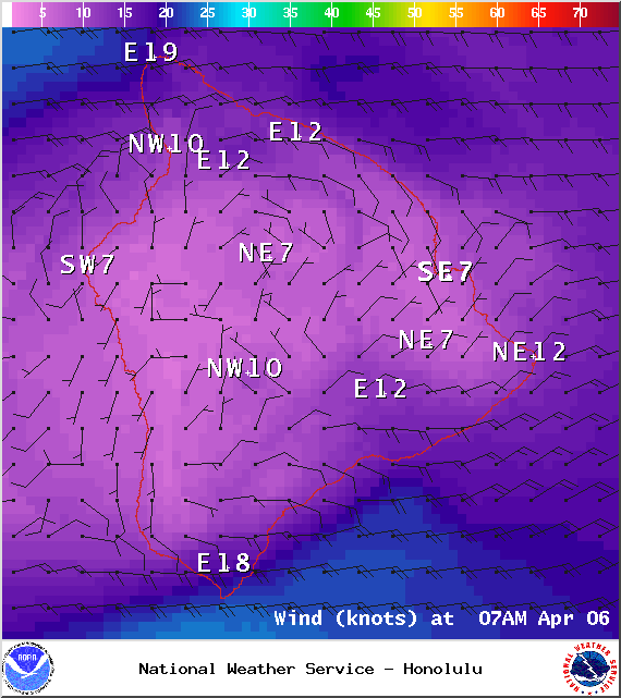
Image: NOAA / NWS
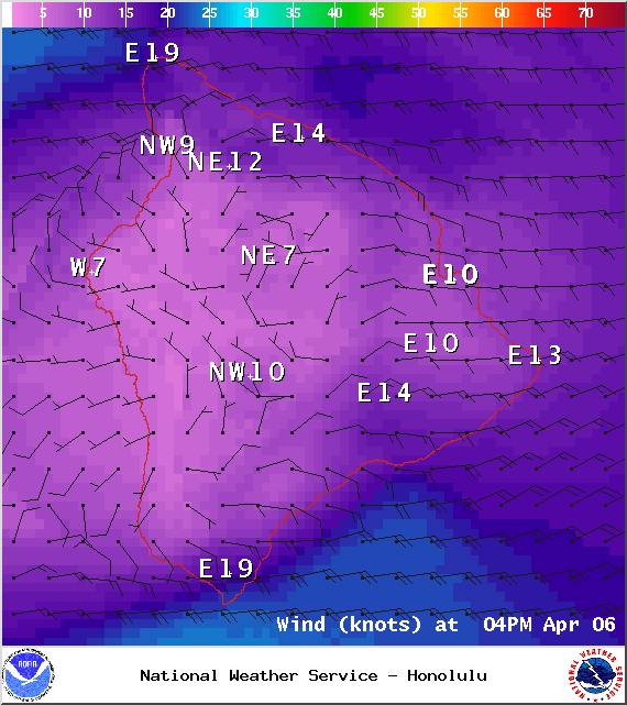
Image: NOAA / NWS
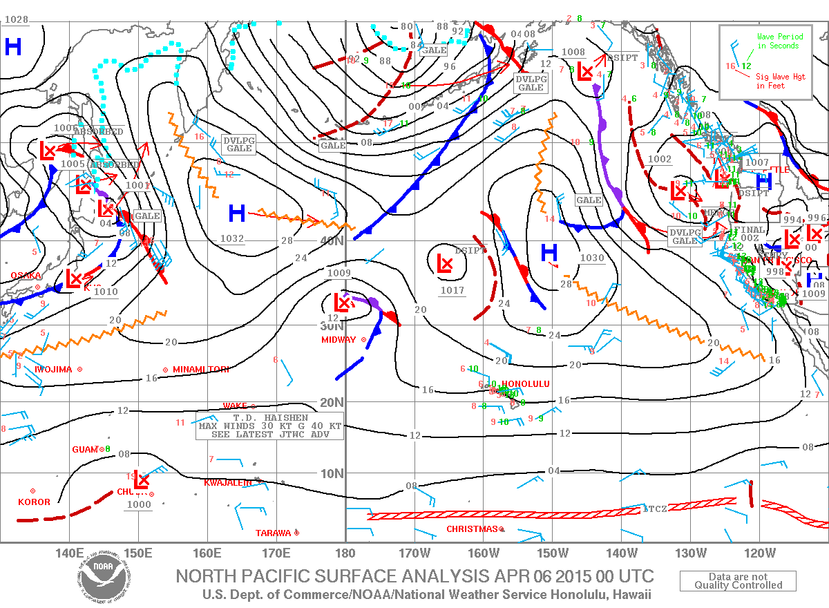
Image: NOAA / NWS
Sponsored Content


