

Enhanced Showers Expected Late Saturday
Alerts
A Small Craft Advisory is posted for the ʻAlenuihāhā channel as well as waters to the south and west of the Big Island through 6:00 p.m. Saturday for east winds from 20 to 25 knots and rough seas up to 12 feet. Inexperienced mariners should avoid navigating in these conditions.
**Click directly on the images below to make them larger. Charts include: Big Island high/low forecasted temperatures, projected winds, chance of cloud cover, projected localized weather conditions, vog/SO2 forecast and expected wave heights.**
Today
Partly cloudy skies are in the forecast with scattered showers in the morning and showers likely in windward areas in the afternoon. Mostly clear skies are expected for leeward areas in the morning with building cloud cover in the afternoon. Trade winds are forecasted from 15 to 20 mph. High temperatures from 80° to 85°.
UV index at 11 (“extreme” exposure level)
Tonight
The windward side is forecasted to get mostly cloudy skies and occasional showers. Leeward spots are expected to get mostly cloudy skies and scattered showers in the evening, then clearing. Trade winds are forecasted around 15 mph. Low temperatures from 68° to 73° are expected.
Sunday
Partly sunny skies are expected with isolated to scattered morning showers for windward locations. The Kona side will have mostly sunny skies in the morning and some afternoon cloud cover and possible isolated afternoon showers. Winds are forecasted out of the northeast from 15 to 20 mph. High temperatures from 80° to 85° and low temperatures from 68° to 73°.
Looking Ahead
Low clouds and modest shower activity will favor windward slopes, while high clouds are expected to increase over parts of the island chain. Easterly trade winds are forecasted to strengthen this weekend. Showers will be focused across windward areas, though pockets of moisture in the trade wind flow will produce some leeward rainfall at times. One such area of showers is expected to pass through late Saturday afternoon and Saturday night.
Our Big Island Now Weather homepage always includes daily: Sunrise | Sunset | Moonrise | Moonset | Moon Phase | Live Weather Cams | 5-day Forecast | Current Temperature & Conditions
**Click here for your detailed Big Island surf report.**
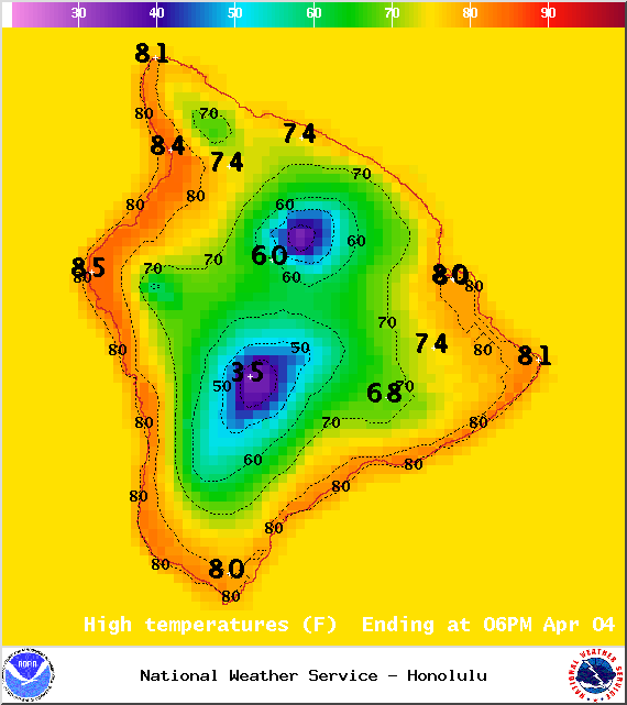
Image: NOAA / NWS
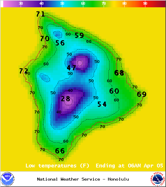
Image: NOAA / NWS
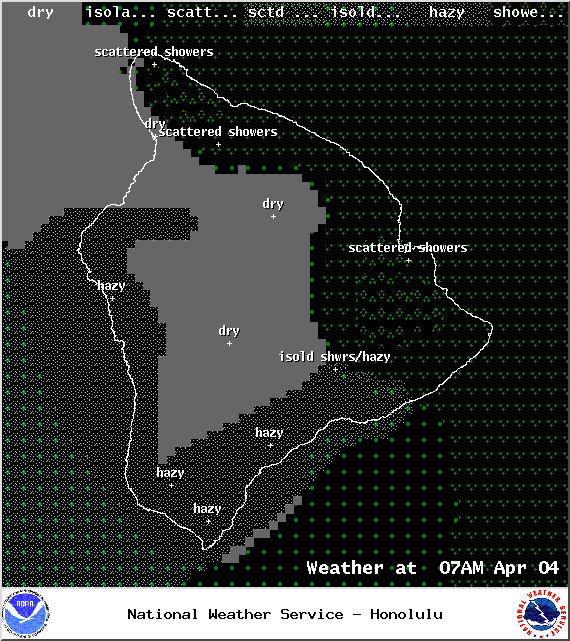
Image: NOAA / NWS
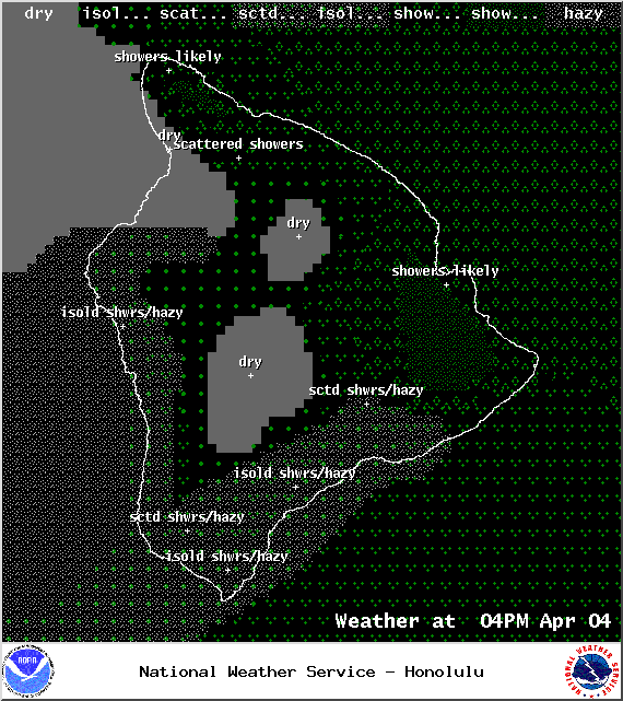
Image: NOAA / NWS
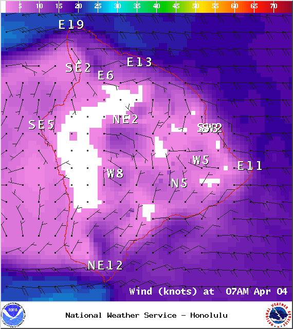
Image: NOAA / NWS
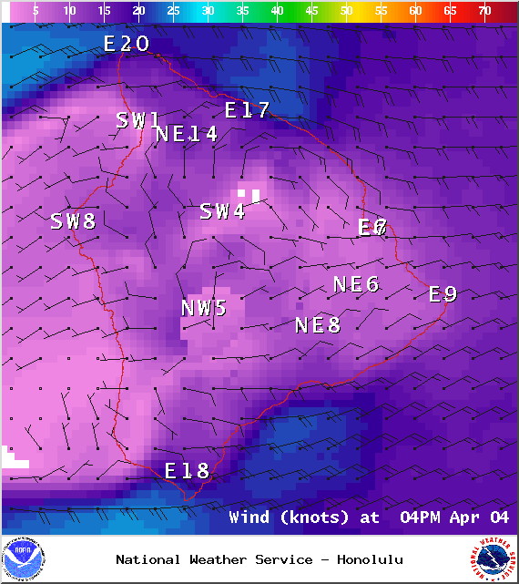
Image: NOAA / NWS
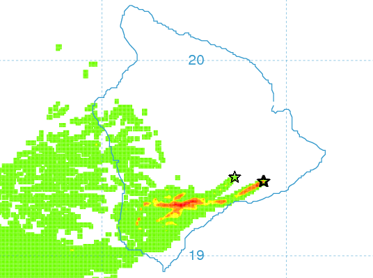
Image: UHSOEST
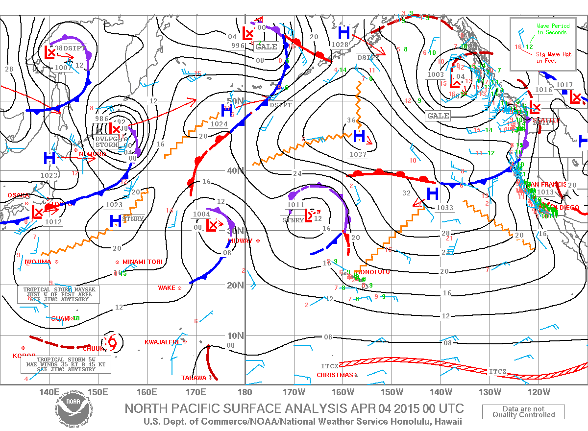
Image: NOAA / NWS
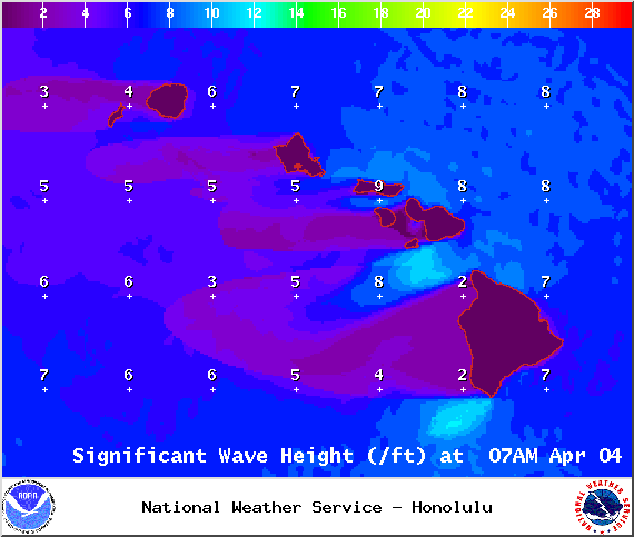
Image: NOAA / NWS
Sponsored Content


