

Couple of Swells Peak This Weekend
Alerts
A Small Craft Advisory is posted for the ʻAlenuihāhā channel as well as waters to the south and west of the Big Island through 6:00 p.m. Saturday for east winds from 20 to 25 knots and rough seas up to 12 feet. Inexperienced mariners should avoid navigating in these conditions.
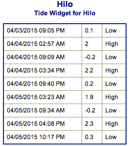
**Click directly on the images below to make them larger. Charts include: Big Island projected winds, tides, swell direction & period and expected wave heights.**
 Big Island Surf Forecast
Hilo side: Messy shoulder high to overhead waves are expected today with some plusses at the best breaks open to the trade swell.
Kona side: Wave heights of knee to waist high are expected. Standout spots could get larger waves on the sets.
South: Wave heights of knee to waist high are expected. Chest to shoulder high waves are possible at the best breaks.
 A small west-northwest is expected to peak this weekend. It starts out a little more northwest before swinging west-northwest Sunday.
Another small west-northwest is expected early next week. With another small pulse possible for the second half of the week as well.
A small south-southwest swell is forecasted for the weekend with another out of the same direction due to fill in the middle of next week. A reinforcement is also possible for next weekend.
Keep in mind, surf heights are measured on the face of the wave from trough to crest. Heights vary from beach to beach, and at the same beach, from break to break.
**Click here for your detailed Big Island weather report.**
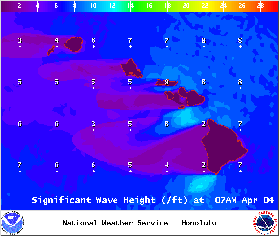
Image: NOAA / NWS
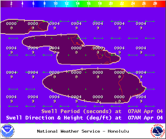
Image: NOAA / NWS
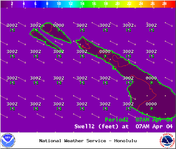
Image: NOAA / NWS
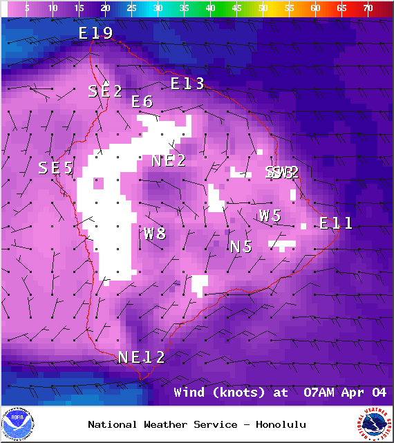
Image: NOAA / NWS
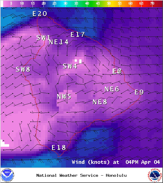
Image: NOAA / NWS
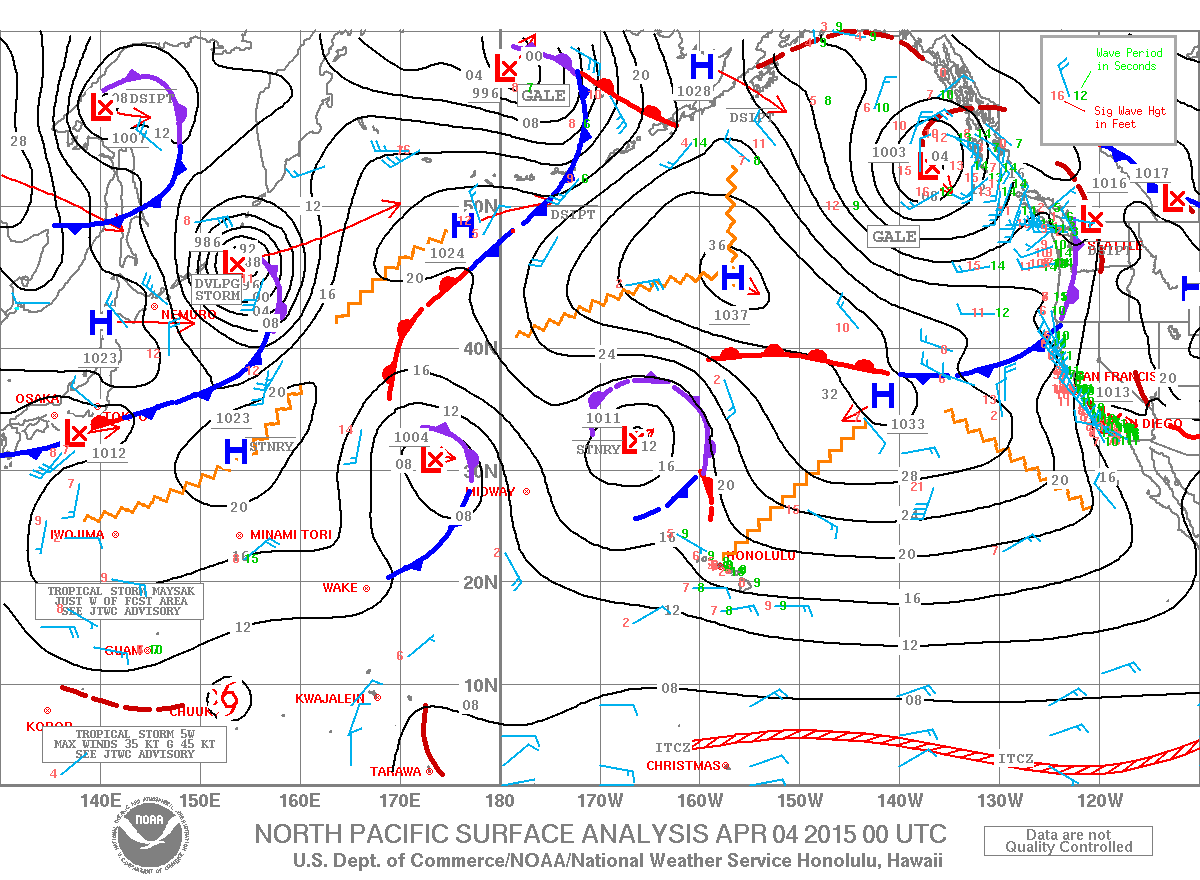
Image: NOAA / NWS
Sponsored Content


