

NW Swell Tops Out Today
Alerts
There are no ocean alerts posted at this time.
**Click directly on the images below to make them larger. Charts include: Big Island projected winds, tides, swell direction & period and expected wave heights.**
 Big Island Surf Forecast
Hilo side: Head high to slightly overhead waves are expected today.
Kona side: Wave heights of ankle to thigh high are expected. Standout spots could get up to waist high on the sets.
South: Wave heights of ankle to thigh high are expected.
Our current northwest swell generated by a storm near the Aleutians is expected to peak Thursday and slowly fade Friday through the weekend.
 Another northwest swell is expected for the weekend, fading through the first part of the week. Energy is also headed our way midweek, peaking late in the week.
Small leftovers expected for southerly exposures. Nothing much through the weekend. There is potential for a new south-southwest swell to build in Monday.
Keep in mind, surf heights are measured on the face of the wave from trough to crest. Heights vary from beach to beach, and at the same beach, from break to break.
**Click here for your detailed Big Island weather report.**
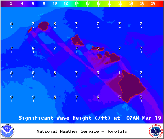
Image: NOAA / NWS

Image: NOAA / NWS

Image: NOAA / NWS
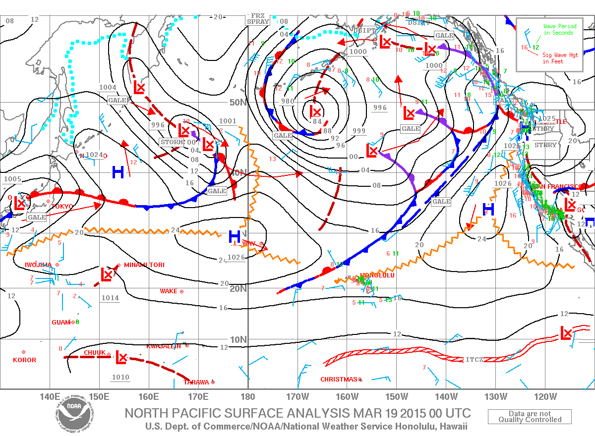
Image: NOAA / NWS
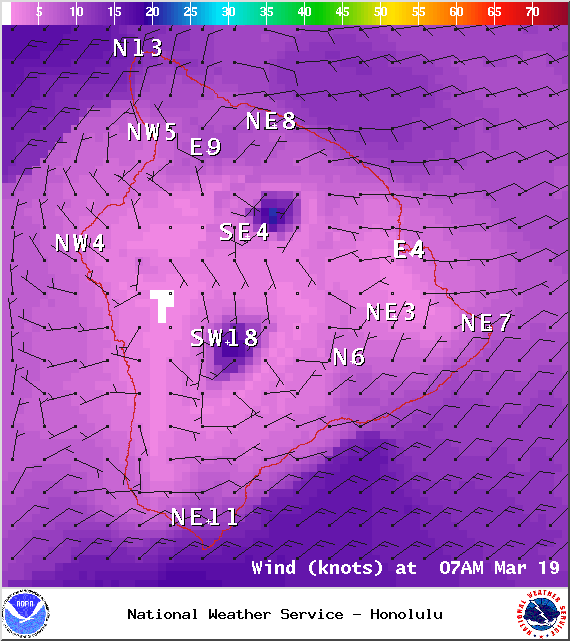
Image: NOAA / NWS

Image: NOAA / NWS
Sponsored Content


