

Blizzard Warning For Summits, Occasional Showers Today
Alerts
A Blizzard Warning is in effect through Thursday at 6:00 p.m. Additional snowfall of 3 to 5 inches is expected with strong winds (45 to 65 mph, gusting to 85 mph or more), blowing snow and freezing fog. The road to the summit is closed at last check. Visibility is a quarter of a mile or less with temperatures in the mid 20s.
A High Surf Advisory will go into effect at 6 p.m. for north exposures of the Big Island. The advisory is posted through Friday at 6 p.m. Surf heights from 12 to 16 feet are expected. Expect strong breaking waves, shore break and strong longshore and rip currents making swimming difficult and dangerous.
A Small Craft Advisory is posted for all island waters from 6 p.m. Wednesday through 6 p.m. Friday. North winds up to 25 knots are expected along with rough seas of 9 to 16 feet. Inexperienced mariners should avoid navigating in these conditions.
**Click directly on the images below to make them larger. Charts include: Big Island high/low forecasted temperatures, projected winds, chance of cloud cover, projected localized weather conditions, vog/SO2 forecast and expected wave heights.**
Today
Cloudy skies are expected today with occasional scattered showers and areas of haze. North winds are forecasted around 15 mph. Cooler than normal temperatures are expected with high temperatures from 73° to 80°.
UV index at 10 (“very high” exposure level)
Tonight
Mostly cloudy skies are expected with scattered showers. North winds are forecasted from 10 to 15 mph. Low temperatures from 64° to 69° are expected.
Looking Ahead
Deep layered clouds will cover the main Hawaiian islands and bring occasional showers to Maui and the Big Island into Thursday. Light winds are expected to turn northerly and increase on Thursday. Trade winds will return briefly for the weekend. Models show a drier weather pattern from late Friday into Saturday. However, this trade pattern may be short lived as a series of systems tracking across the north Pacific may bring the potential for one of the fronts to impact the state. It’s still too far out to say for sure though.
Our Big Island Now Weather homepage always includes daily: Sunrise | Sunset | Moonrise | Moonset | Moon Phase | Live Weather Cams | 5-day Forecast | Current Temperature & Conditions
**Click here for your detailed Big Island surf report.**
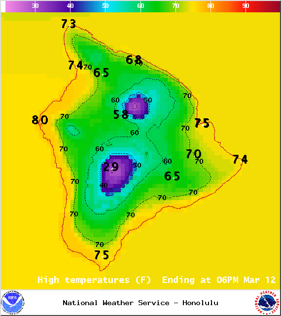
Image: NOAA / NWS
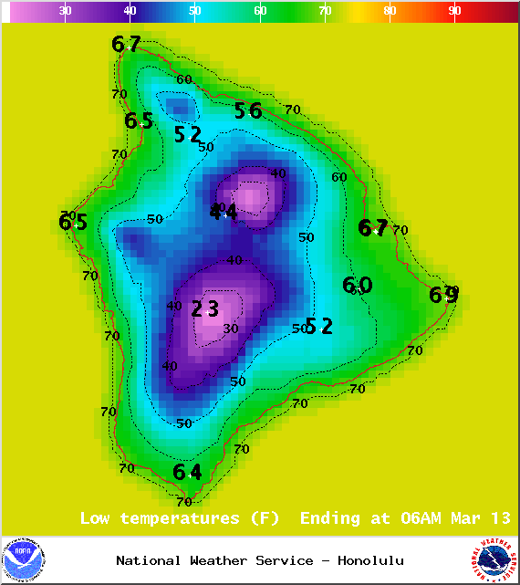
Image: NOAA / NWS
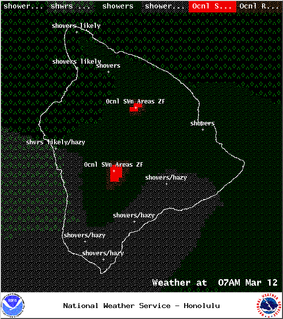
Image: NOAA / NWS
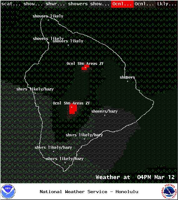
Image: NOAA / NWS
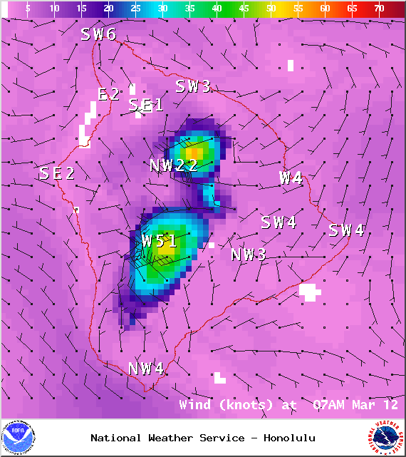
Image: NOAA / NWS
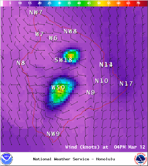
Image: NOAA / NWS
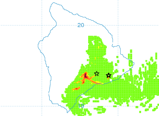
Image: UHSOEST
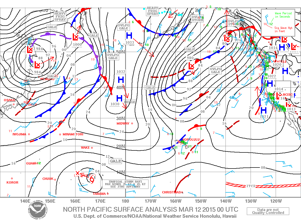
Image: NOAA / NWS
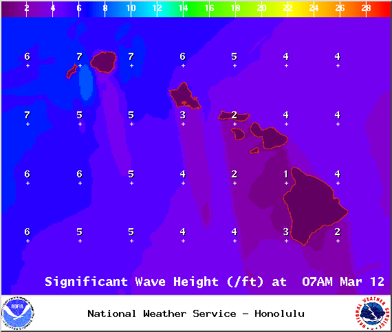
Image: NOAA / NWS
Sponsored Content


