

Solid Swell Later This Week
Alerts
There are no ocean alerts posted for the Big Island at this time.
**Click directly on the images below to make them larger. Charts include: Big Island projected winds, tides, swell direction & period and expected wave heights.**
 Big Island Surf Forecast
Hilo side: Wave heights from overhead to a few feet overhead are expected, the best breaks could be slightly bigger. Surf is expected to hold in the morning, then fade.
Kona side: Wave heights from ankle to knee high are expected. The best spots could get waist high waves on the sets.
South: Wave heights of ankle to knee high are expected. Standout spots could get up to chest high on the sets.
 Our current north swell is expected to slowly fading through the middle of the week.
A strong storm over the Aleutians is expected to bring a solid north-northwest swell building Thursday and peaking Friday afternoon. Most of the size will show for the northeast or Hilo coastline while the Kona side will be heavily shadowed from this swell.
Mix of energy out of the south will linger through Thursday. A slightly bigger swell is expected to build late Thursday and peak late Friday. This swell was generated by a storm in the Tasman Sea.
Keep in mind, surf heights are measured on the face of the wave from trough to crest. Heights vary from beach to beach, and at the same beach, from break to break.
**Click here for your detailed Big Island weather report.**
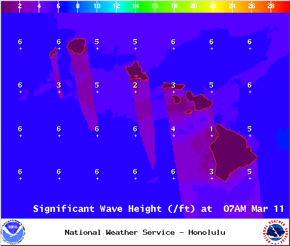
Image: NOAA / NWS

Image: NOAA / NWS
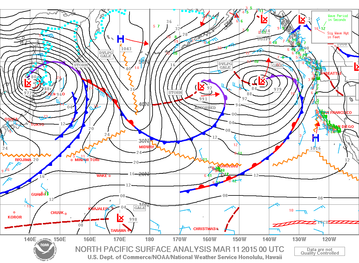
Image: NOAA / NWS
Image: NOAA / NWS
Image: NOAA / NWS
Sponsored Content


