

Improving Trend in Weather Short-Lived
Alerts
A High Wind Warning is posted for the summits of Mauna Kea and Mauna Loa for 45 to 65 mph west winds. Gusts could reach over 80 mph. This may make driving difficult and dangerous. The advisory is posted through 6:00 p.m. Thursday.
A Winter Weather Advisory is posted through 6:00 a.m. Tuesday for expected winter conditions of snow, ice and freezing fog. Up to 0.5 inches of new snow is expected tonight.
A Winter Storm Watch is in effect from Tuesday evening through Thursday afternoon. Additional snowfall of 5 to 8 inches is expected with strong winds and freezing fog. The road to the summit is closed at last check.
**Click directly on the images below to make them larger. Charts include: Big Island high/low forecasted temperatures, projected winds, chance of cloud cover, projected localized weather conditions, vog/SO2 forecast and expected wave heights.**
Today
Mostly cloudy skies are expected today for windward and mauka areas with scattered showers. Scattered showers are in the forecast for leeward areas in the afternoon. A decreasing trend for rainfall is expected after the morning showers. Widespread haze is forecasted in the afternoon (see UHSOEST vog model above). Northeast winds are forecasted around 15 mph. Cooler than normal temperatures are expected with high temperatures from 75° to 80°.
UV index at 9 (“very high” exposure level)
Tonight
Mostly cloudy skies are expected with some showers in the evening, then showers likely after midnight as an area of instability approaches. East winds are forecasted from 10 to 15 mph. Low temperatures from 66° to 71° are expected.
Looking Ahead
Gentle to moderate north to northeast winds should bring dry and stable conditions to the smaller islands over the next couple of days. The disturbance responsible for much of the precipitation on the Big Island and Maui will move east of the area early Tuesday. Another area of unsettled weather is expected to bring layered clouds and rainfall back over the eastern part of the state Tuesday night through Thursday night. Trade winds are expected over the state Friday through the weekend.
Our Big Island Now Weather homepage always includes daily: Sunrise | Sunset | Moonrise | Moonset | Moon Phase | Live Weather Cams | 5-day Forecast | Current Temperature & Conditions
**Click here for your detailed Big Island surf report.**
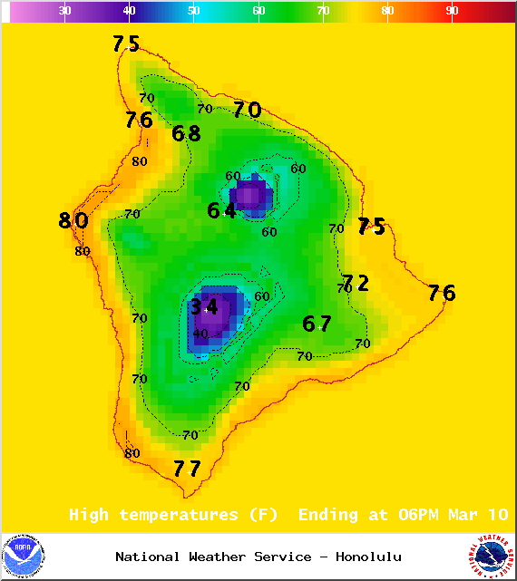
Image: NOAA / NWS
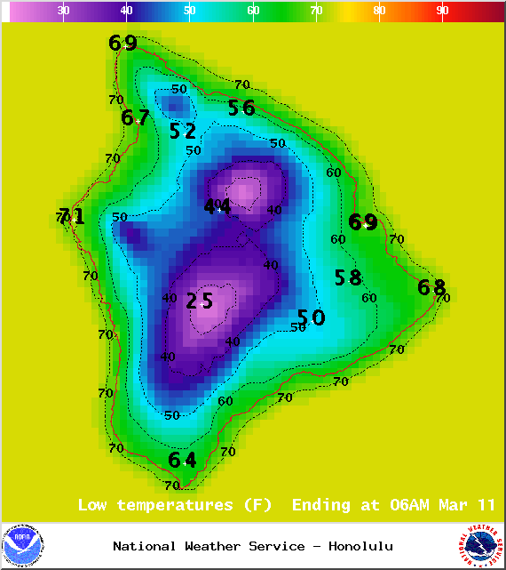
Image: NOAA / NWS
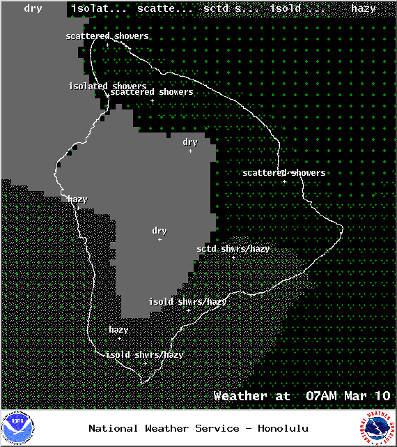
Image: NOAA / NWS
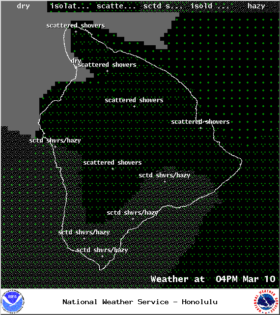
Image: NOAA / NWS
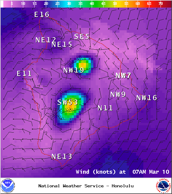
Image: NOAA / NWS
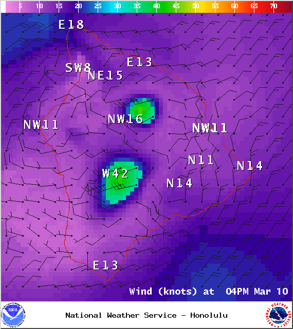
Image: NOAA / NWS
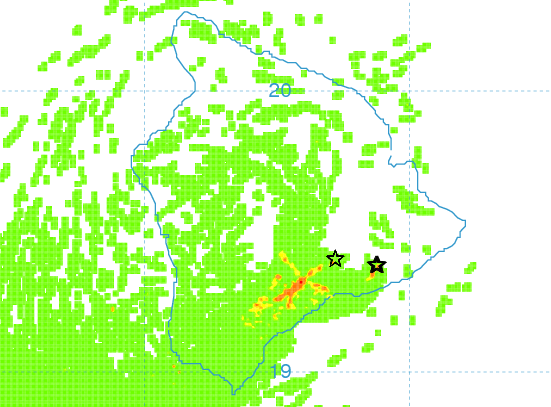
Image: UHSOEST
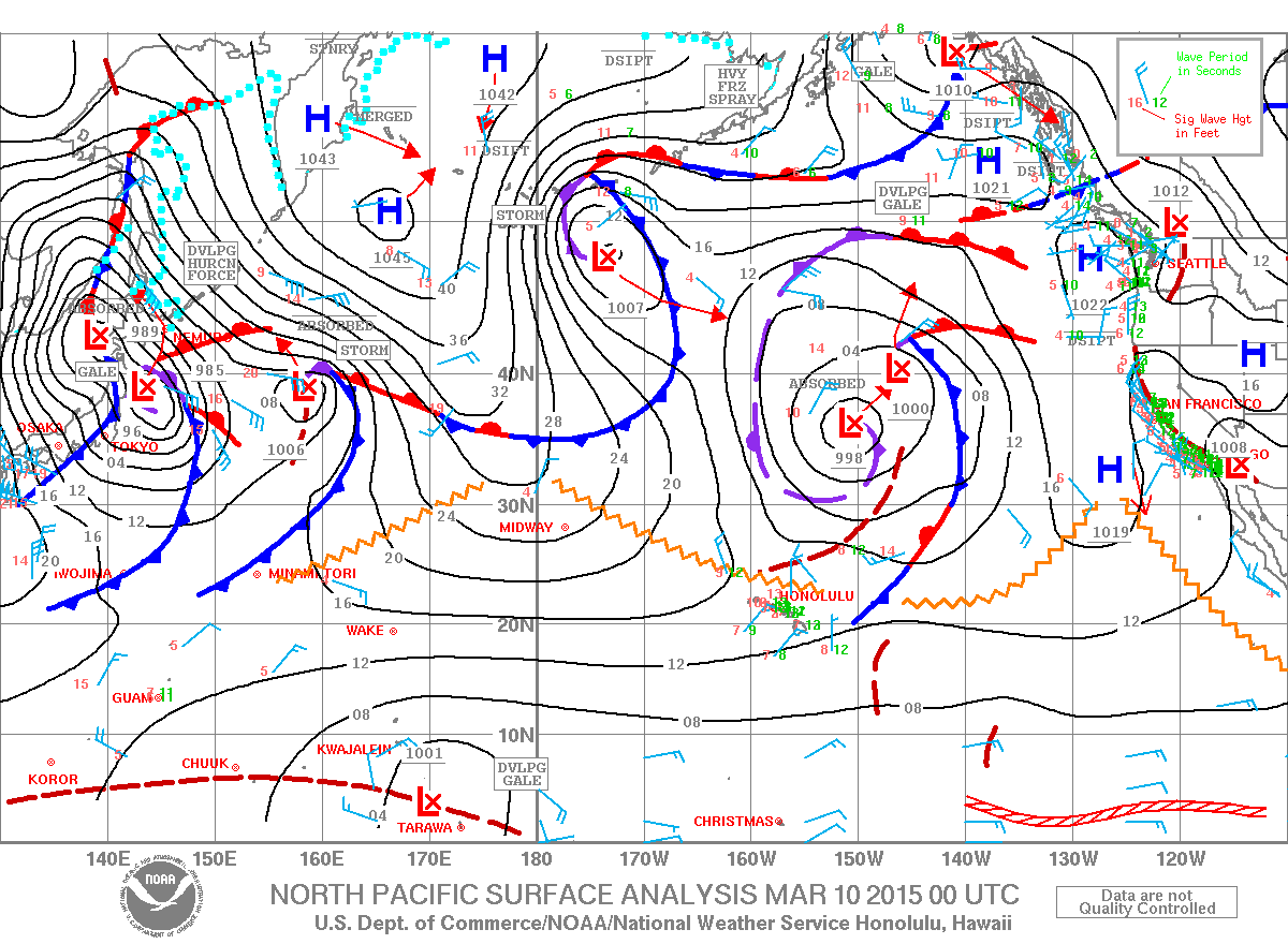
Image: NOAA / NWS
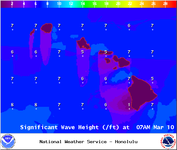
Image: NOAA / NWS
Sponsored Content


