

Wet Windward Side, Cool Winds Today
Alerts
A Small Craft Advisory is posted for the ʻAlenuihāhā channel as well as waters to the south and west of the Big Island. The advisory is through 6:00 p.m. Saturday for northeast winds from 20 to 25 knots and rough seas up to 11 feet. Inexperienced mariners should avoid navigating in these conditions.
A Wind Advisory is posted for the summits of Mauna Kea and Mauna Loa for 30 to 55 mph west winds. This may make driving difficult. The advisory is posted through 6:00 p.m. Saturday. At last check the road to the summit was open to the general public.
**Click directly on the images below to make them larger. Charts include: Big Island high/low forecasted temperatures, projected winds, chance of cloud cover, projected localized weather conditions, vog/SO2 forecast and expected wave heights.**
Today
Partly to mostly cloudy skies are expected today for windward areas with passing showers likely during the day. Mostly clear skies are in the forecast for leeward areas in the morning with just isolated showers as clouds build in the afternoon. North winds are forecasted from 15 to 20 mph. High temperatures from 79° to 84°.
UV index at 8 (“very high” exposure level)
Tonight
Mostly cloudy skies are expected with showers likely for windward spots and scattered showers for lee areas. Cool north winds are forecasted around 15 mph. Low temperatures from 66° to 71° are expected.
Sunday
Windward spots are expected to be mostly cloudy with showers likely. The Kona side is forecasted to get partly cloudy skies with off and on scattered showers. Winds are forecasted out of the north around 15mph. High temperatures from 74° to 79° and low temperatures from 66° to 71°.
Looking Ahead
Brisk and cool northeasterly winds will continue to produce wet conditions across windward slopes through early Saturday, especially on the Big Island and Maui. Winds will decrease during the weekend. Deeper moisture south of the Big Island may push far enough north to increase rainfall over the Big Island on Sunday and Monday and possibly again during the middle of next week. Temperatures are expected to continue to feel cooler than normal with dew points in the upper 50s and low 60s.
Our Big Island Now Weather homepage always includes daily: Sunrise | Sunset | Moonrise | Moonset | Moon Phase | Live Weather Cams | 5-day Forecast | Current Temperature & Conditions
**Click here for your detailed Big Island surf report.**

Image: NOAA / NWS

Image: NOAA / NWS

Image: NOAA / NWS

Image: NOAA / NWS
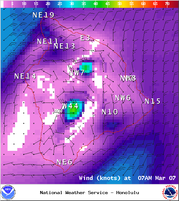
Image: NOAA / NWS
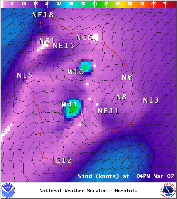
Image: NOAA / NWS
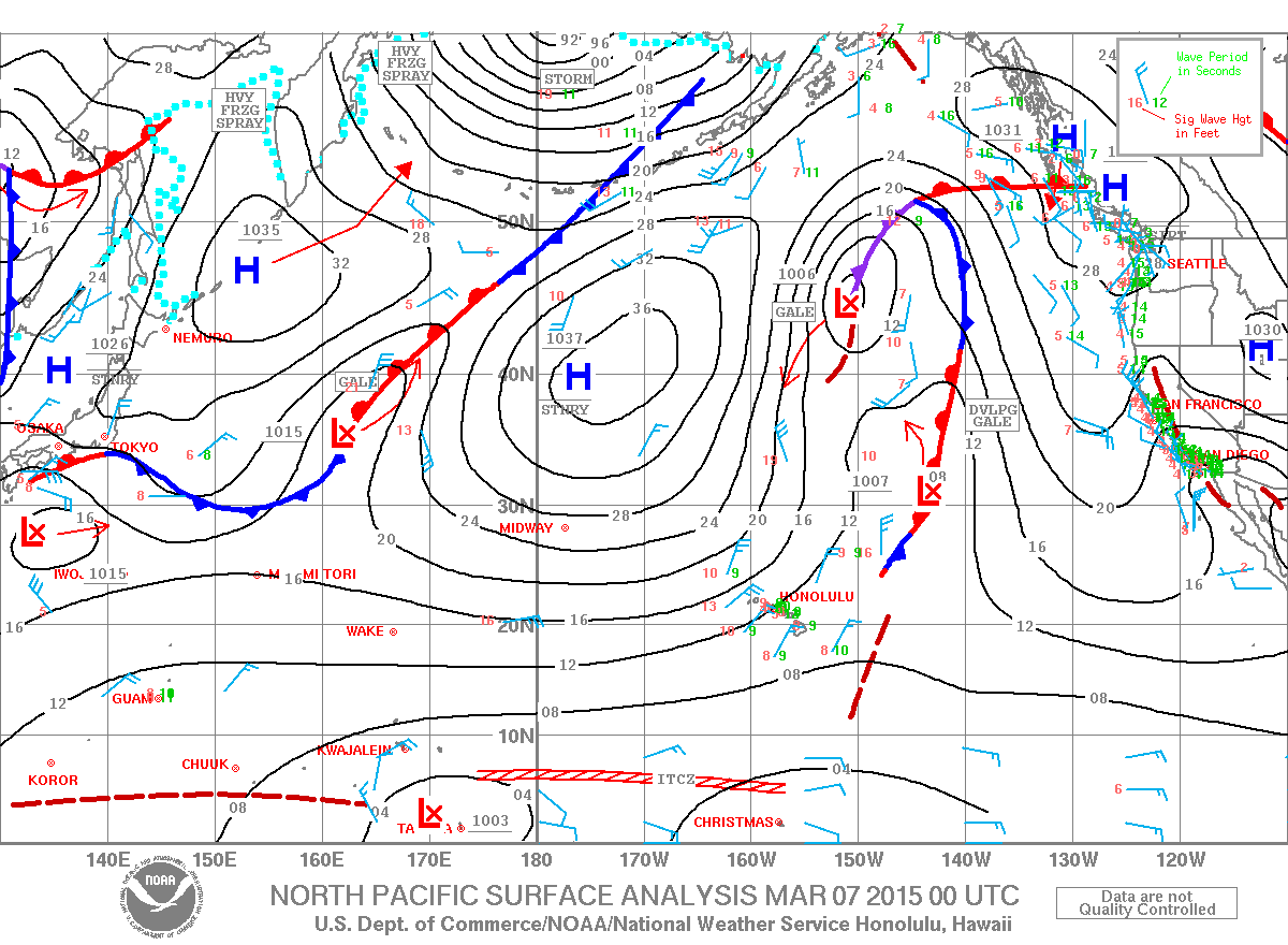
Image: NOAA / NWS
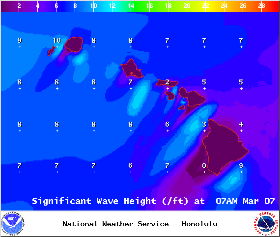
Image: NOAA / NWS
Sponsored Content


