

PM Thunderstorms Possible Today
Alerts (Updated at 3:30 p.m.)
The National Weather Service has issued a Flash Flood Watch for the island of Hawaii through 6:00 a.m. Thursday. An area of instability is expected to push moisture up toward the island that could potential cause flooding and thunderstorms through Wednesday night. The rainfall will mainly focus over windward areas. Excessive runoff could result in rock and mudslides in steep terrain. Fast-moving waters could create life-threatening conditions.
**Click directly on the images below to make them larger. Charts include: Big Island high/low forecasted temperatures, projected winds, chance of cloud cover, projected localized weather conditions, vog/SO2 forecast and expected wave heights.**
Today
We expect mostly cloudy skies today and showers are likely for windward areas. Mostly sunny skies for leeward spots in the morning, becoming partly cloudy in the afternoon. The Kona side could see scattered afternoon showers and possibly even thunderstorms. Trade winds are forecasted up to about 15 mph. High temperatures from 78° to 83°.
UV index at 8 (“very high” exposure level)
Tonight
Mostly cloudy skies are expected with showers likely for windward spots and isolated showers for the leeward side. Northeast winds are forecasted around 15 mph. Low temperatures from 68° to 73° are expected.
Next Full Moon: 8:06 a.m. on Mar. 5
Looking Ahead
Trade winds are expected to continue blowing over the islands. An area of instability is expected to keep our weather rather wet through Wednesday night. Another round of heavy showers or thundershowers is possible with the greatest threat on Wednesday night for the Big Island. The trough aloft will also likely produce strong winds and snow over the high elevations on the Big Island. Clouds and showers are expected to taper off starting Thursday. Trade winds will strengthen brining drier air back over the islands through the end of the week.
Our Big Island Now Weather homepage always includes daily: Sunrise | Sunset | Moonrise | Moonset | Moon Phase | Live Weather Cams | 5-day Forecast | Current Temperature & Conditions
**Click here for your detailed Big Island surf report.**
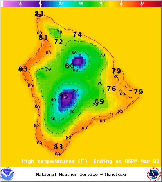
Image: NOAA / NWS
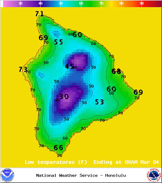
Image: NOAA / NWS
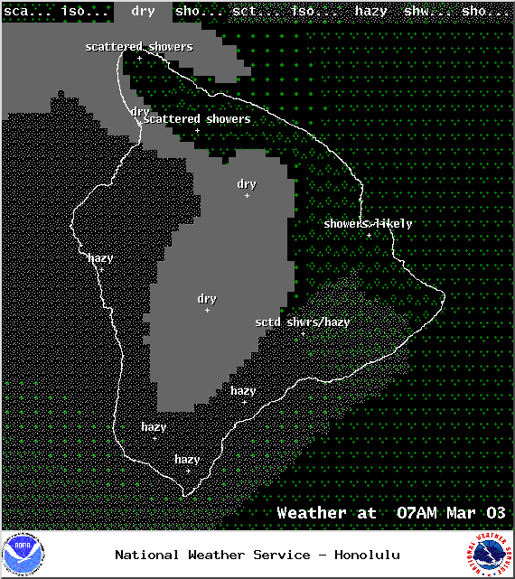
Image: NOAA / NWS
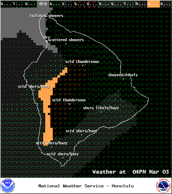
Image: NOAA / NWS
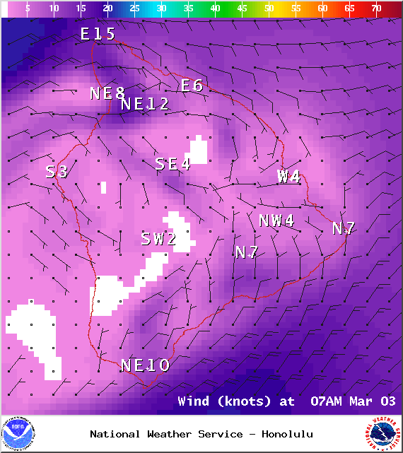
Image: NOAA / NWS
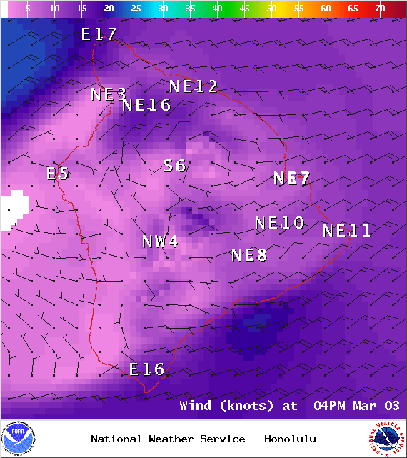
Image: NOAA / NWS
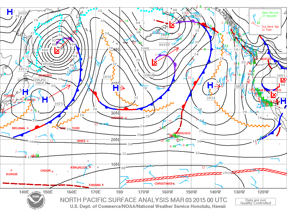
Image: NOAA / NWS
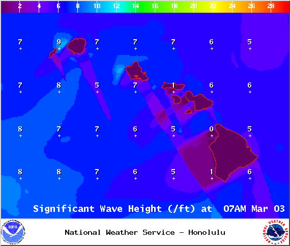
Image: NOAA / NWS
Sponsored Content


