

NW and SSE Swells Expected Today
Alerts
There are no ocean alerts posted at this time.
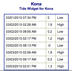
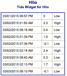
**Click directly on the images below to make them larger. Charts include: Big Island projected winds, tides, swell direction & period and expected wave heights.**
 Big Island Surf Forecast
Hilo side: Wave heights from chest to head high are expected.
Kona side: Wave heights from ankle to waist high are expected.
South: Wave heights of ankle to waist high are expected.
A northwest swell is expected to build today, peaking late Monday before slowly lowering on Tuesday.
 A south-southeast swell is expected to build on Monday and peak Tuesday.
A west-northwest and a south-southwest swell are expected to move in midweek. Maybe even some short period north-northwest.
Keep in mind, surf heights are measured on the face of the wave from trough to crest. Heights vary from beach to beach, and at the same beach, from break to break.
**Click here for your detailed Big Island weather report.**

Image: NOAA / NWS
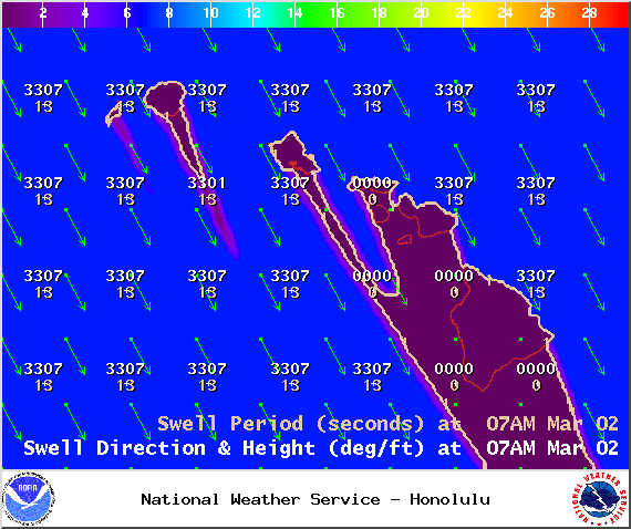
Image: NOAA / NWS
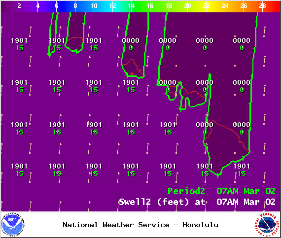
Image: NOAA / NWS
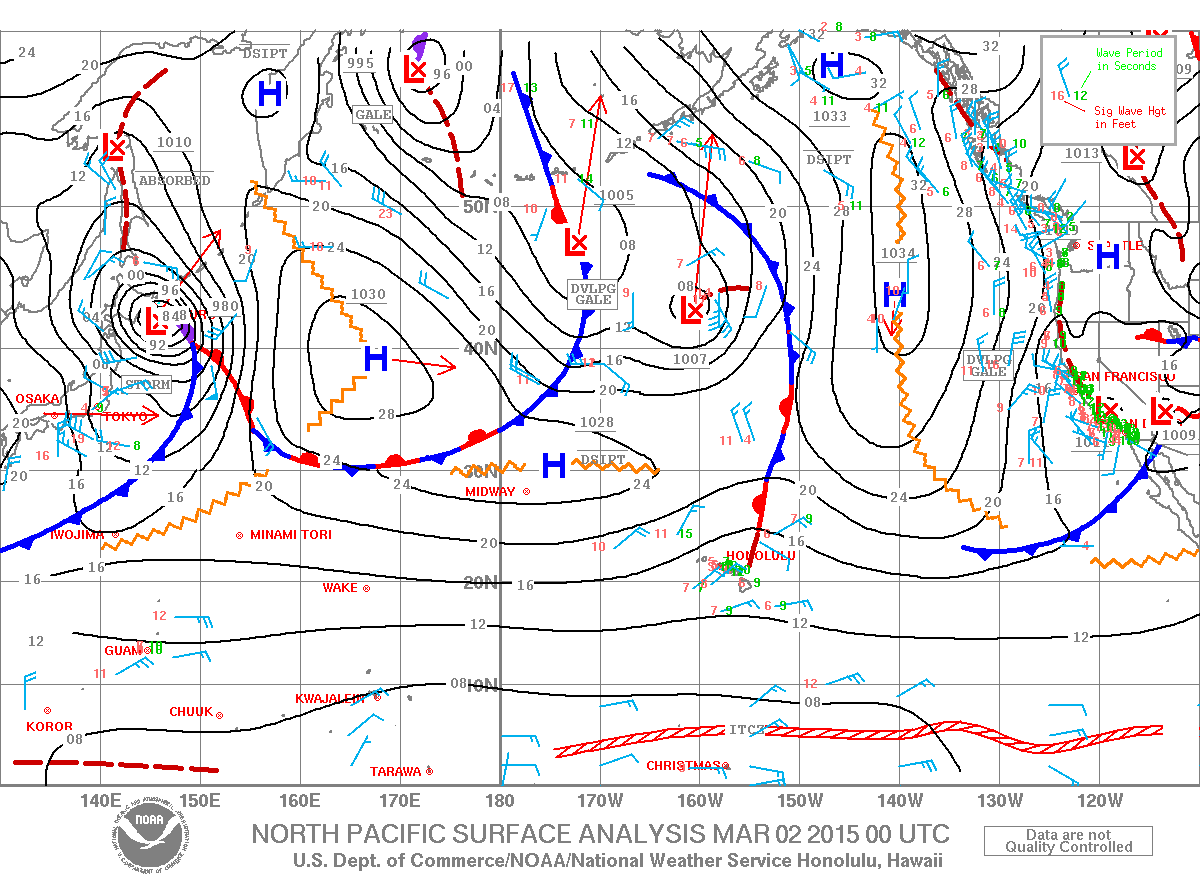
Image: NOAA / NWS
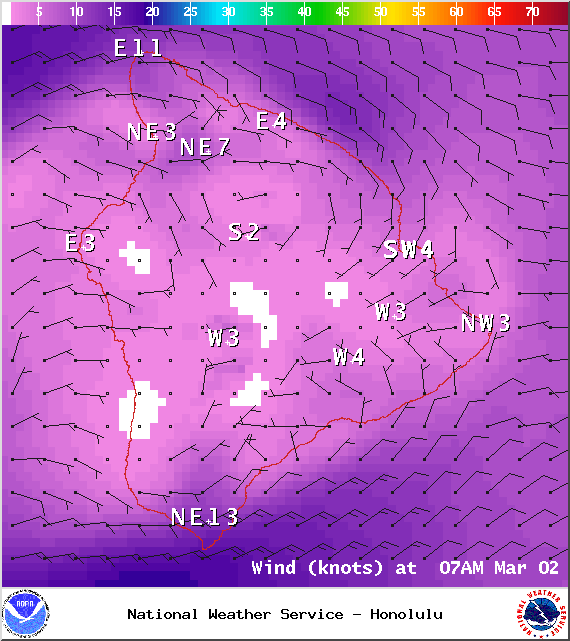
Image: NOAA / NWS
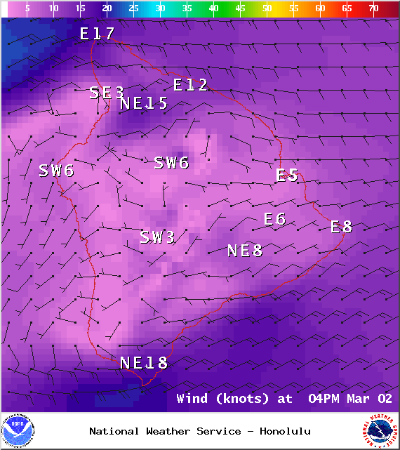
Image: NOAA / NWS
Sponsored Content


