

High Surf Advisory Posted for South and West Shores
Alerts
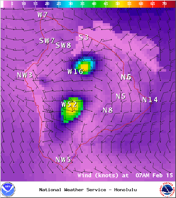
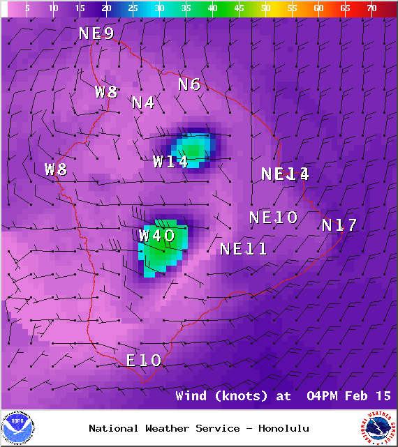
A Small Craft Advisory is posted for all Big Island waters through 6:00 p.m. Saturday for southwest winds from 30 to 35 knots with gusts to 50 knots and rough seas of 10 to 14 feet. Inexperienced mariners should avoid navigating in these conditions.
A High Surf Advisory is in effect for the south and west facing shores (6 to 8 foot faces) from 6:00 a.m. Saturday through 6:00 a.m. Sunday. Expect strong breaking waves, shore break and strong longshore and rip currents making swimming difficult and dangerous.
A Gale Warning is posted for all off shore waters.
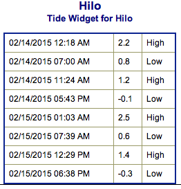
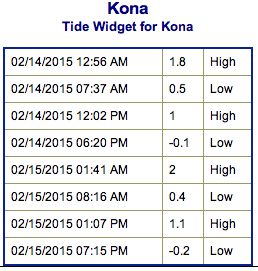
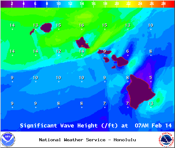
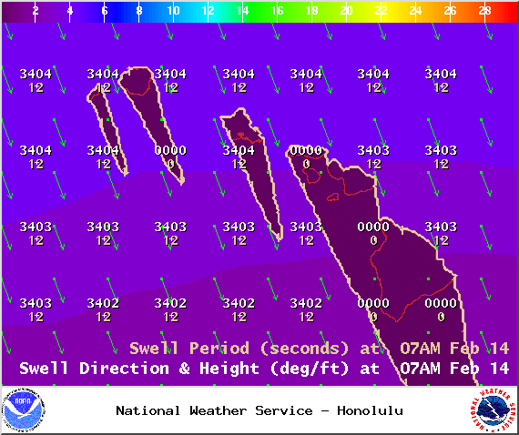
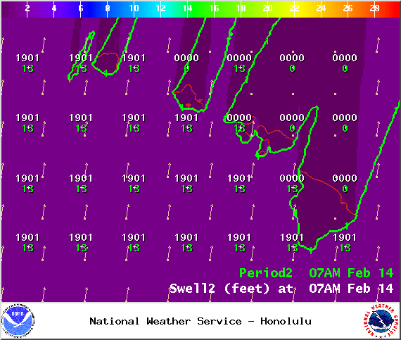
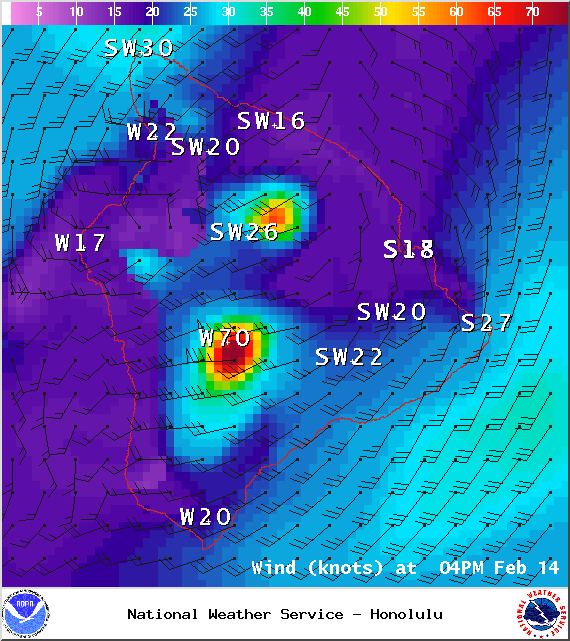
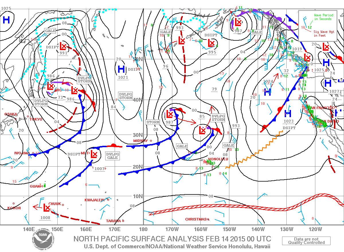
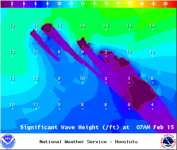
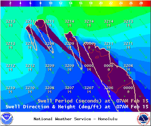
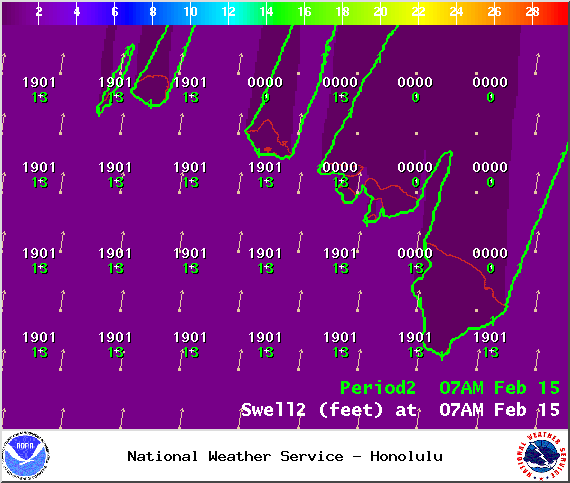
**Click directly on the images below to make them larger. Charts include: Big Island projected winds, tides, swell direction & period and expected wave heights.**
 Big Island Surf Forecast
Hilo side: Surf heights are expected around chest to head high. The best breaks open to the swell could see larger waves on the sets.
Kona side: Surf heights are forecasted to be waist to shoulder high. Possibly up to head high on the sets at the best breaks.
South: Waist to chest high waves are expected with occasional shoulder to head high waves on the sets at the best breaks. Sloppy and messy conditions.
Shorter period mix of northwesterly swells expected today mainly showing for the Hilo side. Kona side is blocked from that particular swell but catching south-southwest swell along with wind chop.
 If the storm develops as models are indicating, the next northwest swell is expected to build late Saturday into Sunday for the Kona side. A larger swell is also expected to build Sunday and peak early Monday bringing waves to the Hilo side. Another west-northwest is expected next week (19/20th).
A recent storm near New Zealand is bringing some fun knee to chest high waves for southern exposures. The swell should hold through Saturday. Swell eases Sunday and through early next week. Southwest wind chop is also expected and the conditions are likely to be sloppy with onshore and shifting winds.
Keep in mind, surf heights are measured on the face of the wave from trough to crest. Heights vary from beach to beach, and at the same beach, from break to break.
**Click here for your detailed Big Island weather report.**
Saturday / Image: NOAA / NWS
Saturday / Image: NOAA / NWS
Saturday / Image: NOAA / NWS
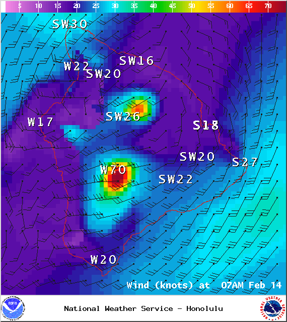
Saturday / Image: NOAA / NWS
Saturday / Image: NOAA / NWS
Saturday / Image: NOAA / NWS
Sunday / Image: NOAA / NWS
Sunday / Image: NOAA / NWS
Sunday / Image: NOAA / NWS
Sunday / Image: NOAA / NWS
Sunday / Image: NOAA / NWS
Sponsored Content


