

Slew of Wind Alerts Posted as Front Approaches
Alerts
A High Wind Warning is posted for the summits of Mauna Kea and Mauna Loa through 6:00 a.m. Thursday morning. West winds from 60 to 75 mph with gusts to 90 mph are expected. The National Weather Service advises that winds this strong can make walking and driving difficult. Travel to the summit should be delayed until winds subside.
A Gale Warning has been issued by the National Weather Service for all offshore waters.
A High Surf Advisory is posted for north-facing shores of the Big Island through 6:00 a.m. Wednesday for 10 to 15 foot faces. Expect strong breaking waves, shore break and strong longshore and rip currents making swimming difficult and dangerous.
A Small Craft Advisory is posted for windward Big Island waters through 6:00 a.m. Wednesday for southwest winds up to 25 knots and rough seas of 9 to 16 feet. Inexperienced mariners should avoid navigating in these conditions.
**Click directly on the images below to make them larger. Charts include: Big Island high/low forecasted temperatures, projected winds, chance of cloud cover, projected localized weather conditions, vog/SO2 forecast and expected wave heights.**
Today
West winds are expected from 15 to 25 mph at lower elevations and could be higher at higher elevations. The summits of Mauna Kea and Mauna Loa are under a High Wind Warning at this time. The west flow is expected to bring hazy skies to windward Big Island (see UHSOEST vog model above). High temperatures should fall in the range of 80° to 86°.
UV index at 8 (“very high” exposure level)
Tonight
Mostly cloudy skies are expected with numerous showers for leeward spots. Windward areas are expected to get partly cloudy skies and scattered showers. West winds are expected from 15 to 25 mph. Low temperatures are forecasted from 66° to 71°.
Next Full Moon: 1:09 p.m. on Feb. 3
Next New Moon: 1:47 p.m. on Feb. 18
Looking Ahead
Southwest winds will continue to strengthen as a front approaches the state from the northwest. The fast-moving front will bring increasing showers as it moves quickly down the island chain. We expect periods of moderate showers and blustery conditions. A series of fronts will bring progressive wet and windy pattern beginning tonight through Friday. A ridge will build over the state this weekend resulting in lighter winds and calmer weather. Because the fronts are so close together and moving so quickly it’s hard to pinpoint exact passage timing for each island but we will keep an eye on it and bring you the latest.
Our Big Island Now Weather homepage always includes daily: Sunrise | Sunset | Moonrise | Moonset | Moon Phase | Live Weather Cams | 5-day Forecast | Current Temperature & Conditions
**Click here for your detailed Big Island surf report.**
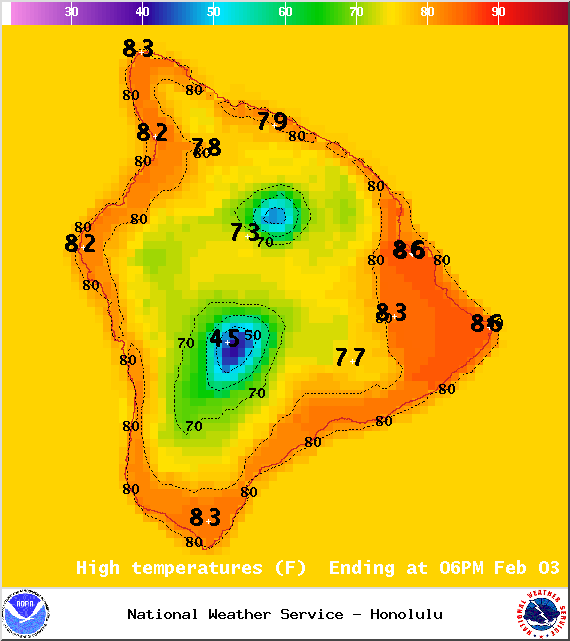
Image: NOAA / NWS
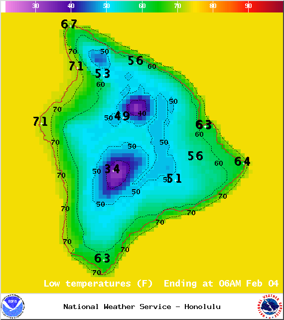
Image: NOAA / NWS
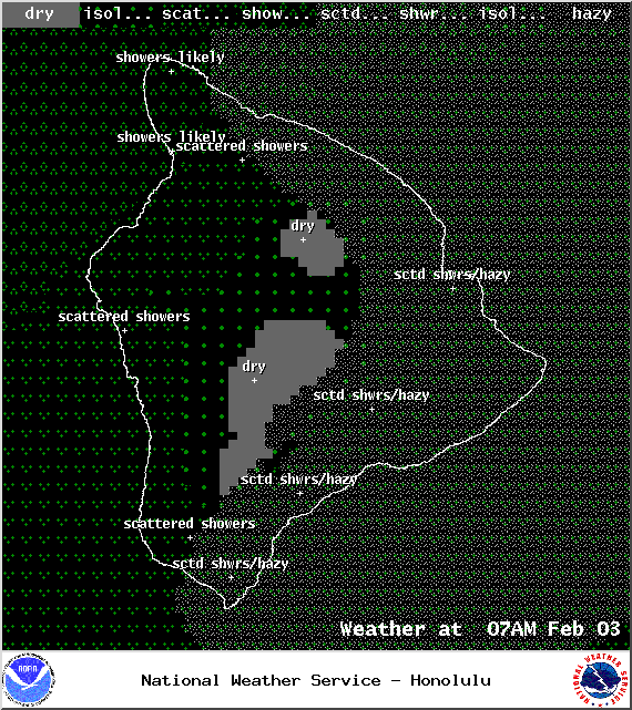
Image: NOAA / NWS
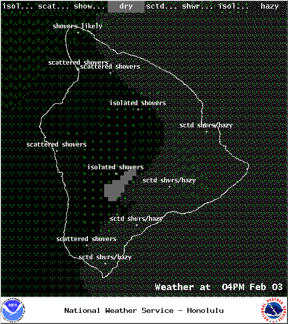
Image: NOAA / NWS
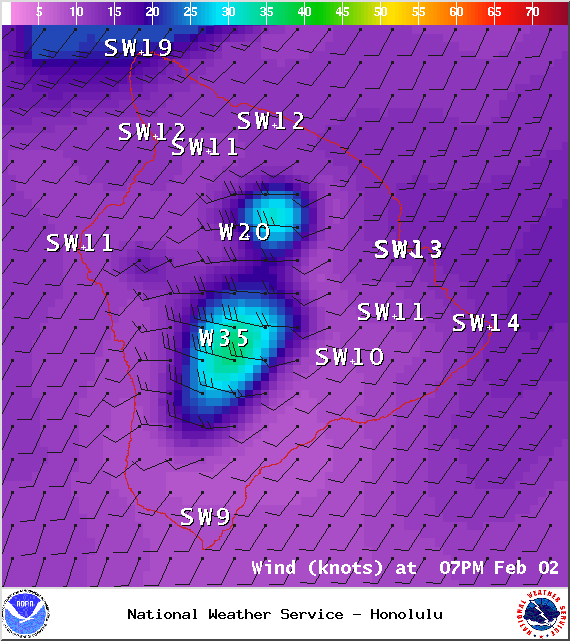
Image: NOAA / NWS
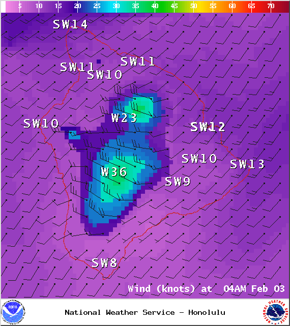
Image: NOAA / NWS
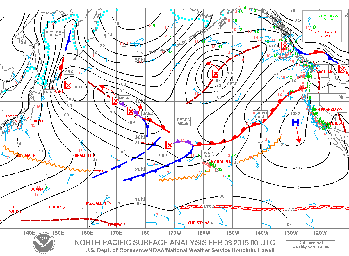
Image: NOAA / NWS
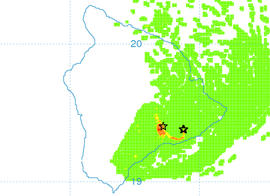
Image: UHSOEST
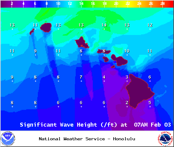
Image: NOAA / NWS
Sponsored Content


