

Haze, Gusty Southwest Winds Today
Alerts
A Wind Advisory is posted for the summits of Mauna Kea and Mauna Loa through 6:00 a.m. Tuesday morning. West winds from 25 to 45 mph with gusts to 65 mph are expected. Winds are expected to increase as we head into the middle of the week. The National Weather Service advises that winds this strong can make walking and driving difficult. Use extra caution when driving and be careful when opening and closing doors. If camping in the area, be sure your tent is well anchored.
A High Surf Advisory is posted from noon today through 6:00 a.m. Tuesday for surf of 10 to 15 feet along north facing shores of the Big Island beginning this afternoon and continuing through Monday night.
A Small Craft Advisory has been issued for Big Island windward waters from noon today through 6:00 a.m. Wednesday for winds up to 25 knots and rough seas from 9 to 14 feet.
**Click directly on the images below to make them larger. Charts include: Big Island high/low forecasted temperatures, projected winds, chance of cloud cover, projected localized weather conditions, vog/SO2 forecast and expected wave heights.**
Today
Mostly cloudy skies and scattered showers are in the forecast today for the Big Island. Southwest winds are expected from 10 to 15 mph at lower elevations and from 20 to 35 mph with higher gusts at higher elevations. The southwest flow is expected to bring hazy skies to much of the Big Island (see UHSOEST vog model above). High temperatures should fall in the range of 80° to 86°.
UV index at 8 (“very high” exposure level)
Tonight
Mostly cloudy skies are expected with scattered showers. Southwest winds are expected up to about 30 mph. Low temperatures are forecasted from 71° to 76°.
Next Full Moon: 1:09 p.m. on Feb. 3
Next New Moon: 1:47 p.m. on Feb. 18
Looking Ahead
Light winds will turn to the southwest Monday as a front approaches from the northwest. The front is expected to pass over the islands Tuesday through Wednesday with an increase in winds. Winds will remain out of the west to northwest through the end of the week, with another front expected to pass over the islands Friday and Friday night.
Our Big Island Now Weather homepage always includes daily: Sunrise | Sunset | Moonrise | Moonset | Moon Phase | Live Weather Cams | 5-day Forecast | Current Temperature & Conditions
**Click here for your detailed Big Island surf report.**
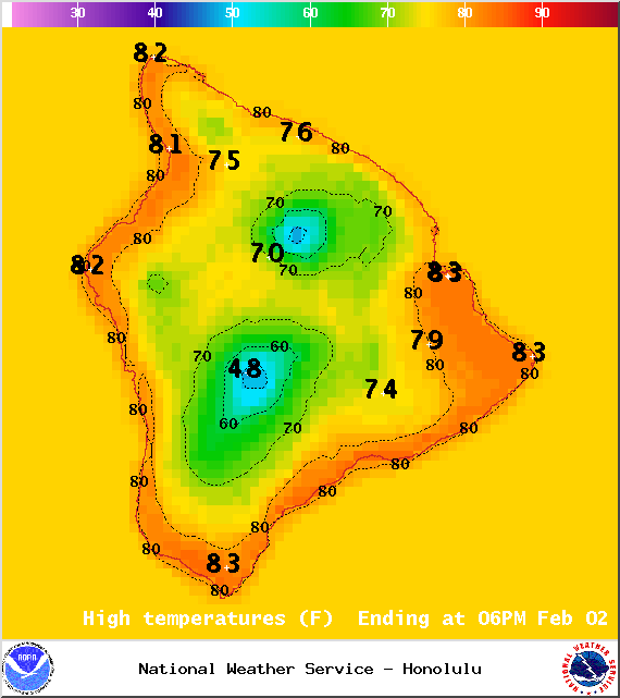
Image: NOAA / NWS
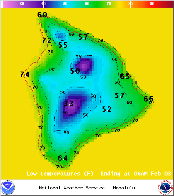
Image: NOAA / NWS
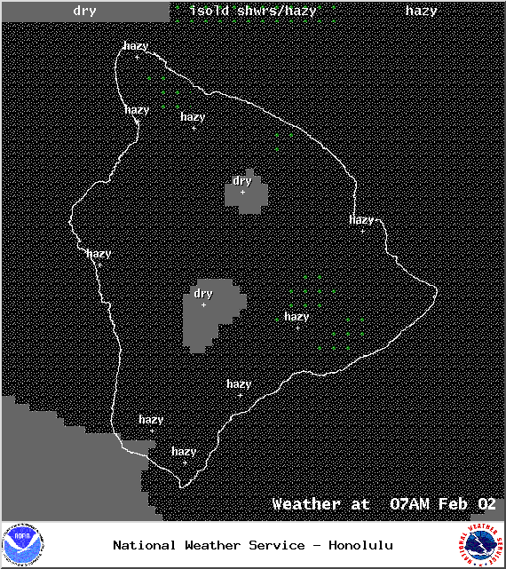
Image: NOAA / NWS
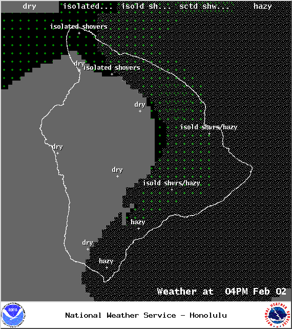
Image: NOAA / NWS
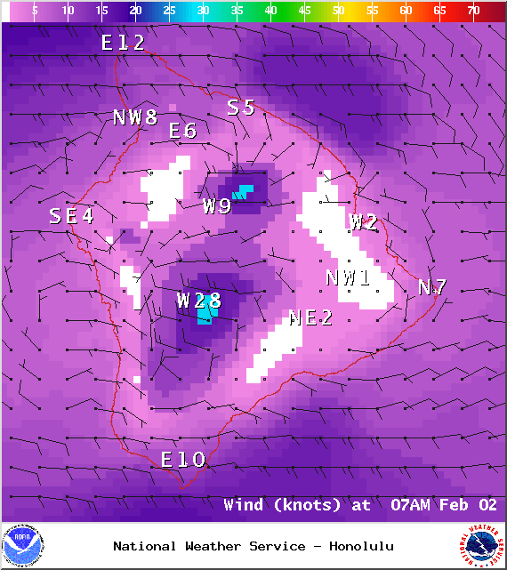
Image: NOAA / NWS
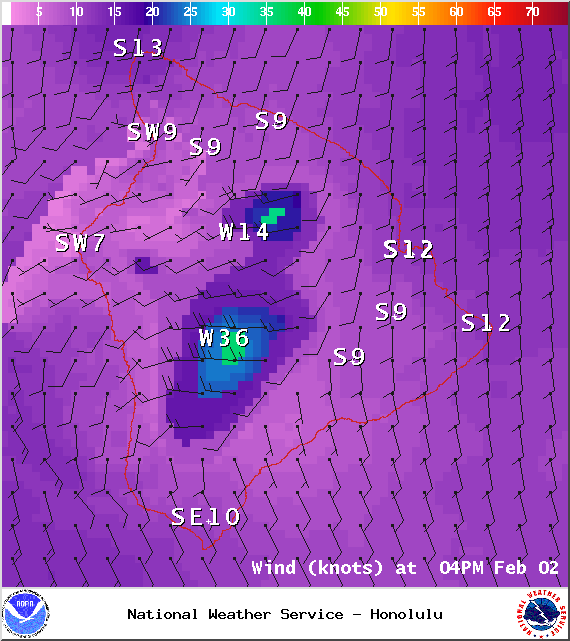
Image: NOAA / NWS

Image: UHSOEST
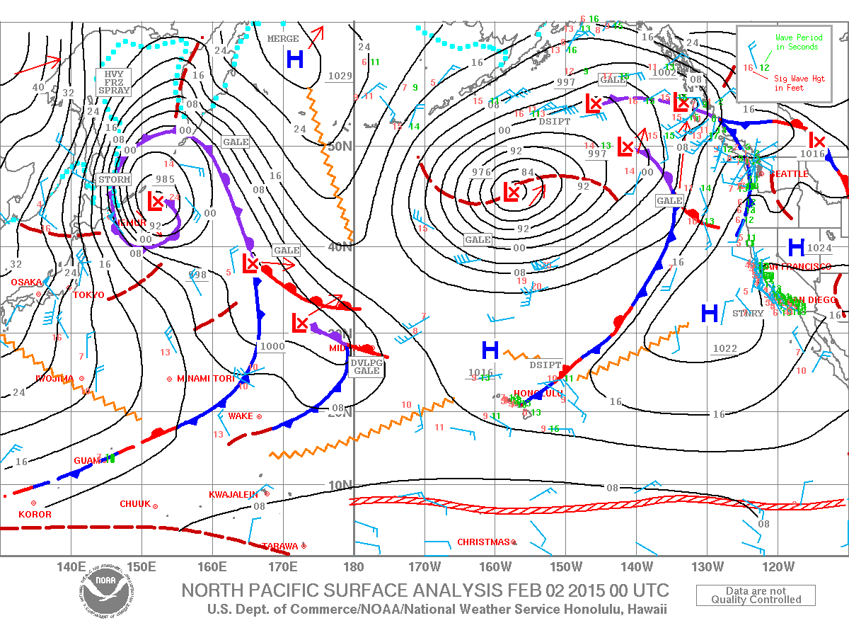
Image: NOAA / NWS
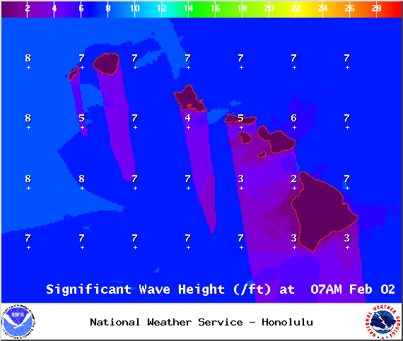
Image: NOAA / NWS
Sponsored Content


