

WEEKEND SURF: Warning Level Surf Today, Fades Sunday
Alerts
A Marine Weather Statement has been issued by the National Weather Service for a very large west-northwest swell. The Weather Service in Honolulu is warning of strong harbor surges and large breaking waves at harbor entrances exposed to the swell. Some locations that could expect such conditions are the Kawaihae and Honokohau harbors.
The High Surf Warning has been extended for the west side of the Big Island. The warning is posted through Sunday at 6:00 a.m. Wave heights of 10 to 15 foot faces are expected. Expect ocean water occasionally sweeping across portions of beaches, very strong breaking waves and strong longshore and rip currents. Breaking waves may occasionally impact harbors making navigating the harbor channel difficult. Large breaking surf, significant shore break and dangerous currents will make entering the water very hazardous. Boaters should be aware of an increased number of surfers in the water.
A Small Craft Advisory has been issued for all island waters through 6:00 a.m. Sunday for winds from 15 to 25 knots and rough seas of 7 to 17 feet.
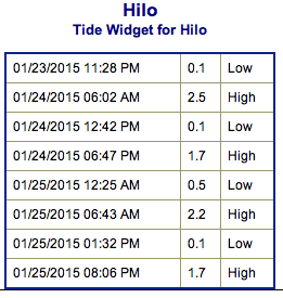
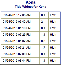
**Weather charts for both Saturday and Sunday are below. Click directly on the images below to enlarge. Charts include: Big Island projected winds, tides, swell direction & period and expected wave heights.**
 Big Island Surf Forecast
Hilo side: Surf heights are expected shoulder to head high. The best breaks open to the swell could see occasional larger waves on the sets, especially later in the day.
Kona side: Surf heights are forecasted to be head high to overhead – possibly a few feet overhead on the sets at the best breaks open to the swell, especially early in the day.
South: Southerly spots open to the west-northwest swell could get waves wrapping up to head high, maybe up to overhead on the sets. Breaks open to the trade swell could see knee to waist high waves.
 Our current swell continues to fade. Warning level surf is expected as a new swell builds. The Kona side is more shadowed with this swell than with the last while the Hilo side should get a fraction more swell making into breaks along that coast. This swell is expected to gradually fade through Sunday and into early next week.
A new storm is developing off of Japan, so we could see another solid west-northwest swell setting up for Wednesday and Thursday of next week.
Small south-southwest brings knee to possibly thigh high waves at the best breaks.
Keep in mind, surf heights are measured on the face of the wave from trough to crest. Heights vary from beach to beach, and at the same beach, from break to break.
**Click here for your detailed Big Island weather report.**
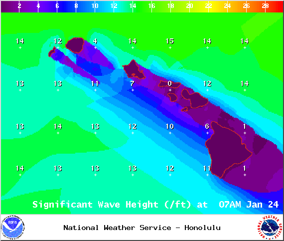
Image: NOAA / NWS
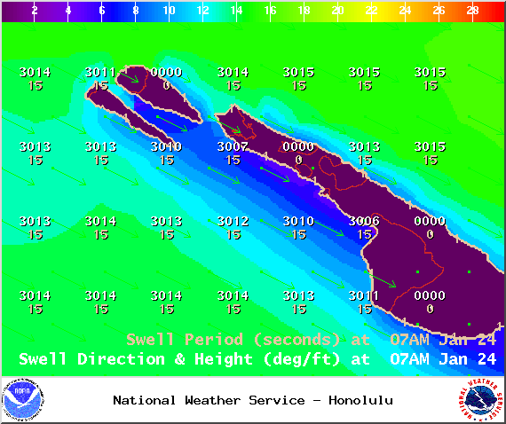
Image: NOAA / NWS
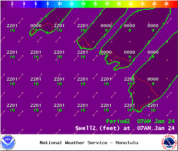
Image: NOAA / NWS
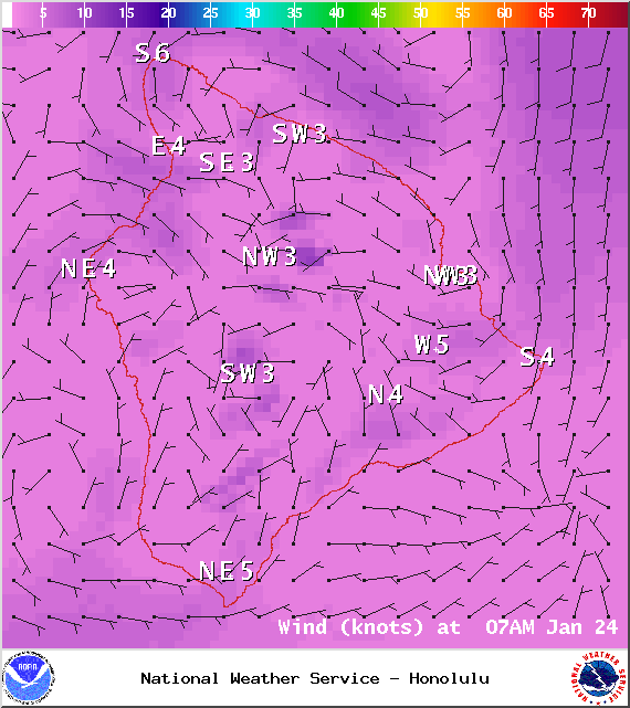
Image: NOAA / NWS
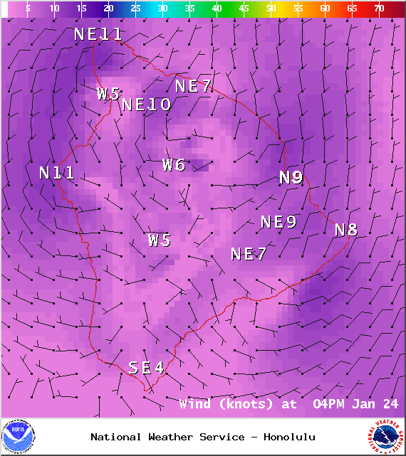
Image: NOAA / NWS
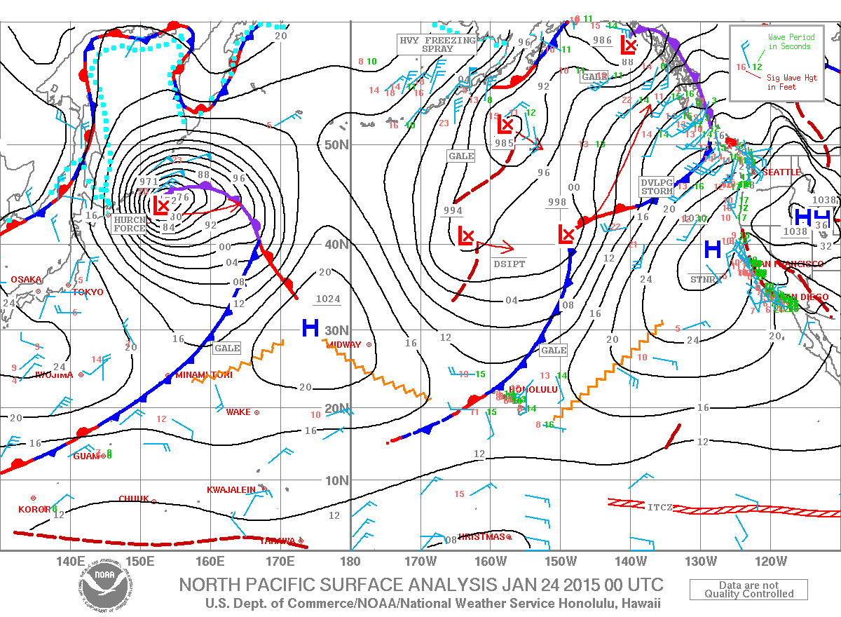
Image: NOAA / NWS
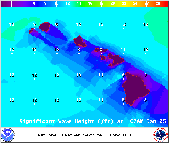
Image: NOAA / NWS
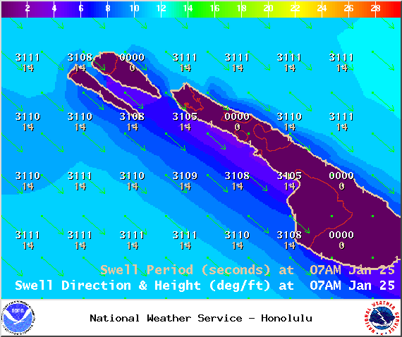
Image: NOAA / NWS
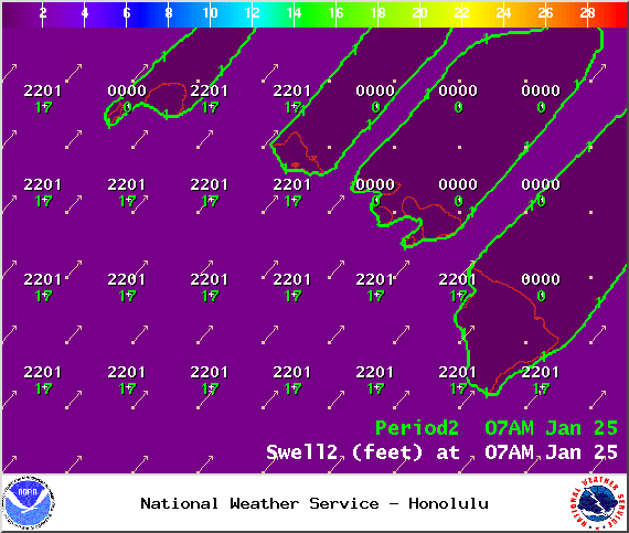
Image: NOAA / NWS
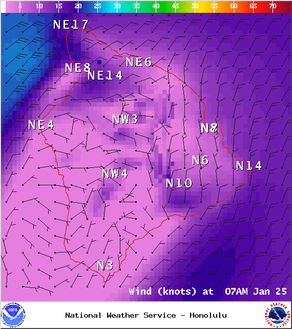
Image: NOAA / NWS
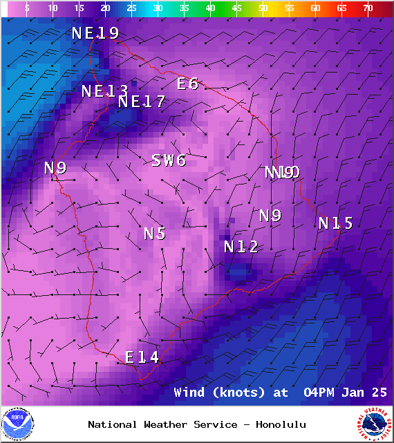
Image: NOAA / NWS
Sponsored Content


