

Hazy Skies Today, Front Expected For Weekend
Alerts
A Marine Weather Statement has been issued by the National Weather Service for a very large west-northwest swell. The Weather Service in Honolulu says the very large swell will remain elevated into Thursday. They are warning of strong harbor surges and large breaking waves at harbor entrances exposed to the swell. One location that could expect such conditions is Honokohau harbor.
A High Surf Warning has been issued for the west side of the Big Island. The warning is posted through Friday at 6:00 p.m. Wave heights of 15 to 20 foot faces are expected. Expect ocean water occasionally sweeping across portions of beaches, very strong breaking waves and strong longshore and rip currents. Breaking waves may occasionally impact harbors making navigating the harbor channel difficult. Large breaking surf, significant shore break and dangerous currents will make entering the water very hazardous. Boaters should be aware of an increased number of surfers in the water.
A Small Craft Advisory has been issued for all island waters through 6:00 p.m. Friday for southwest winds from 10 to 20 knots and rough seas of 7 to 16 feet.
**Click directly on the images below to make them larger. Charts include: Big Island high/low forecasted temperatures, projected winds, chance of cloud cover, projected localized weather conditions, vog/SO2 forecast and expected wave heights.**
Today, Thursday, January 22, 2015
Partly cloudy skies are expected today. Variable winds up to 15 mph are forecasted. There is a southerly component to the wind so haze could spread over onto the Hilo side of the island as well today (see UHSOEST vog model above). Afternoon sea breezes are expected to bring cloud cover and possible showers to the leeward side. High temperatures should fall in the range of 80° to 85°.
Sunrise: 6:57 a.m.
Sunset: 6:07 p.m.
UV index at 8 (“very high” exposure level)
Tonight
Partly cloudy skies are expected. Windward spots can expect isolated showers in the evening with scattered showers after midnight. Leeward areas should become mostly clear after the land breeze takes hold. Variable winds up to 15 mph are expected. Low temperatures are forecasted from 67° to 72° degrees.
Moonrise: 8:42 a.m.
Moonset: 8:50 p.m.
Next New Moon: Jan. 20 at 3:14 a.m.
Next Full Moon: 1:09 p.m. on Feb. 3
Looking Ahead
Winds will turn to the south and southwest and become stronger on Thursday as a front approaches the islands from the northwest. The front will bring increasing showers, starting over Kauai county on Friday and spread down the island chain through the weekend. High pressure will bring a dry trade wind regime in the wake of the front on Sunday and into early next week. Large surf from a northwest swell will also continue through the weekend.
Almanac for Hilo Airport
Maximum Temperature for today:
Normal 79°
Record 86° / Set in 1998
Minimum Temperature for today:
Normal 64°
Record 58° / Set in 2013
**Click here for your detailed Big Island surf report.**
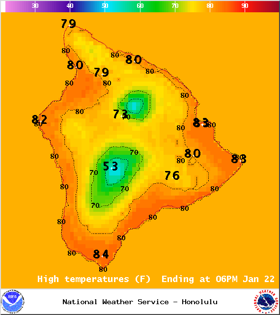
Image: NOAA / NWS

Image: NOAA / NWS
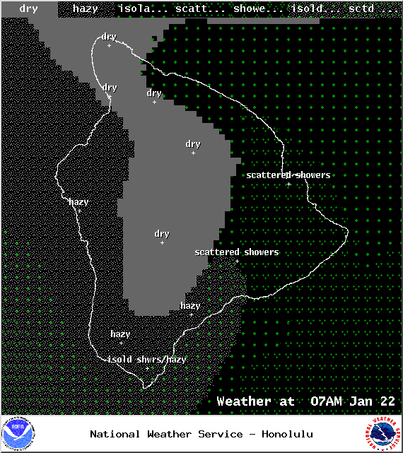
Image: NOAA / NWS
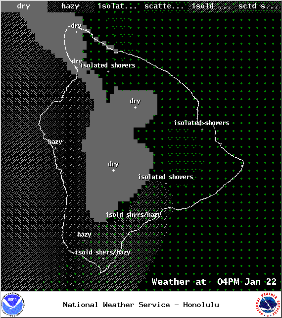
Image: NOAA / NWS
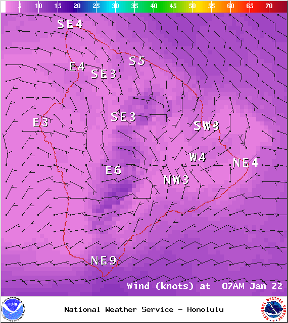
Image: NOAA / NWS

Image: NOAA / NWS
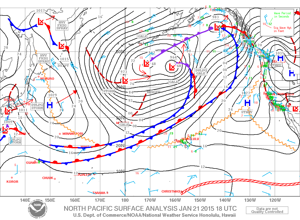
Image: NOAA / NWS
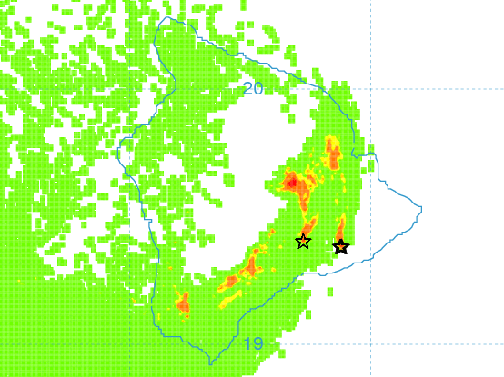
Image: UHSOEST
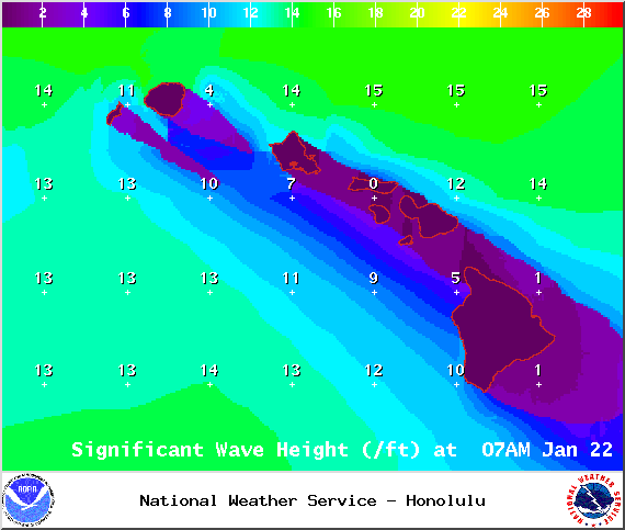
Image: NOAA / NWS
Sponsored Content


