

WEEKEND WEATHER: Sunshine & Light Winds
Alerts
There are no weather alerts posted at this time.
**Click directly on the images below to make them larger. Charts include: Big Island high/low forecasted temperatures, projected winds, chance of cloud cover, projected localized weather conditions, vog/SO2 forecast and expected wave heights.**
Today, Saturday, January 10, 2015
Light and variable winds are expected today up to 15 mph with partly sunny skies and just isolated showers. As the land heats up, sea breezes are expected to develop which will lead to afternoon cloud cover and possible isolated showers. Hazy skies are expected in the afternoon for parts of the Big Island (see UHSOEST vog model above). High temperatures should fall in the range of 79° to 84°.
Sunrise: 6:57 a.m.
Sunset: 5:59 p.m.
UV index at 7 (“high” exposure level)
Tonight
Partly cloudy skies and isolated showers are expected. Leeward spots may be cloudy to start but are expected to clear as the land breeze takes hold. Variable winds up to 15 mph are expected. Low temperatures are forecasted from 65° to 70° degrees.
Moonrise: 10:52 p.m.
Moonset: 11:07 a.m. on Jan. 11
Next New Moon: Jan. 20 at 3:14 a.m.
Next Full Moon: 1:09 p.m. on Feb. 3
Almanac for Hilo Airport
Maximum Temperature for today:
Normal 79°
Record 85° / Set in 1980 and tied in 1997 and 2010
Minimum Temperature for today:
Normal 64°
Record 54° / Set in 1995
Sunday, January 11, 2015
Partly cloudy skies and isolated showers are expected today with variable winds up to 15 mph. Highs from 79° to 84° and lows from 65° to 70°.
Sunrise: 6:57 a.m.
Sunset: 5:59 p.m.
UV index at 7 (“high” exposure level)
Looking Ahead
Light southeast flow is expected for the weekend resulting in land and sea breezes over the islands and periods of vog and haze. We don’t expect a lot of moisture in the coming days. A weakening front in our vicinity will cut off our trade winds for the early part of next week but isn’t expected to reach the islands. Another front is expected to to approach the Aloha State after that so light and variable winds with land and sea breeze conditions are expected through end of the week as well.
**Click here for your detailed Big Island surf report.**
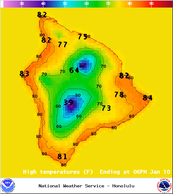
Image: NOAA / NWS
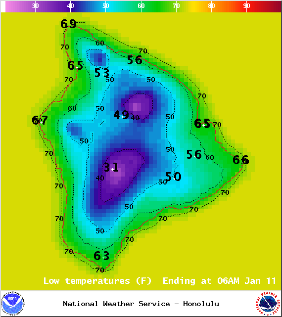
Image: NOAA / NWS
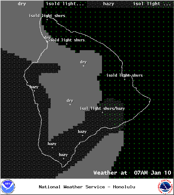
Image: NOAA / NWS
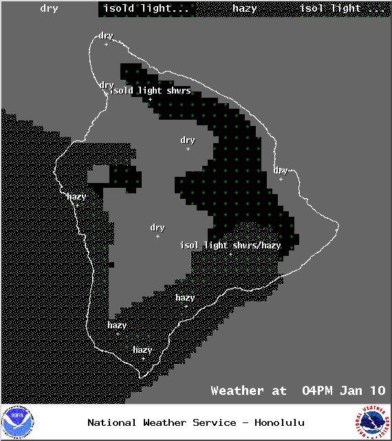
Image: NOAA / NWS
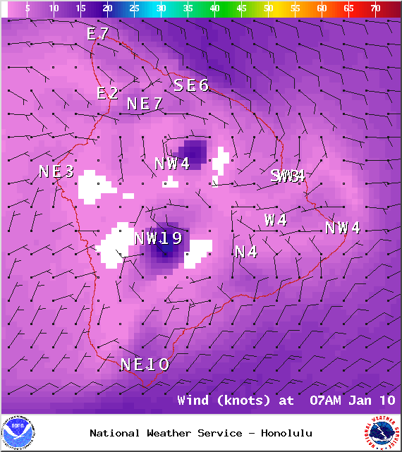
Image: NOAA / NWS
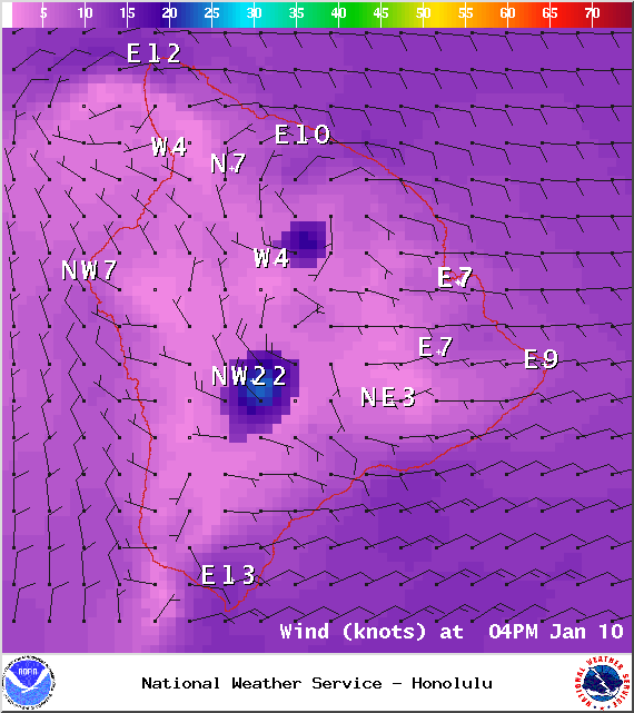
Image: NOAA / NWS
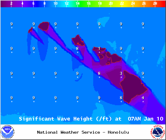
Image: NOAA / NWS
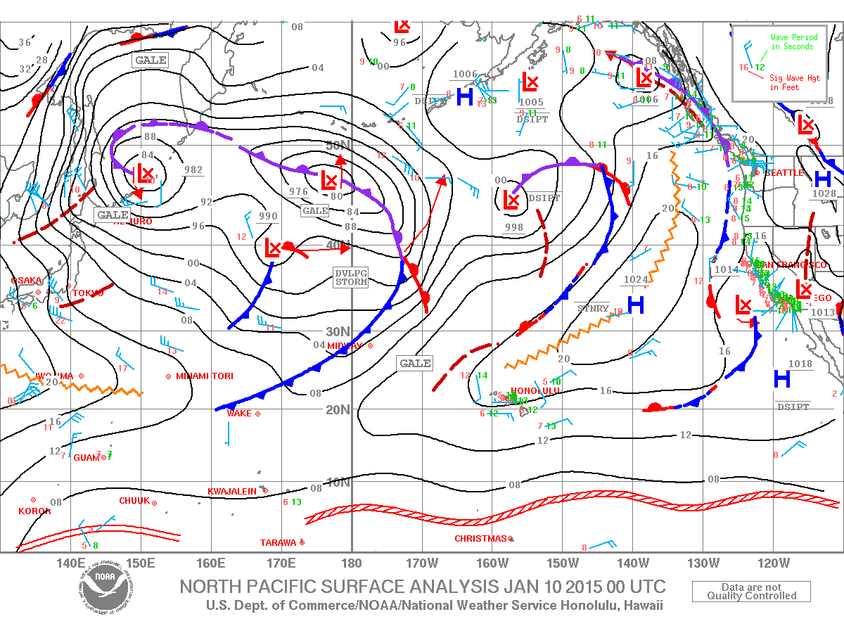
Image: NOAA / NWS
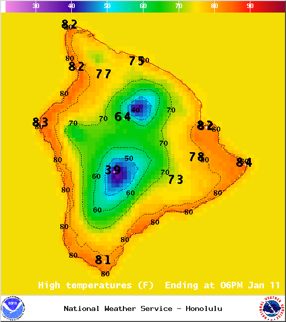
Image: NOAA / NWS
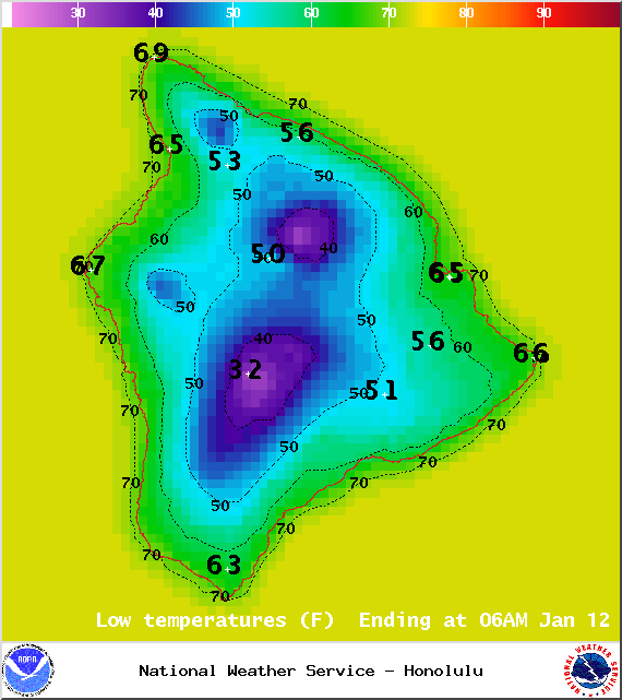
Image: NOAA / NWS
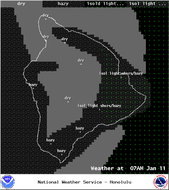
Image: NOAA / NWS
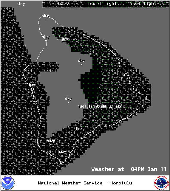
Image: NOAA / NWS
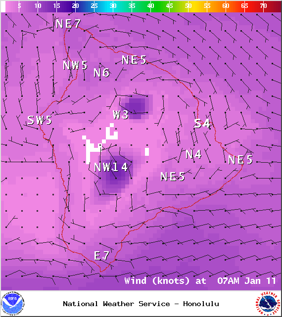
Image: NOAA / NWS
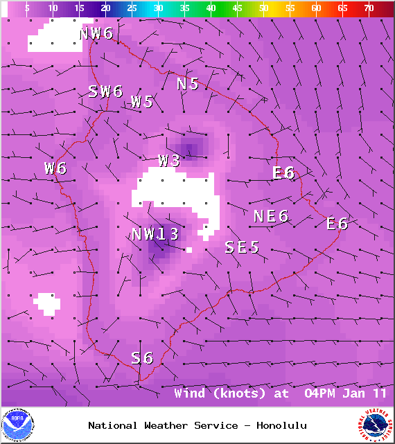
Image: NOAA / NWS
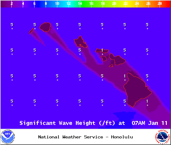
Image: NOAA / NWS
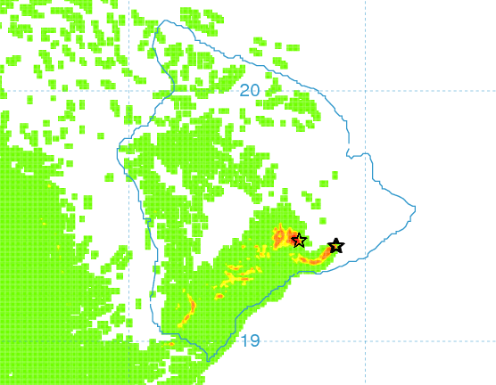
Saturday afternoon vog forecast – Image: UHSOEST
Sponsored Content


